
The Colorado River is the principal source of water for agriculture and riparian vegetation in Arizona, southern California, and southern Nevada. To account for water use by each State or individual and to verify lands fallowed for conservation programs and other water management needs, BOR routinely monitors more than 3.5 million acres of agriculture land and riparian vegetation along the Lower Colorado River, from Hoover Dam south to the international border with Mexico. Multispectral satellite and aerial images are analyzed in combination with other spatial data in a Geographic Information Systems (GIS) environment to generate information regarding crop and riparian types, acreages, and water use estimates.
These data and information assist the BOR in meeting its U.S. Supreme Court mandate to provide detailed and accurate records of diversions, return flows, and consumptive use estimates of water diverted from the mainstream of the Lower Colorado River. This program is an example of implementing remote-sensing-based methodologies to routinely meet Reclamation’s water management needs.
http://www.usbr.gov/lc/region/g4000/wtracct.html
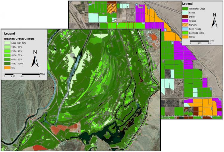
Reclamation uses remote sensing and GIS processes to map crop and riparian vegetation groups and to estimate the evapotranspiration associated with these groups. Examples of the riparian database at Laguna Dam in Arizona (left) and agricultural database near Coachella, California (right).