
The NPS contracted with ABR, Inc., to develop a map that depicts the day of the year that a Landsat 30-meter pixel becomes snow free during the spring from 1999 to 2015. Annual coverage is available from 2010 to 2015. The project also includes mapping lichen distribution across a large swath of east-central Alaska and the Yukon. These maps allow managers to monitor trends in landscapes, which informs issues such as access, habitat condition and timing of management or treatment activities.
https://irma.nps.gov/DataStore/Reference/Profile/2238597
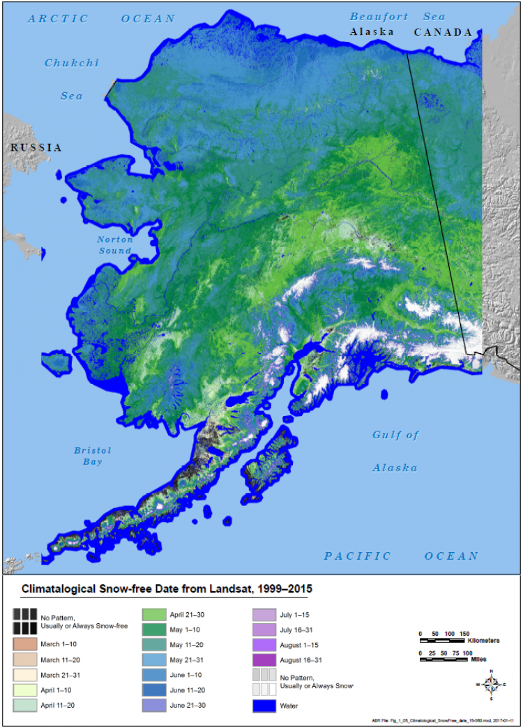
Map showing snow melt timing in Alaska
Platform