
Geographers and remote sensing specialists at OSMRE use unmanned aircraft systems (UAS; drones) to capture images and create mathematically correct 2D and 3D models of active and abandoned coal mining sites and features. The byproducts of these models, such as elevation data and composite aerial images, help OSMRE solve problems and make decisions about reclamation activities. The products of these models are highly accurate and detailed, providing managers with reliable information to make informed decisions. For example, detailed digital elevation models (DEMs) are used in volumetric calculation of pit areas to determine how much backfill material is necessary to bring a pit back to approximate original contour. OSMRE currently uses a 3DR Solo with a Ricoh GR II payload and a number of software programs, including Agisoft PhotoScan Professional, ArcGIS, Global Mapper, and others, that aid in the entire workflow, from flight to post-processing. In the near future, OSMRE will incorporate a new multispectral payload to capture near-infrared wavelengths, allowing for vegetative analysis and other advanced remote sensing techniques. Such analyses are requirements included in approved coal mining permits and for bond release.
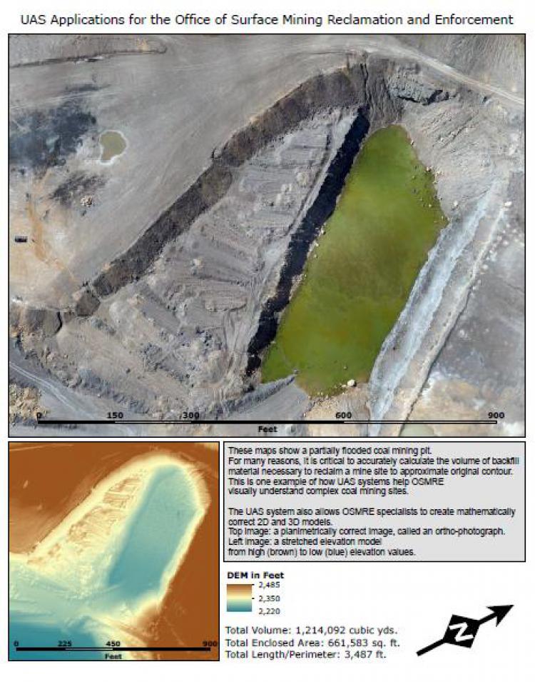
UAS-derived composite aerial image of a partially flooded coal mining pit (top) and DEM (bottom). UAS systems help OSMRE specialists understand complex coal mining sites, including enabling creation of precise DEM data. Such data allow for the calculation of the volume of backfill material needed to reclaim a mine site to approximate original contour.