
Enceladus has active eruptions of water ice that create and sustain the famous rings of Saturn. The jets of water are fed from a global ocean hidden underneath a thick shell of ice. Further studies of the interior of this fascinating "ocean world" will need to better combine data from the various instruments on the now defunct Cassini spacecraft. Such data fusion requires foundational geospatial products, including a network of reference points and a global topographic map. The USGS is generating these products for use by the international planetary science community by using rigorous photogrammetry to solve for the three-dimensional position of features on Enceladus. This is only possible through the continually improved capabilities of the USGS Integrated Software for Imagers and Spectrometers combined with the decades of experience of expert users.
https://astrogeology.usgs.gov/search/map/Enceladus/Cassini/Enceladus_Ca…
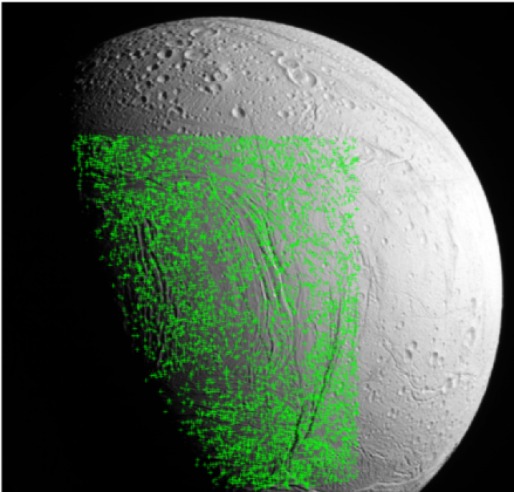
A small portion of the dense control network established for Enceladus. Green tie points are shown. The local radius of each tie point is calculated photogrammetrically to generate the shape model.