
In 2017, the National Park Service approached the USGS National Unmanned Aircraft Systems (UAS) Project Office to acquire geospatial data in support of developing a flood management plan for the Fort Laramie National Historic Site, Fort Laramie, Wyoming. Originally established as a private fur trading fort in 1834, Fort Laramie evolved into the largest military post on the northern plains and eventually became part of the National Park System in 1938. Located at the confluence of the Laramie and North Platte Rivers, the park experienced two consecutive 100-year flood events in 2015 and 2016. Damage to the park highlighted a need to implement a flood management plan.
The mission objective involved collection of high-density lidar point cloud data to generate a bare-earth digital terrain model to be used in additional flood analysis for the Fort Laramie National Historic Site. The two remote pilots collected laser scans (lidar) and natural color imagery over a 3-day period. The average point density of the point cloud product was approximately 210 points per square meter with penetration of thick vegetation to provide ground-based returns near the river channel. The lidar sensor on board the UAS allowed the data collection to be conducted with a two-man crew over the entire area of the national historic site.
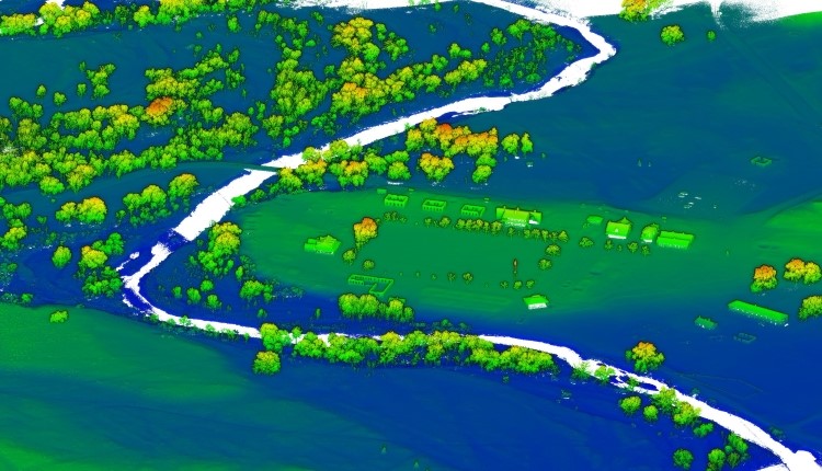
The USGS used a UAS equipped with a lidar sensor to acquire a high-density point cloud of horizontal and vertical data measurement. The resulting data are shown with a color ramp applied displaying high-resolution scaled elevation values.