
Innovative cloud computing resources for remote sensing science have enabled advanced capabilities and analysis for solving complex large-scale data gap challenges within the USGS Water Availability and Use Science Program. With a vision for water budget estimation for the entire Nation, this research program integrates big data research and development into model applications, evaluation, and results.
Scientists at the USGS Earth Resources and Observation Science (EROS) Center collaborate with members from the Desert Research Institute using the Google Earth Engine (GEE) cloud platform to create nationwide quantitative evapotranspiration (ET) estimates with freely available Landsat thermal (infrared) imagery and weather data using the Operational Simplified Surface Energy Balance (SSEBop) model. Multi-year nationwide results are supporting the National Water Census through field-level ET information across broad scales and timeframes.
Leveraging the power of GEE for model implementation, the team combined 30-meter Landsat data with state-of-the-art science and technology to quickly and efficiently map ET for water resource assessment, development, and management at the field and basin level. These developments demonstrate collaborative efforts to apply cloud computing for ET mapping at unprecedented scales so that results can be used to more accurately and efficiently inform water use and water census programs.
The EROS Center develops and shares these ET products with USGS Water Science Centers that are responsible for compiling water use information every 5 years. This research and data integration also supports invested efforts of the Bureau of Reclamation to address water resource challenges facing the Nation.
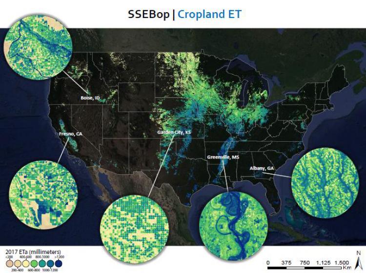
Map of 2017 Landsat ET across nationwide cropland cover extents.