
The USGS Earth Resources Observation and Science (EROS) Center’s National Land Cover Database team, in collaboration with the Bureau of Land Management (BLM), is producing the most comprehensive remote-sensing-based quantification of western U.S. shrublands to date. Nine individual products are being produced that represent primary shrubland components of percent shrub, percent sagebrush, percent big sagebrush, percent herbaceous, percent annual herbaceous, percent litter, percent bare ground, shrub height, and sagebrush height. This approach relies on three major steps:
1. Create training datasets using field sampling and high-resolution satellite imagery at selected sites
2. Extrapolate these training datasets to the landscape level using Landsat 8
3. Validate the final products with independent field measurements
Almost all the shrub and grasslands of the western United States are currently being mapped with this process. Once the base components are produced, an additional process developed by the USGS classifies where and how much these components have changed since 1983. This process depends on the Landsat archive to provide historical imagery that is analyzed for spectral change, with changed areas subsequently labeled using training data from unchanged areas. The result provides up to a 32-year record of how these different shrub components have changed across time historically in response to climate, revealing trends that can be projected into the future for sagebrush ecosystems.
https://www.mrlc.gov/nlcdshrub.php
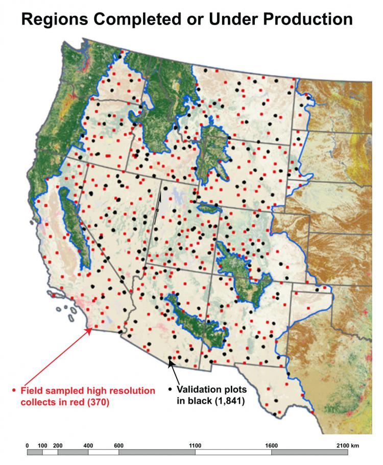
Areas under production for nine USGS shrub/grass mapping products (in tan shading). Red dots represent areas of intensive field sampling. Black dots represent areas of independent validation.