
Since 2014, the National Operations Center (NOC) has provided remotely sensed geospatial data products to support management officials conducting Emergency Stabilization and Rehabilitation (ESR) activities on wildfire-affected BLM lands. The ESR program is implemented to lessen post-fire effects such as erosion and to restore affected habitats. Remote sensing products assist management officials in monitoring vegetation treatments and reforestation, and rehabilitating land cover. To support 2019 ESR efforts, the NOC is providing products derived from the European Space Agency’s Sentinel-2 satellites to requesting officials. The products include pre- and post-event Sentinel-2 visible to shortwave-infrared (VSWIR) imagery, which have been spatially subset to the fire-affected area to reduce file storage space. Normalized Difference Vegetation Index (NDVI), Normalized Burn Ratio (NBR), Delta NDVI (dNDVI), Delta NBR (dNBR), and fire-retardant location products are also disseminated to meet ESR objectives. In addition, the NOC provides a classification product identifying burned and unburned cover.
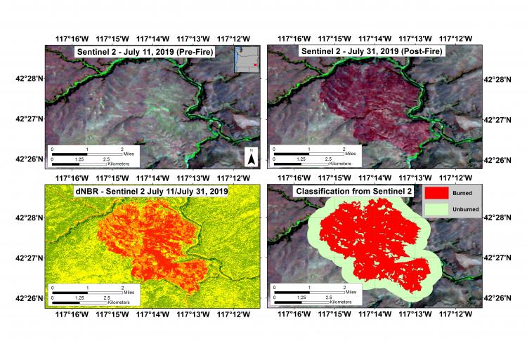
Sentinel-2 products derived in response to the Drummond Basin Fire in Oregon (from left to right): pre-fire multispectral image, post-fire multispectral image, dNBR from pre- and post-fire NBRs, and a vector classification identifying burned and unburned cover.