
Landscape Cover Analysis and Reporting Tools (LandCART) is an online mapping application being developed by the BLM Geospatial Imaging group at the National Operations Center (NOC) through a National Aeronautics and Space Administration (NASA) Research Opportunities in Space and Earth Science (ROSES) grant in partnership with U.S. Geological Survey and University of California-Los Angeles (UCLA) geospatial researchers. This application will enhance the BLM’s ability to produce estimates of Assessment, Inventory, and Monitoring (AIM) indicators using NASA Earth observing data in places and times where in situ data are not available. The tool is being created to help address user-defined management questions—particularly trend analysis questions—and to provide documentation required by the National Environmental Policy Act (NEPA). LandCART will support appropriate NEPA documentation and ensure reproducibility by allowing for exporting both input and output data, along with information from the underlying algorithms. Extrapolations will be accompanied by error and confidence estimates to enhance their utility in decision making. LandCART, designed and housed at UCLA throughout the grant timeframe, is in alpha testing during the summer of 2019. All programming, design, and calculations are performed within the Google Earth Engine, and the application is served in Earth Engine AppsExperimental. Advantages of this process over several other fractional vegetation cover datasets supported by the BLM include (1) the use of powerful cloud computing architecture; (2) the ability to produce predicted maps on the fly for an area of interest, a time period of interest (from 1984 to the present), and a variety of indicators/variables; (3) the ability to download the predicted data along with the raw satellite imagery (i.e., Landsat) for each selection; and (4) the use of the most up-to-date imagery and AIM data points. The project is in its third of four years, with the expectation of publishing a fully functional online application for use by all BLM staff as well as the general public.
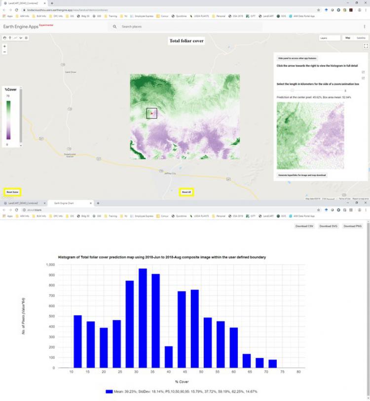
Screen captures of results of fractional total foliar cover prediction near Lander, Wyoming, displayed in the alpha testing version of LandCART.