
The USGS Dakota Water Science Center is conducting high-resolution hydrographic mapping on two additional study areas in southeastern South Dakota. One study area is adjacent to a previous effort near Sioux Falls, and a second area is in Union County in the extreme southeastern corner of the state. Lidar-derived digital elevation models are being processed using the Selective Drainage Toolbox (https://doi.org/10.5066/F7TQ60FD) to identify potential culvert locations. Some culverts can be confirmed using aerial imagery, while other potential culvert locations will be used to direct field verification activities. All confirmed culverts will be added to a culvert inventory and hydroenforced into the elevation models for more accurate representation of the actual drainage network. The culvert inventory, lidar-based flow network, and other derivative layers will provide resource managers and urban planners with better detail and a more current picture of hydrographic features within the study area.
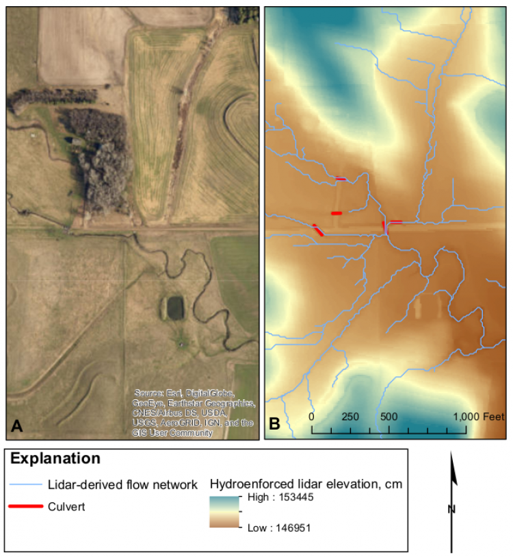
Imagery (A) and high-resolution hydrographic mapping layers (B) for an area in southeastern South Dakota.