
The North American Land Change Monitoring System (NALCMS) is a collaborative initiative between Canada, Mexico, and the United States to monitor land cover and its change over time. The NALCMS’ 19 land cover classes are based on the Land Cover Classification System (LCCS) standard developed by the Food and Agriculture Organization (FAO) of the United Nations. In 2017, NALCMS released a 30-meter dataset of North America that shows land cover in 2010. In 2019, NALCMS released a dataset of 2015 land cover at the same 30-meter resolution, along with a change product showing land cover change from 2010 to 2015—the first ever change product for all of North America at 30-meter resolution. These products can be used for a variety of applications, including carbon sequestration analysis, wildlife habitat mapping, ecosystem monitoring, environmental planning, water quality assessments, and evaluation of biofuels production potential. NALCMS datasets are available at the Commission for Environmental Cooperation website.
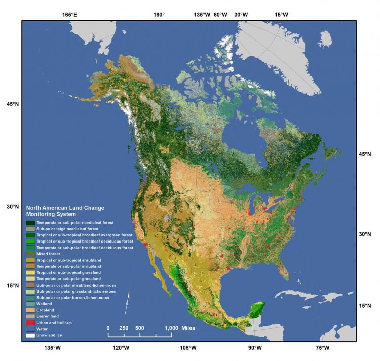
NALCMS land cover for 2010.