
Elevation data are critical for assessments of sea-level rise and coastal flooding exposure. Previous research has demonstrated that the quality of data used in elevation-based assessments must be well understood and applied to properly model potential impacts. In the case of large-area assessments (regional, continental, global), several choices are available for digital elevation models (DEMs) for the required topographic information to project potential impacts of raised coastal water levels, whether a simple inundation model is used or a more complex process-based or probabilistic model is employed. An accuracy evaluation has been conducted of remote sensing-derived DEMs to quantify their inherent vertical uncertainty (error) to demonstrate how accuracy information should be considered when planning and implementing a sea-level rise or coastal flooding assessment. The evaluation approach includes comparison of the DEMs with high-accuracy geodetic control points as the independent reference data over a variety of coastal relief settings (U.S. Atlantic, Gulf, and Pacific mainland coasts, and Pacific islands). The global DEMs evaluated include SRTM (Shuttle Radar Topography Mission), ASTER (Advanced Spaceborne Thermal Emission and Reflection) GDEM (Global Digital Elevation Model), ALOS (Advanced Land Observing Satellite) World 3D, TanDEM-X, and NASADEM. The accuracy characterization results show that current global DEMs are not adequate for high-confidence mapping of exposure to fine increments (less than 1 meter) of sea-level rise or with shorter planning horizons (less than 100 years) and thus they should not be used for such mapping, but they are suitable for general delineation of low-elevation coastal zones (10 meters and lower in elevation). The requirement remains for a freely available, high-accuracy, high-resolution global elevation model that supports quantitative sea-level rise and coastal inundation assessments at high confidence levels.
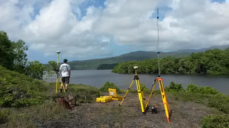
Collecting reference control point data for evaluating uncertainty of coastal elevation models used for inundation assessments.