
Burn severity mapping is commonly informed by changes in vegetation spectral response; the Monitoring Trends in Burn Severity program, for instance, relies on pre- and post-fire Landsat image pairs to delineate and characterize fire severity. However, satellite-derived spectral response conveys limited information about changes in vegetation structure because it only represents the uppermost layer of the canopy. Structural changes in the vegetation understory, in particular, may be obscured. In contrast, light detection and ranging (lidar) data penetrates the canopy and records the three-dimensional (3D) structure of all vegetation layers. A comparison of pre- and post-fire lidar data can thus supply information about fire-caused structural changes. The complementary information derived from lidar and multispectral data may provide a more complete picture of burn severity on the landscape. Research by the Fire Science Team at the Earth Resources Observation and Science (EROS) Center explores how a 3D characterization of burn severity can be integrated into operational mapping programs. The objective is to learn how pre- and post-fire vegetation structure and burn severity are correlated. This correlation will depend on a series of factors including vegetation/forest type, severity of burn, time of data acquisition, and data acquisition specifications. A multi-scale research plan focusing on the Legion Lake Fire, which burned over 54,000 acres in the Black Hills of South Dakota, is being implemented to explore these factors. Field-based composite burn index, ground-based lidar as well as unmanned aircraft system (UAS)-based imagery and space-based observations are being used to explore how vegetation structure is impacted by fire from the plot-level to landscape- and regional-levels. The plot-level observations provide detailed but highly localized data, which are useful in building initial models. The space-based observations provide data to derive regionally consistent and comprehensive assessments of 3D burn severity. The UAS data serve as an important bridge across observation and mapping scales. Knowing how observations, relationships, and errors vary over spatial scales is important to developing actionable science products. As the work expands, having the UAS capacity to strategically collect targeted data (e.g., before and after a prescribed burn) will be valuable for advancing 3D burn severity mapping.
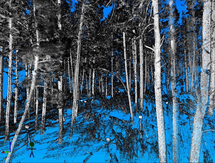
Ground-based light detection and ranging (lidar) data collected at one of the plots on the Legion Lake Fire. The data provide a tremendous amount of detail regarding the arrangement of vegetation canopy material, which will help characterize structure change caused by fire.