
The USGS 3D Elevation Program (3DEP) effort to acquire new statewide Alaska elevation data is complete. The overall goal of 3DEP is to complete acquisition of the first-ever national baseline of consistent high-resolution elevation data—both bare-earth and three-dimensional point clouds—collected in a timeframe of less than a decade. The USGS coordinated with other Federal agency partners and the State of Alaska to fund the acquisition of the Alaska Interferometric Synthetic Aperture Radar (InSAR) data from 2010 to 2019. USGS used its Geospatial Products and Services Contract (GPSC) to acquire 5-meter resolution elevation data using InSAR sensors flown on aircraft. The products available from the Alaska effort include a Digital Terrain Model (DTM) representing the bare earth, a Digital Surface Model (DSM) representing the tops of vegetation and structures, and an orthorectified radar intensity image (ORI). Final data acquisition occurred in late summer 2019. The data were processed by the vendors through spring 2020 and are now available for users to download free of charge and without use restrictions on The National Map.
In fiscal year 2020, USGS and the National Geospatial-Intelligence Agency (NGA) began collaborating to acquire a statewide satellite imagery mosaic for Alaska to augment the statewide InSAR elevation dataset. Specifications require delivery of a 4-band (RGB natural color and near-infrared) mosaic at 0.5-meter resolution, orthorectified using InSAR to meet specified accuracy requirements. Source imagery for the mosaic comes from archived satellite scenes acquired predominantly from 2017 to present during summer months through a request from the National Digital Orthophoto Program (NDOP) to NGA. Data delivery is expected in spring 2021. The imagery will be displayed on several State and Federal imagery servicers for the public to view and can be used internally by multiple Federal agencies and the State of Alaska. The statewide imagery and InSAR datasets will be used in tandem to support a wide variety of mapping, resource management, and public safety applications. These Alaska mapping efforts have been coordinated through the Alaska Mapping Executive Committee (AMEC), an executive body co-chaired by the Department of the Interior and the Department of Commerce. AMEC members represent multiple Federal agencies and the State.
https://www.usgs.gov/core-science-systems/ngp/user-engagement-office/alaska-mapping-initiative
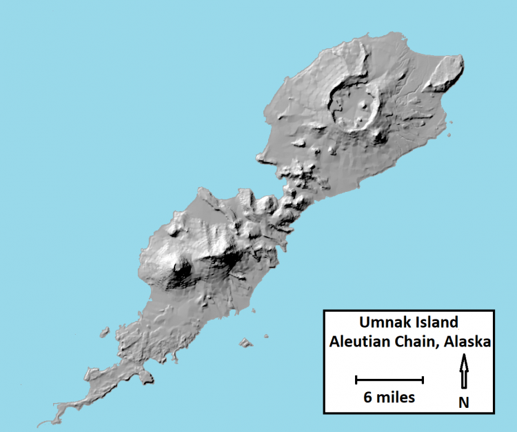
InSAR hillshade representation of Umnak Island, Aleutian Chain, Alaska.