
Lithium is a critical element for making the high-efficiency batteries used in electric cars, cell phones, computers, and solar grid electric storage. The largest lithium production in the world comes from lithium-rich brines in playas (dry lake beds), such as the Salar de Atacama located in Chile, South America. The United States has approximately 110 playas in the West that are of sufficient size to contain lithium-rich brines. This study is developing algorithms to map minerals in playas in the western U.S. to assess lithium potential. Advanced Spaceborne Thermal Emission and Reflection Radiometer (ASTER) data have been used to map minerals at the Salar de Atacama and are being used to develop mineral maps of important domestic lithium-rich playas, including Clayton Valley in Nevada. Deposit models suggest that the lithium source at the Salar de Atacama is from silica and lithium-rich volcanic tuffs that may have been hydrothermally altered. ASTER-derived mineral maps of the Salar de Atacama and Clayton Valley show silica-rich hydrothermally altered mineralogy, which includes alunite, kaolinite, muscovite, epidote, calcite-dolomite (carbonate), epidote-chlorite, and hydrothermal quartz (silica). In addition, ASTER mineral maps show that the Salar de Atacama and Clayton Valley playas contain halite, which suggests that there is enough precipitation and/or ground water and evaporation in the playa to support a sufficient volume of lithium-rich brine.
https://pubs.usgs.gov/of/2013/1006/OF13-1006.pdf
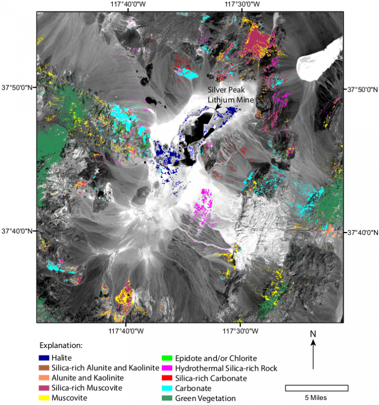
An ASTER mineral map of the Clayton Valley playa which contains the Silver Peak Lithium Mine. The background image is ASTER band 3.