
The USGS Upper Midwest Environmental Sciences Center (UMESC) participated in a small subsection of a larger scope of work for the U.S. Army Corps of Engineers (USACE) led by staff at the University of Wisconsin-La Crosse and the USGS Upper Midwest Water Science Center. The larger scope provides technical assistance to USACE’s Habitat Rehabilitation and Enhancement Project (HREP) Adaptive Management and Monitoring Plan for McGregor Island Complex on the Mississippi River near McGregor, Iowa. This partnership will provide the USACE with 1) baseline geomorphic assessments, 2) baseline topographic surveys, 3) baseline findings report, and 4) photo recording of the island’s shoreline.
Traditional topographic surveying of river-shore embankments collected with a total station and/or survey-grade global positioning system requires staff, GPS equipment, boat assets, logistical planning, time, and funds. The USGS UMESC performed an exploratory study of the use of multibeam bathymetry and terrestrial light detection and ranging (lidar) for mapping, assessing, and monitoring island bank integrity of the McGregor Island Complex for an HREP assessment of river-shore embankments. This project acquired terrestrial lidar and multibeam bathymetry to produce topographic maps of McGregor Island for the USACE. As a pilot project, the USACE will use these results to determine if lidar and bathymetry data will be collected for future HREP river-shoreline assessments.
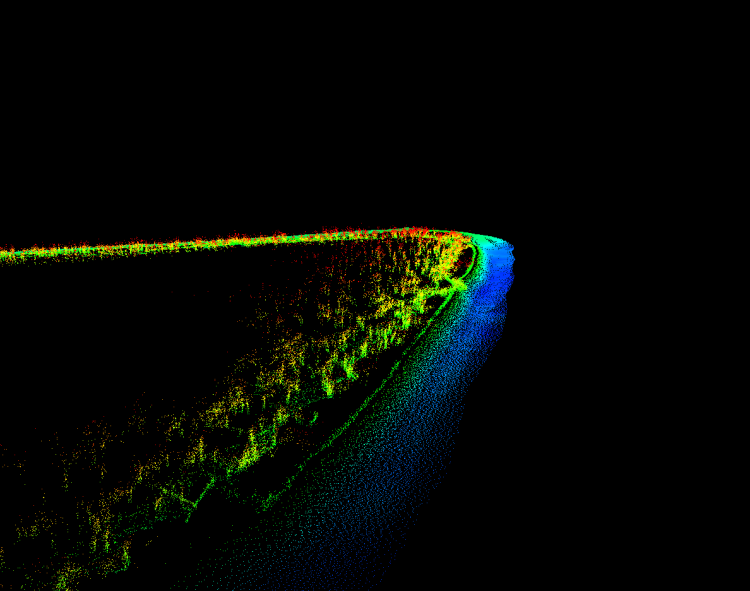
Light detection and ranging (lidar) and bathymetry point cloud along the north shore of McGregor Island, Pool 10 of the Upper Mississippi River near Marquette, Iowa. The view is oblique, approximately 2000 feet across, centered on latitude-longitude 43.06 N, 91.17 W, with the top oriented to the northwest.