
Landslides are a major geologic hazard in Oregon. Landslide inventory mapping helps resource managers understand the spatial pattern of existing landslides and provides information to characterize landslide risk associated with various landscapes. In 2015, the BLM Coos Bay District began a multiyear collaborative landslide inventory mapping project with the Oregon Department of Geology and Mineral Industries (DOGAMI). The BLM Coos Bay District has land in Douglas, Coos, and Curry Counties in Oregon. All three counties have relatively weak geologic units, steep topography, and high annual precipitation, and are subject to large subduction zone earthquakes; they thus have relatively high landslide hazards.
The project has two primary goals: to create a detailed landslide inventory and to provide real-world training to students studying geologic hazards. Four Portland State University geology students benefitted from this opportunity during the initial project period of 2015–2017. One of the students was hired by the Colorado Geologic Survey to work on landslide hazard reduction in Colorado and another now works for DOGAMI. The other two students work for private companies dealing with geologic engineering and landslide consulting.
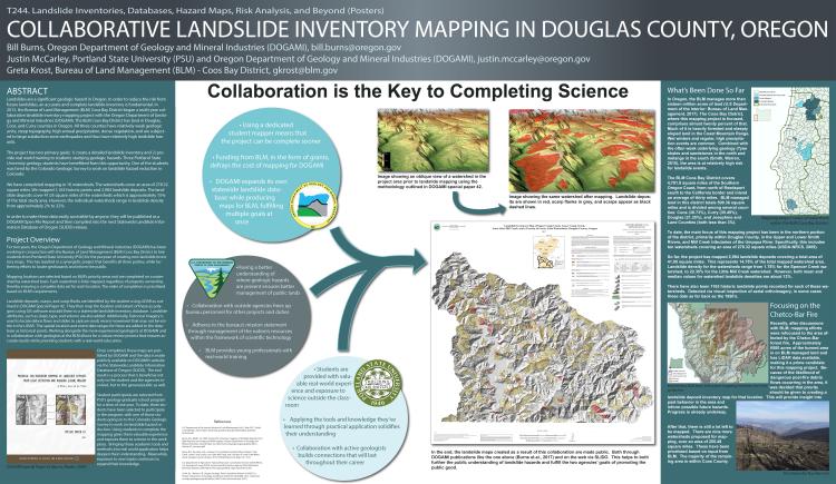
The initial phase completed mapping in three watersheds that cover an area of 278.32 square miles, documenting 1,163 historic locations and 2,984 landslide deposits. The landslide deposits cover 15% of the watersheds, or 41.05 square miles. However, the individual watersheds range in landslide density from approximately 2% to 32%. Four more watersheds were mapped since the initial phase completion and publication in 2017.
In order to make these data easily accessible, they are published as a DOGAMI Open File Report and then compiled into the next Statewide Landslide Information Database of Oregon (SLIDO) release.
Landslide inventory maps and project highlights from the project’s initial phase (https://gsa.confex.com/gsa/2017AM/webprogram/Paper307434.html).