
A 2021 high-resolution image collection is the most recent in a rich archive of aerial imagery used to track changes of the Colorado River in the Grand Canyon. The imagery was acquired from an airplane in Grand Canyon National Park along the Colorado River corridor and the Little Colorado River starting Memorial Day weekend and continuing through the first week of June 2021. It will be used by the USGS Grand Canyon Monitoring and Research Center (GCMRC) and partners from the Glen Canyon Dam Adaptive Management Program (GCDAMP) to monitor changes in the Colorado River and riparian ecosystem in the Grand Canyon and impacts of management including Glen Canyon Dam operations. Water released from Glen Canyon Dam was reduced to a steady discharge of 8,000 cubic feet per second (cfs) in the Colorado River for the duration of the image collection mission. The low river discharge is required because consistent water levels are necessary for remote sensing image analyses that compare this new image dataset to historical datasets, which also were collected with a constant discharge of 8,000 cfs.
Similar to the 2021 imagery collection, 4-band multispectral imagery and photogrammetrically derived topography data were also previously acquired in 2002, 2005, 2009, and 2013. With each of those previous digital image acquisitions, USGS GCMRC remote sensing staff developed and improved upon a methodology for producing a spatially seamless, spectrally consistent, and nearly cloud- and blemish-free image mosaic. That proven methodology will be used to develop an image mosaic from the 2021 acquisition.
An abbreviated history of aerial remote sensing of the Colorado River in Grand Canyon is as follows:
• The earliest air photos are black and white prints acquired from an airplane in 1935
• The first set of air photos acquired after Glen Canyon Dam was completed are black and white prints from May 1965
• The first color and color-infrared air photos were acquired during flights in the 1980s
• The first digital multispectral images were acquired in the late 1990s
• The first acquisition similar to this year's overflight (high spatial resolution digital multispectral imagery and digital topography) occurred in May 2002, and then again in 2004, 2005, 2009, 2013, 2021
GCMRC scientists have leveraged this rich archive of data to relate observations of land cover changes to physical, biological, and hydrological processes. This remote sensing science helps to support resource management decisions in the iconic Grand Canyon and Colorado River.
https://www.usgs.gov/centers/sbsc/science/airborne-remote-sensing-grand-canyon
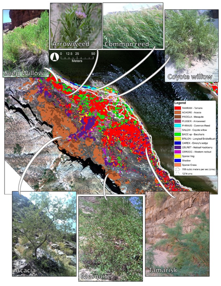
Detailed vegetation classification derived from high-resolution aerial imagery and topography data acquired in the Colorado River in Grand Canyon National Park. Photographs by Laura Durning representing seven of the 26 species included in the analysis of vegetation within the historical Colorado River corridor (river kilometers from Lees Ferry, 77.6).