
USGS has acquired an updated statewide satellite imagery mosaic for Alaska. The 4-band (red, green, blue, and near-infrared) 0.5-meter ground resolution mosaic was orthorectified using recently acquired statewide InSAR data to meet desired accuracy requirements. Source imagery for the mosaic comes from archived satellite scenes acquired predominantly from 2017 to the present during summer months. Older scenes were used to fill gaps in more recent scenes present due to persistent cloud cover over some locations in Alaska. The mosaic is licensed for public viewing and is available through the USGS National Map Viewer and the State of Alaska’s Geoportal. Additional imagery services provided by the State of Alaska allow non-commercial users with Geospatial Information Systems (GIS) to link to and use the imagery as a backdrop within their GIS applications. Also, agencies participating in the Alaska Mapping Executive Committee (AMEC) are licensed to receive a copy for internal use. The powerful combination of an updated statewide imagery mosaic and the recently completed statewide InSAR dataset that was acquired under direction of the 3D Elevation Program supports a wide variety of mapping, resource management, and public safety applications. These two substantial Alaska mapping efforts have been coordinated through the AMEC, an executive body co-chaired by the Department of the Interior and the Department of Commerce. AMEC members represent multiple Federal agencies and the State of Alaska.
https://www.usgs.gov/core-science-systems/ngp/user-engagement-office/alaska-mapping-initiative
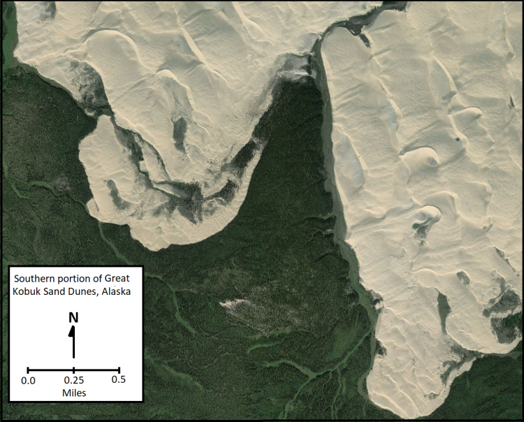
Satellite image view of a portion of the Great Kobuk Sand Dunes, Kobuk Valley National Park, Alaska.