
Accelerating glacier change in the early 21st century is impacting sea level, water resources, and ecosystems across North America and globally. Yet, direct field measurements of glacier change are laborious and logistically challenging to obtain, and less than 0.001% of glaciers on Earth have detailed long-term (more than 30 years) records. The USGS Benchmark Glacier project and collaborators at the University of Washington have automated the production and analysis of Digital Elevation Models (DEMs) using historical aerial and modern satellite imagery to address this data gap and capture glacier change at broad spatial scales. Precision mapping of entire mountain regions allows researchers to quantify the rate of glacier change over several decades and resolve physical drivers of variability between glaciers. Preliminary analysis resolves ice loss across the Crown of the Continent in Glacier National Park, Montana, and will expand to include glaciated regions in the Pacific Northwest and Alaska.
https://www2.usgs.gov/landresources/lcs/glacierstudies/default.asp
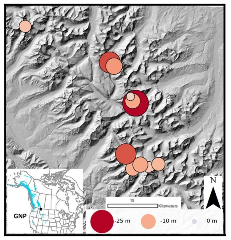
Map of mean surface elevation change of glaciers within Glacier National Park, Montana during 1966–2015. Each dot represents an individual glacier, with its size and color indicating its average surface elevation change.