
Rangeland ecosystems in the western United States (U.S.) are vulnerable to climate change, fire, and anthropogenic disturbances, yet available geospatial data for assessing trends in condition or fire risk, for example, may not be sufficient to inform management practices. To address this need, scientists from the USGS Earth Resources Observation and Science (EROS) Center and the Bureau of Land Management developed the Rangeland Condition Monitoring Assessment and Projection (RCMAP) project. This project quantifies the percent cover of rangeland components across the western U.S. using Landsat imagery from 1985–2020. The RCMAP product suite includes eight fractional components (annual herbaceous, bare ground, herbaceous, litter, non-sagebrush shrub, perennial herbaceous, sagebrush and shrub) and the temporal trends of each, along with rule-based error maps. An automated method was developed to identify change in spectral conditions between each year in the Landsat archive and the circa 2016 base year. Results showed the net cover of shrub, sagebrush, and litter significantly (p < 0.05) decreased across the range, while bare ground and herbaceous cover had no significant change and annual herbaceous cover significantly (p < 0.05) increased. Change was ubiquitous, with a mean of 92% of pixels with some change and 38% of pixels with significant change (p < 0.05). However, most change was gradual; well over half of pixels had a range of less than 10%, and most change occurred outside of known disturbances such as fires and vegetation treatments.
RCMAP fractional component time-series data spanning 1985–2020 and trends analysis products are now available for download and on the rangelands viewer application. This dataset is designed for out-of-the-box application and provides a foundation for both historical and future monitoring at ecosystem scales, including research in sage-grouse habitat and population dynamics, restoration success, and treatment effect.
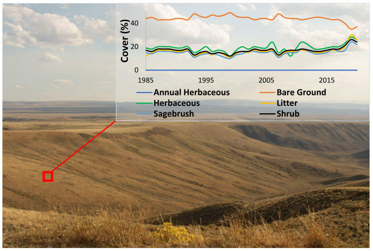
Example of RCMAP fractional component time-series trajectory in southwest Wyoming (https://doi.org/10.3133/fs20223036).