
The Colorado River delta riparian vegetation has been declining since 2000 as measured by Landsat. USGS scientists used the two-band Enhanced Vegetation Index (EVI2) as a proxy for greenness and as an input to calculate actual evapotranspiration (ETa, mmd-1). Restoration initially started in 2010 and has become more widespread and successful in recent years since 2019. Three sources of water have been provided to the region. The first was a two-month “pulse flow” of water released in 2014 from the Morelos Dam near Yuma, Arizona, as part of a United States-Mexico agreement known as Minute 319.The second source was from directed flows to the restoration sites under a subsequent binational agreement known as Minute 323, and the third came from excess flows from the Main Outlet Drain Extension (MODE) canal, which redirects agricultural runoff in Arizona. To track EVI2 and ETa changes over a 21-year period (2000-2020), the USGS research team focused on the first four of the seven reaches below the Morelos Dam (Reaches 1 and 2 form the border between Mexico and the U.S. while Reaches 3-7 comprise stretches through the Colorado River delta to the Sea of Cortez). The team studied the effects of restoration, which includes 13 sites with initial planting dates between 2010 and 2018 along the full river corridor from the United States-Mexico boundary at Morelos Dam through Reach 4. To determine if restoration sites had an impact on reach-level riparian health and water use, data were calculated separately for the adjacent unrestored riparian areas. Over the 21 years, the unrestored riparian corridor EVI2 decreased by 23.6% and ETa decreased by 32.0% (0.87 mmd-1), whereas in restored sites EVI2 increased by 11.2% and ETa increased by 5.4% (0.18 mmd-1). Because very little restored vegetation existed due to the initial planting dates occurring after 2010, these years were separately evaluated. Using 2011-2020, the unrestored riparian corridor showed decreases in EVI2 of 11.3% and reductions in ETa of 28.2% (-0.73 mmd-1); however, restored areas increased in both metrics. In this decade, restored sites showed an increase in EVI2 of 35.8% and ETa increased by 19.6% (0.58 mmd-1). Since the Minute 319 pulse flow in 2014, most of the restored vegetation has been maintained by base flows and irrigation drainage. EVI2 and ET(EVI2) as a function of the Standardized Precipitation Evapotranspiration Index (SPEI) for drought periods highlight that restored and unrestored sites respond differently. Unrestored reaches are in decline, but restored sites increased in both EVI2 and ETa. Restored sites do not significantly impact unrestored adjacent area, but smaller surface flows, a greater reliance on directed agricultural return flows, and deliveries of water to restoration sites have revitalized habitat and increased ecosystem services in the delta.
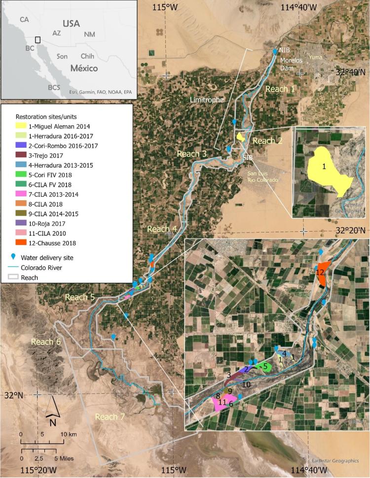
The location of the Colorado River delta riparian corridor research project is shown along with the individual reaches and the locations of the restoration sites.