
This river corridor assessment documents sediment mobility, vegetation change, and river response to flood disturbance along a 140-kilometer segment of the main-stem Klamath River below Iron Gate Dam, California. Field and remote sensing methods were used to assess fundamental indicators of active sediment transport and river response to a combination of natural runoff events and reservoir releases during the study period from 2005 to 2019. Discharge measurements at two gaged sites and bed-material samples at two ungaged sites provided direct and indirect evidence of mobile bed conditions, scour and fill, and surface flushing of fine sediment. Available remote sensing datasets collected in 2005, 2009, 2010, and 2016 were used to determine sediment storage, delineate flood inundation boundaries, and provide indirect evidence of flood-induced scour. High-resolution three- and four-band imagery from the National Agriculture Imagery Program (NAIP) collected in 2005, 2009, and 2016 was used as the base for mapping riparian vegetation. The time series of vegetation maps document the response of riparian vegetation to flood disturbance in 2006 and subsequent recovery during a drier period that included the 2012–2016 drought. Example vegetation maps illustrate the shadow, bare ground, and three vegetation classes for a selected reach downstream from Beaver Creek.
During the study period, flows greater than or equal to 6,030 cubic feet per second mobilized the substrate, caused localized scour, and flushed fine sediment from bar surfaces. Flows greater than or equal to 10,400 cubic feet per second stripped vegetation from bars and floodplains and produced deeper scour. Flood disturbance within the study reach is produced by the combined effect of natural flows and reservoir releases, which resulted in mobile bed conditions during the study period. Periodic scour and substrate disturbance are considered by the U.S. Fish and Wildlife Service to be integral for managing disease-induced mortality of juvenile and adult salmonids. Substrate conditions conducive to parasites that host infectious diseases, particularly Ceratonova shasta, occur periodically. Study results are useful for interpreting linkages among physical and biological processes and for evaluating the effectiveness of flow management targeted to improve riverbed conditions for endangered salmonid populations.
https://doi.org/10.3133/ofr20201141
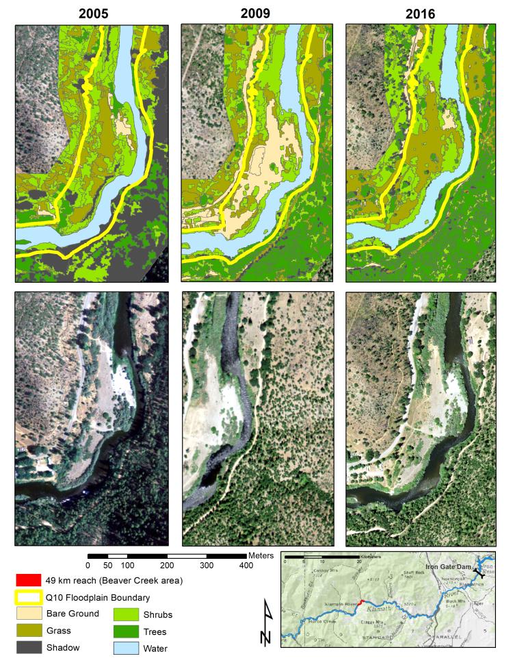
Example maps of riparian vegetation for 2005, 2009, and 2016 for the reach below the confluence of Beaver Creek, located 49 km downstream from Iron Gate Dam along the main-stem Klamath River, California.