
The Delaware River Basin is an important water resource for Philadelphia and other cities in the region. It was chosen to demonstrate USGS’s model integration efforts to investigate the relationships among water use, land cover, and climate to assess and forecast the impact of changes in these parameters on the environment and water resources. Scientists at the USGS Earth Resources Observation and Science (EROS) Center used the VegetationET (VegET) model to estimate soil moisture, evapotranspiration (ET), and runoff using a combination of daily weather and remotely sensed data to provide daily historical and future estimates of water use from 1950–2099 for the basin. Projected land cover data from FOREcasting SCEnarios for Land-use Change (FORE-SCE) was used to parameterize the model. The vast amount of data created for this study was processed using a cloud computing platform through the USGS Cloud Hosting Service (CHS) Pangeo Framework. The time series of the 150-year annual ET revealed different patterns of dry and wet periods, as well as an overall increasing trend in ET values on an annual scale. The causes for the increasing trend could be linked to an increase in the potential ET due to increasing temperature and/or favorable vegetation changes associated with projected rainfall patterns and land use change. Further investigations may support better understanding of each parameter as well as the relationships among water, land cover, and climate.
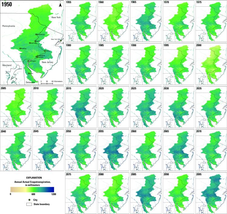
Annual total evapotranspiration (mm) for the Delaware River Basin at 250-meter resolution from 1950 to 2099 displayed with 5-year increments.