

2018 Eruption
Earth Resources Observation and Science (EROS) Center - Earthshots
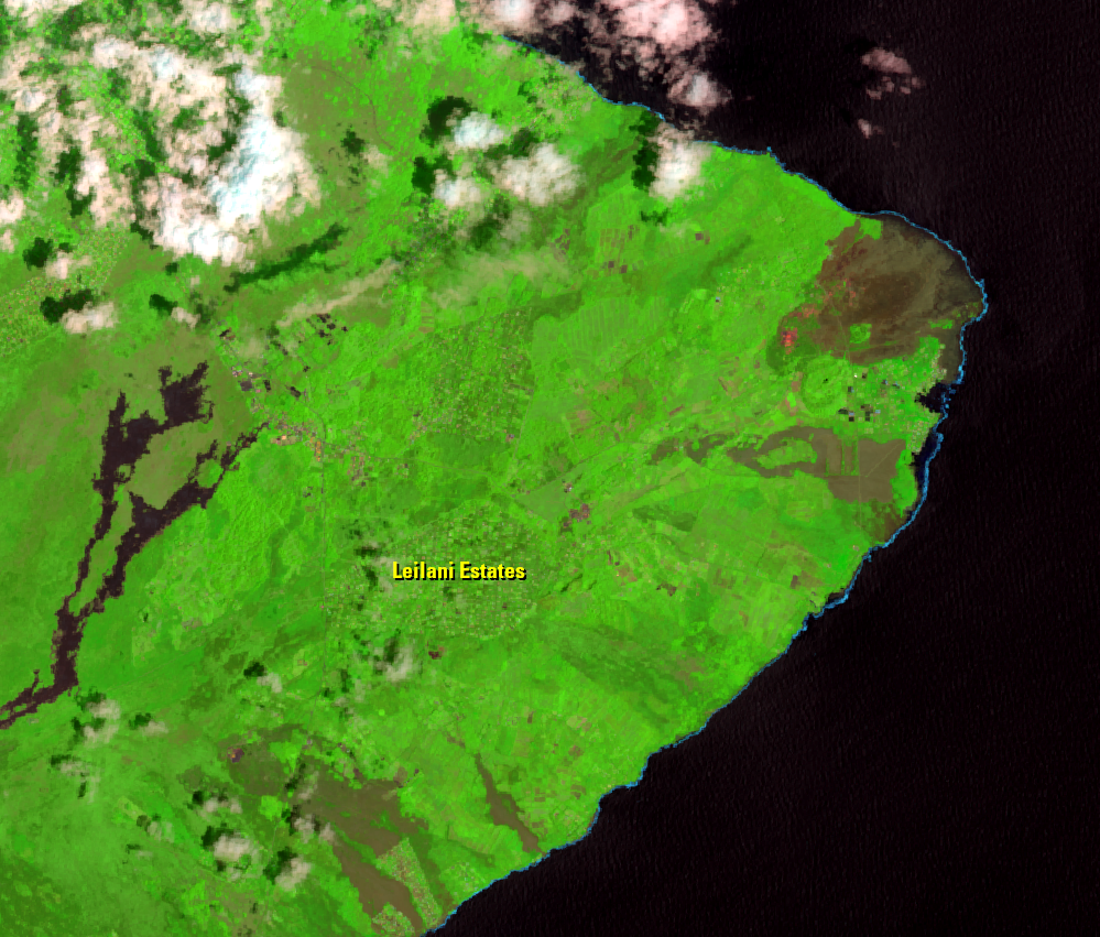
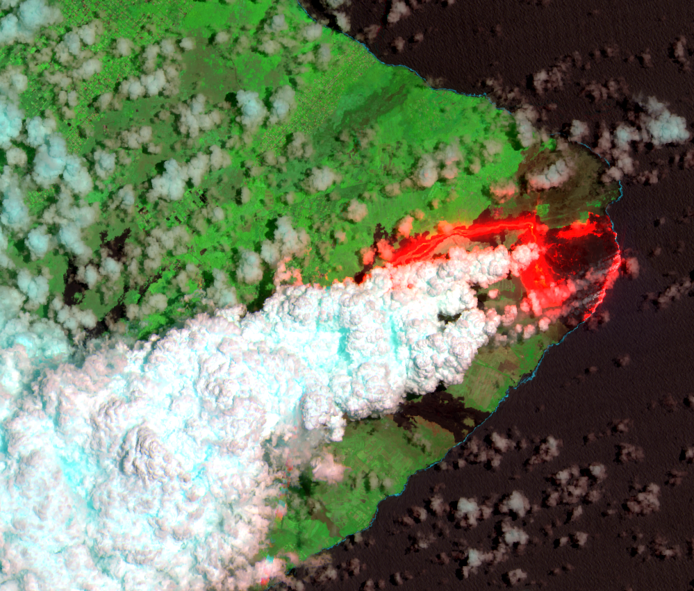
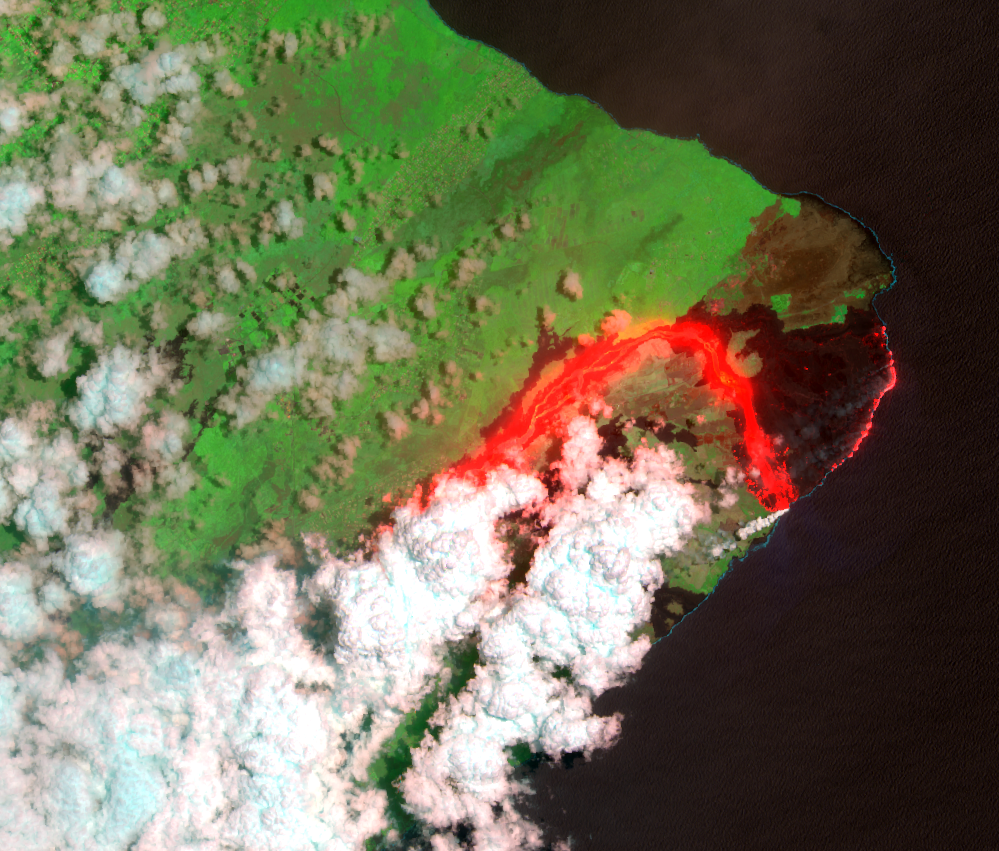
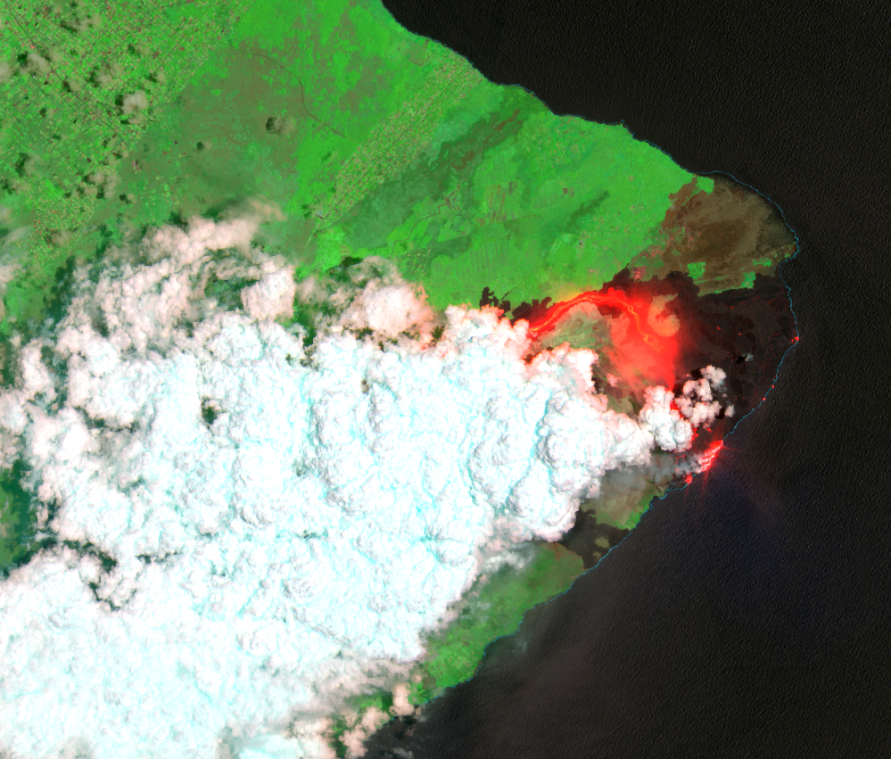
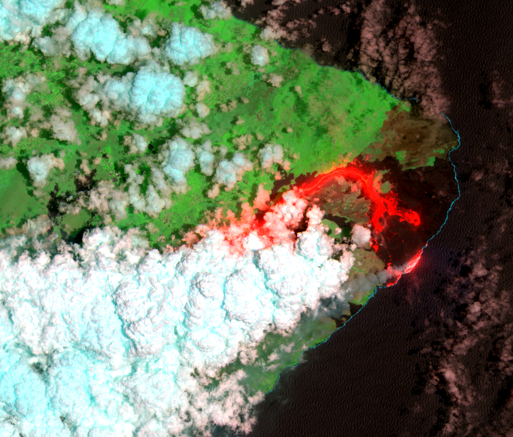
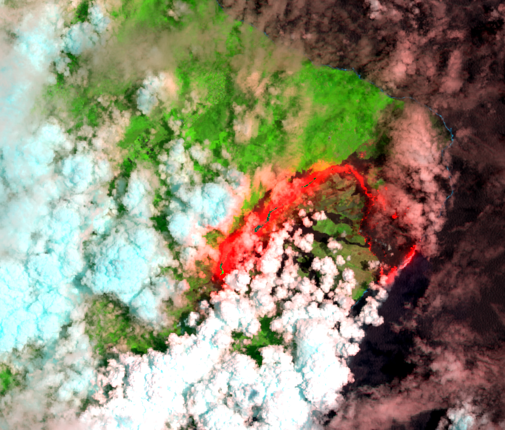
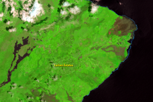
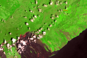
On April 30, 2018, rapid changes in the East Rift Zone were detected. The Pu‘u ‘Ō‘ō crater floor collapsed. Ground deformation toward the east indicated magma intrusion approaching the Leilani Estates neighborhood, 20 km from Pu‘u ‘Ō‘ō.
Based on numerous geological, geochemical, and geophysical instruments, the USGS Hawaiian Volcano Observatory and other scientists determined that magma had drained from below Pu‘u ‘Ō‘ō crater. It then intruded through underground tunnels and emerged at eruptive vents, or fissures, in the lower East Rift Zone.
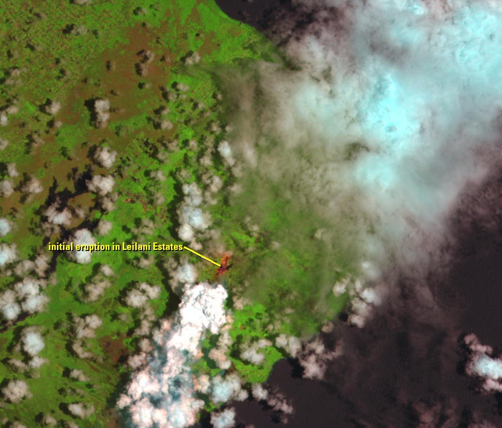
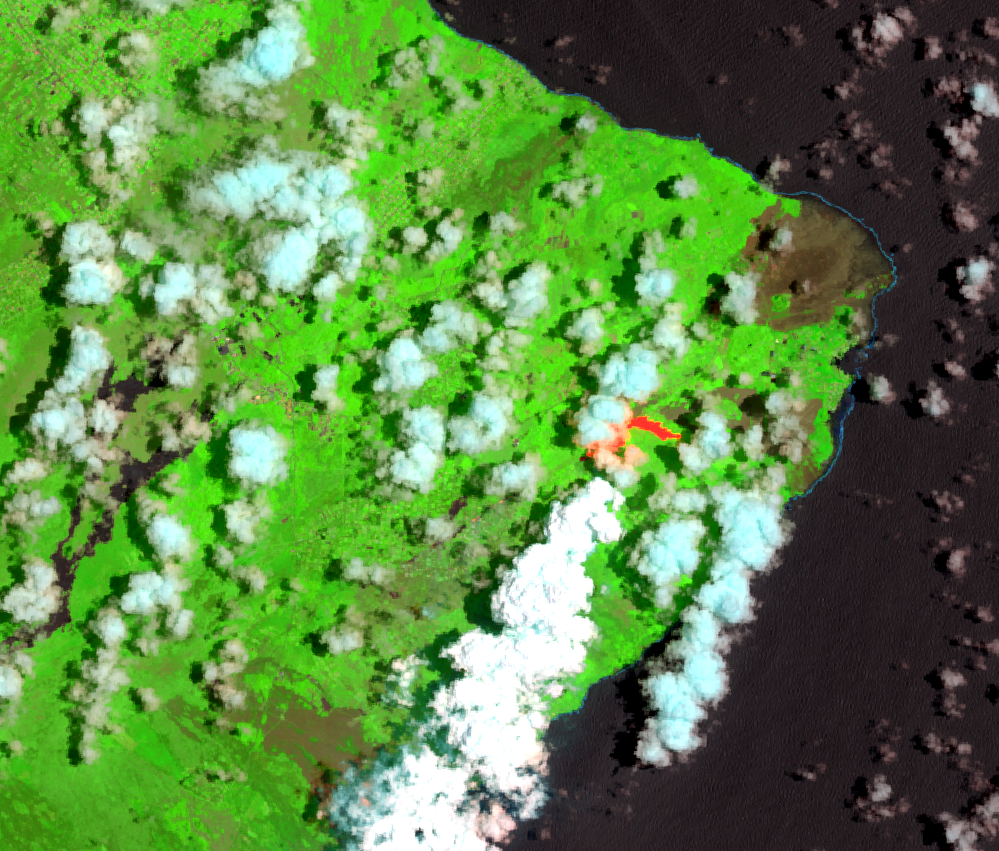
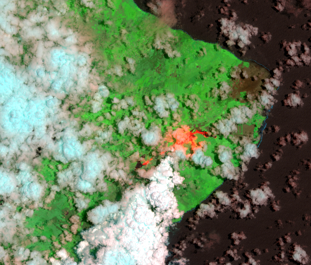
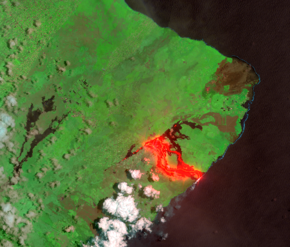
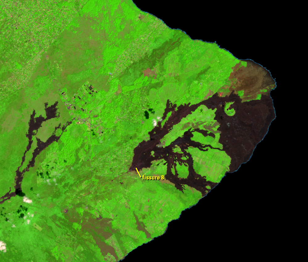
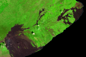
On May 3, the first of 24 fissures along a 6-km line opened within Leilani Estates. Fissure 8 became the dominant vent on May 28. It shot lava tens of meters into the air and sent a vigorous flow toward the coast, ultimately entering the ocean near the eastern tip of the island.
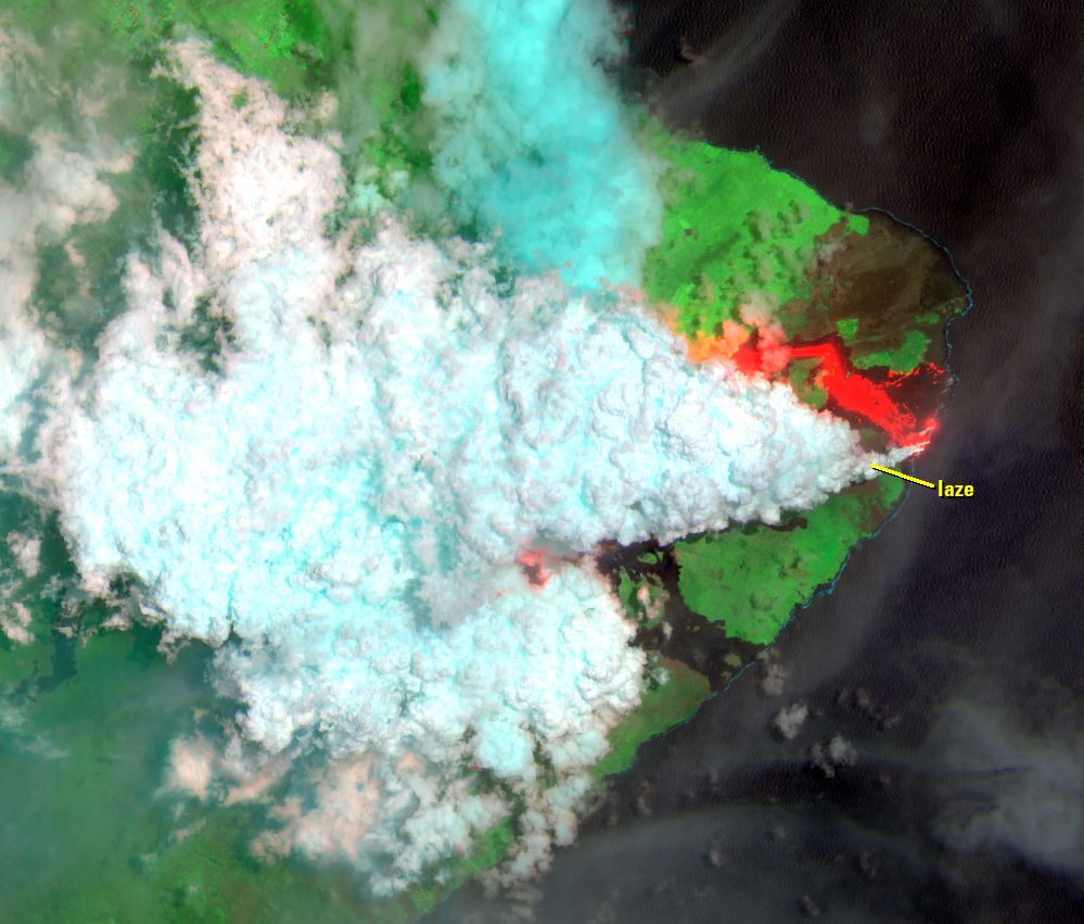
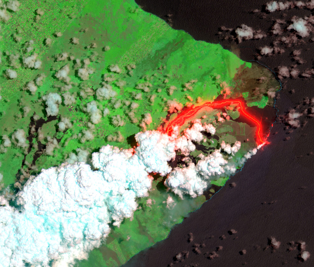
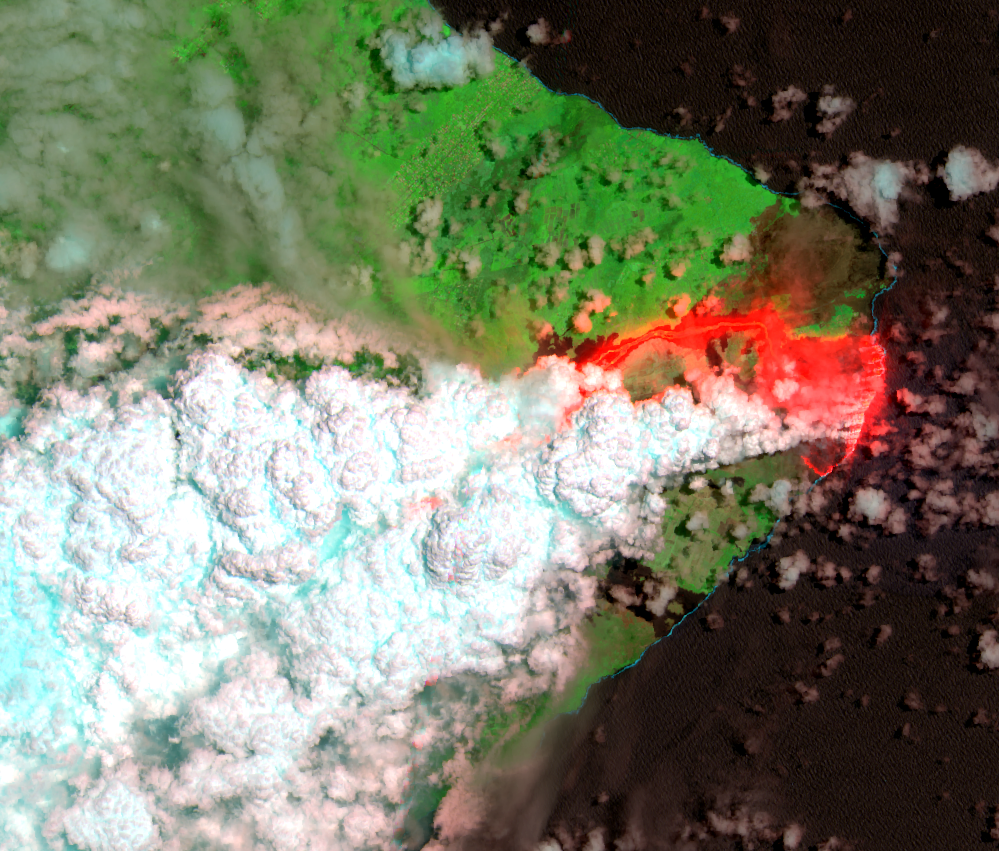
This series of images shows the progression of the lava flows throughout the summer of 2018. Clouds often obscure views of the island, but numerous observations from Landsat, Sentinel-2, and Resourcesat offered peeks through the clouds to the location of fresh lava. Some of the images also show “laze.” When lava mixes with seawater, it creates a noxious gas plume that looks like clouds or smoke. The word is a blend of the words lava and haze. Laze can cause skin and eye irritation and breathing difficulties.
This flow ended abruptly on August 4, 2018. By this time, lava had destroyed more than 700 structures, covered 13.7 square miles (35.5 km2) of land, and added about 741 acres (300 hectares) of land to the island. Lava was a couple hundred meters thick in some places.
Imagery
Every picture has a story to tell

Correlated
Additional story information
Downloads
Other Stories
Related imagery and additional content
2018 Eruption
On April 30, 2018, rapid changes in the East Rift Zone were detected. ...
End of the Pu‘u ‘Ō‘ō Eruption
Meanwhile, at the summit of Kīlauea, the Halema‘uma‘u crater and surro...
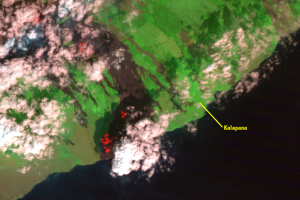
Kalapana
The Pu‘u ‘Ō‘ō eruption took a destructive turn in March 1990. Breakout...
Pāhoa
On June 27, 2014, new fissures erupted just east of Pu‘u ‘Ō‘ō crater a...

Pu‘u ‘Ō‘ō
The 2018 eruption was part of an ongoing eruption sequence that starte...