

Alaska
Earth Resources Observation and Science (EROS) Center - Earthshots
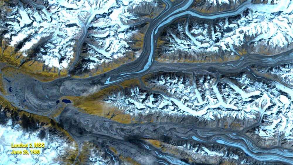
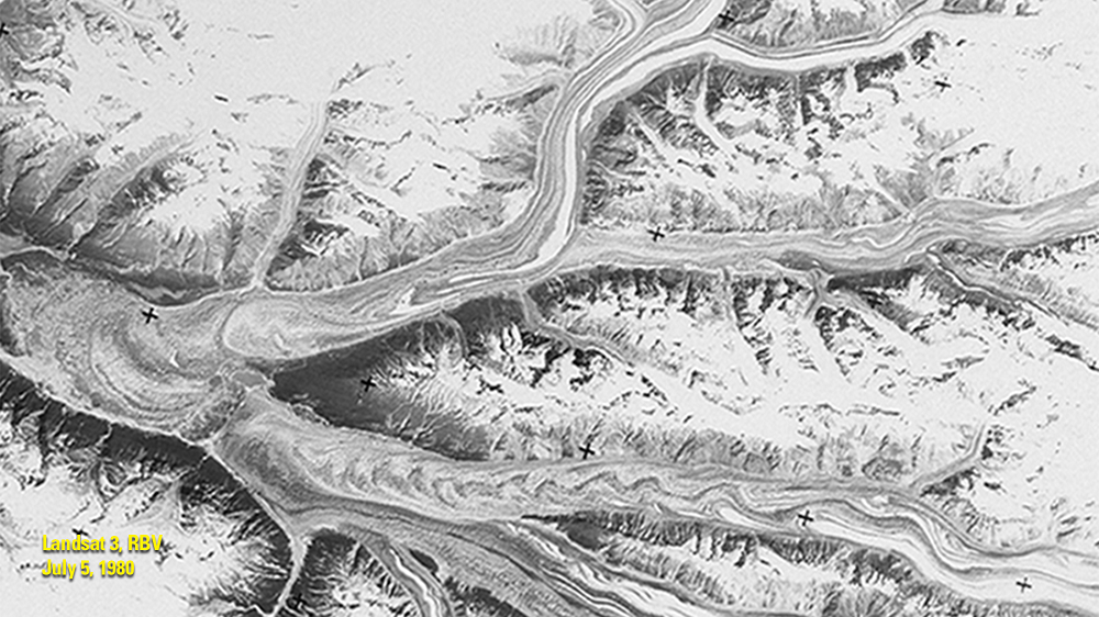
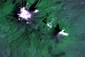
One of the factors that improves on Landsat sensors over the project’s history is the quality of the data. For example, compare these images of glaciers in Alaska’s Chitina River Valley from 1980. There is more background noise in an RBV image than there is in the MSS image. The RBV on Landsat 3 had a slightly higher spatial resolution, but the low signal-to-noise ratio makes it harder to pull out surface detail.
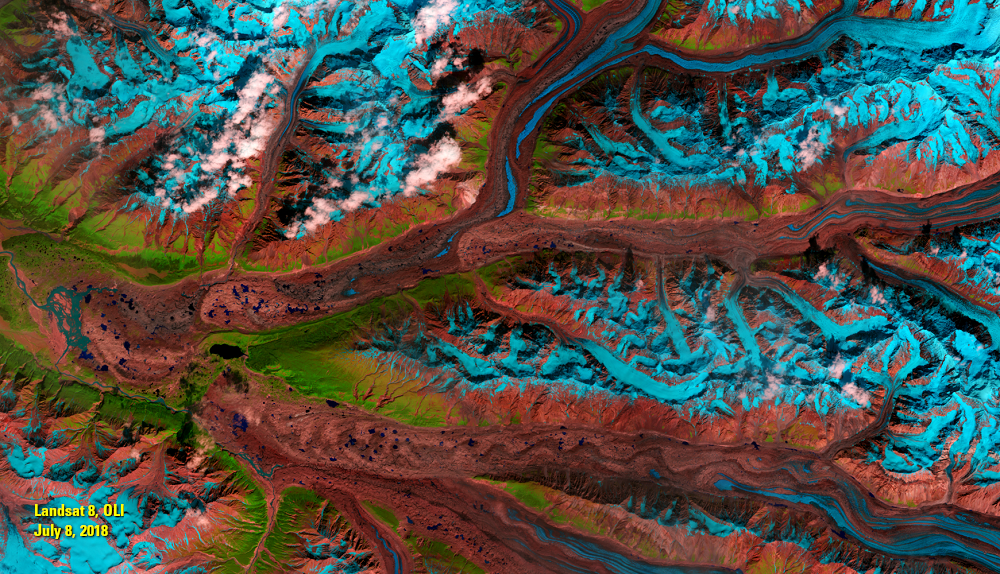
The 2018 image from Landsat 8’s Operational Land Imager has even better signal-to-noise ratio and higher resolution than both early sensors. The image reveals more detail about the roughness and flow of the ice. Landsat 8’s shortwave infrared bands provide a better distinction between ice and rock or soil.
High-quality data is needed in studying glaciers. Glaciers reflect visible light and appear bright white in natural color satellite images. But a glacier absorbs near-infrared light. The near-infrared and shortwave infrared imaging on later Landsats show the difference between snow and bare ground more clearly.
However, glaciologists still found RBV useful for mapping arctic regions. In high latitudes, images acquired at low sun angles helped enhance local topographic relief. The high resolution of the RBV on Landsat 3 supplemented MSS imagery.
In the RBV image of the Chitina River Valley, the brightest wavy streaks are glaciers. Note that they extend farther downstream in 1980 than they do in 2018. In the Landsat 8 image, wavy blue streaks indicate glaciers. They are generally in the same location as in the 1980 image, just diminished.
While RBV might not be exactly what is needed or have the ideal attributes for a study or for mapping forests, glaciers, and other land covers, perhaps it’s one more tool to add to the collection in studying land change. It’s at least worth another look. Besides, as Faundeen said, “RBV is another interesting chapter in the Landsat story.”
Imagery
Every picture has a story to tell
Correlated
Additional story information
Downloads
Other Stories
Related imagery and additional content
Alaska
One of the factors that improves on Landsat sensors over the project’s...
Mt. Ararat
Despite its problems, RBV data has been used in land change studies. R...
RBV Data
Roughly 138,000 images were taken by the RBV on Landsat 3. The data we...
RBV's Beginnings
Landsat’s RBV had an inauspicious beginning. It rode into orbit on Lan...
RBV's Problems
Because of RBV’s higher spatial resolution than MSS, glaciologists wer...