

Artificial Holes
Earth Resources Observation and Science (EROS) Center - Earthshots
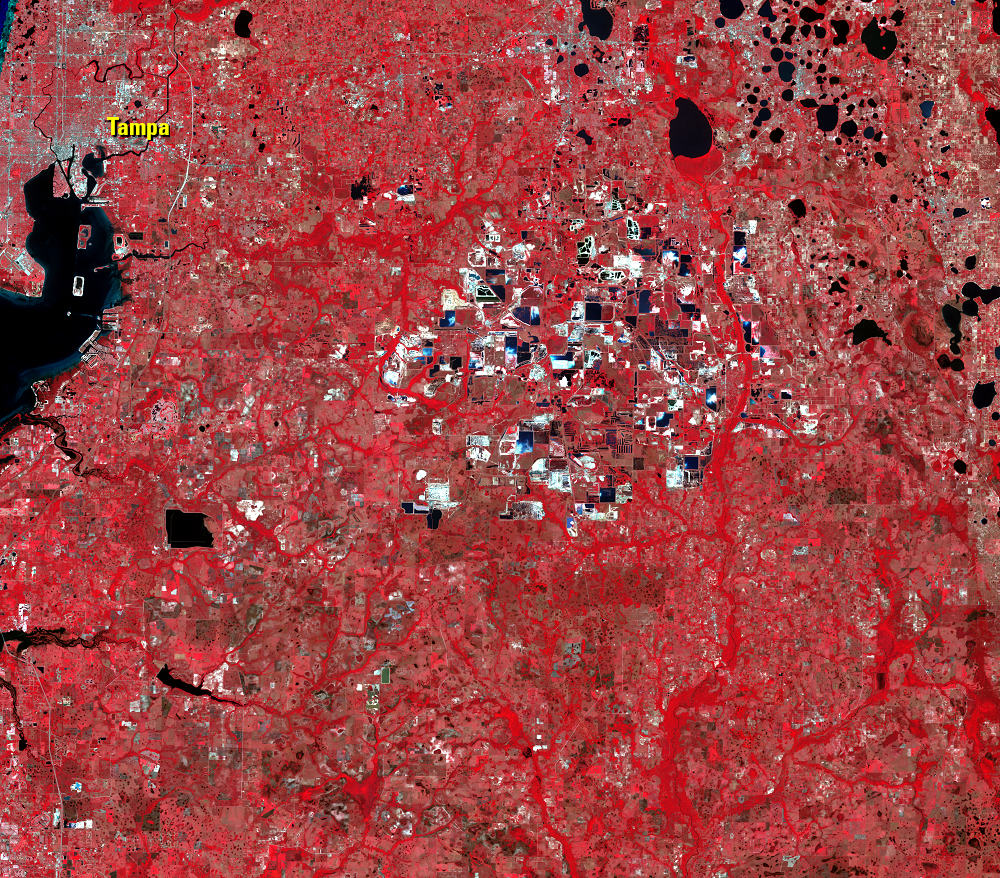
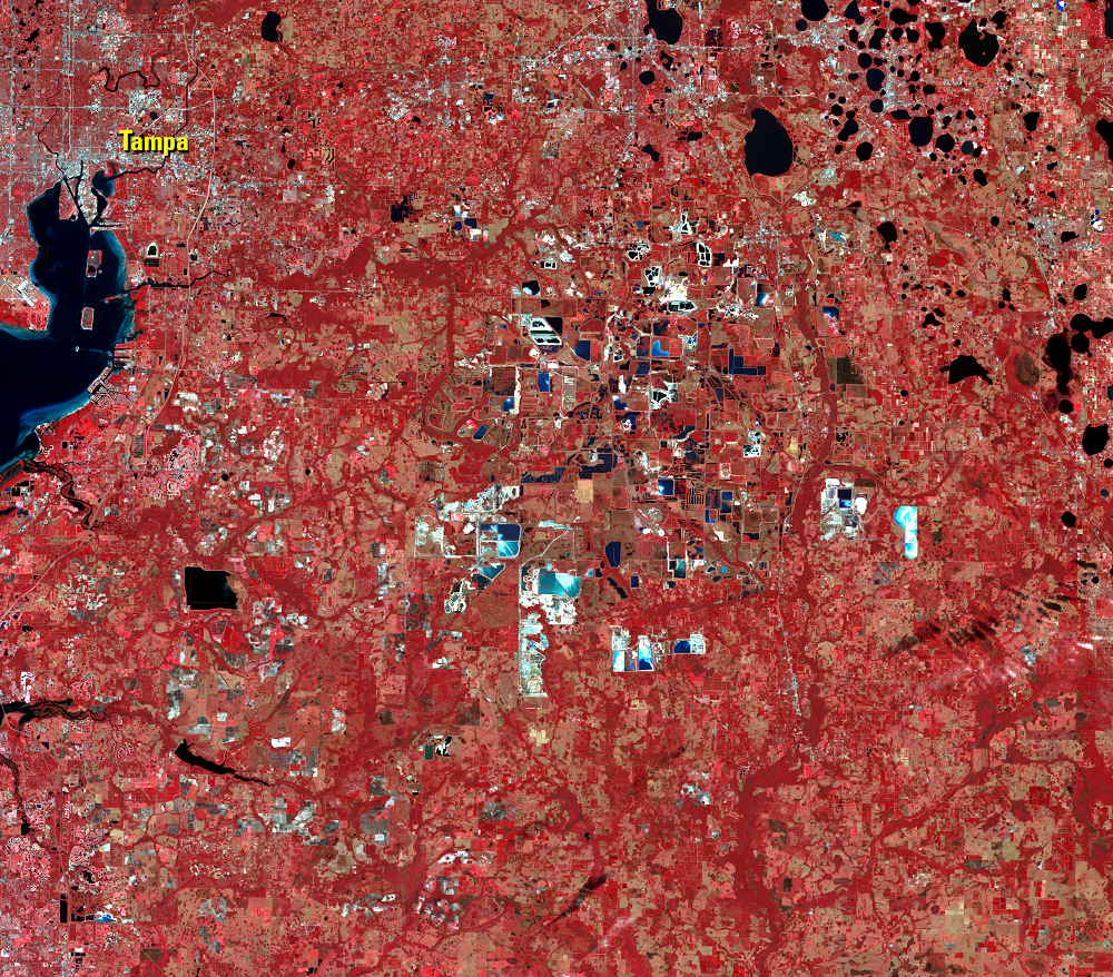
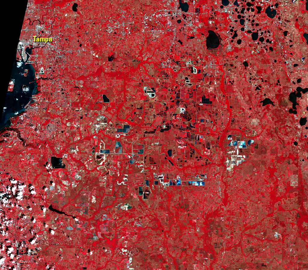
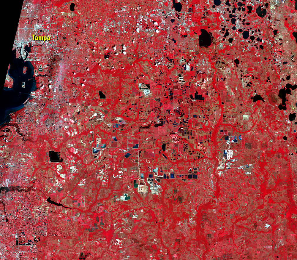
The bodies of water further south, east of Tampa, look completely different, because they have a much more human origin: phosphate mining.
South of Orlando lies the world's most productive source of phosphate, a critical nutrient for modern agriculture. In these images, plants look red and phosphate mines appear as a bright, high-contrast mix of white bare earth and blue-black ponds. The images show the phosphate region expanding, as more lands were put through the cycle of mining and reclamation.
Under just the right conditions, some ocean sediments (like those forming limestone) become rich in phosphorus. Ideally, an upwelling of cold, phosphorus-rich water to the shallow waters near shore stimulates all forms of sea life, from algae to animals. Their shells and bones, plus crystals of phosphorus, concentrate phosphorus on the ocean floor. Moving water—tides and currents underwater, streams and floods above sea level—sorts the heavy phosphate pebbles from the lighter sands, further concentrating the valuable nutrient.
Imagery


Downloads
Related Content
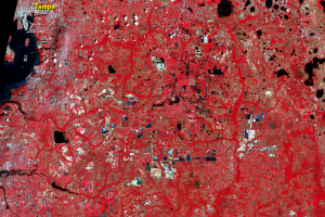
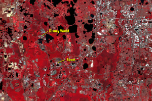
Orlando, Florida, USA
The physical growth of Orlando, Florida, especially to the east and so...
Artificial Holes
The bodies of water further south, east of Tampa, look completely diff...
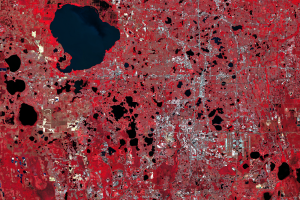
Natural Holes
As rain falls through the sky it absorbs carbon dioxide, making it sli...
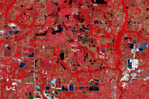
Phosphate Mines
The central phosphate region of Florida has been strip mined since 188...