

Ayeyarwady Delta, Myanmar
Earth Resources Observation and Science (EROS) Center - Earthshots
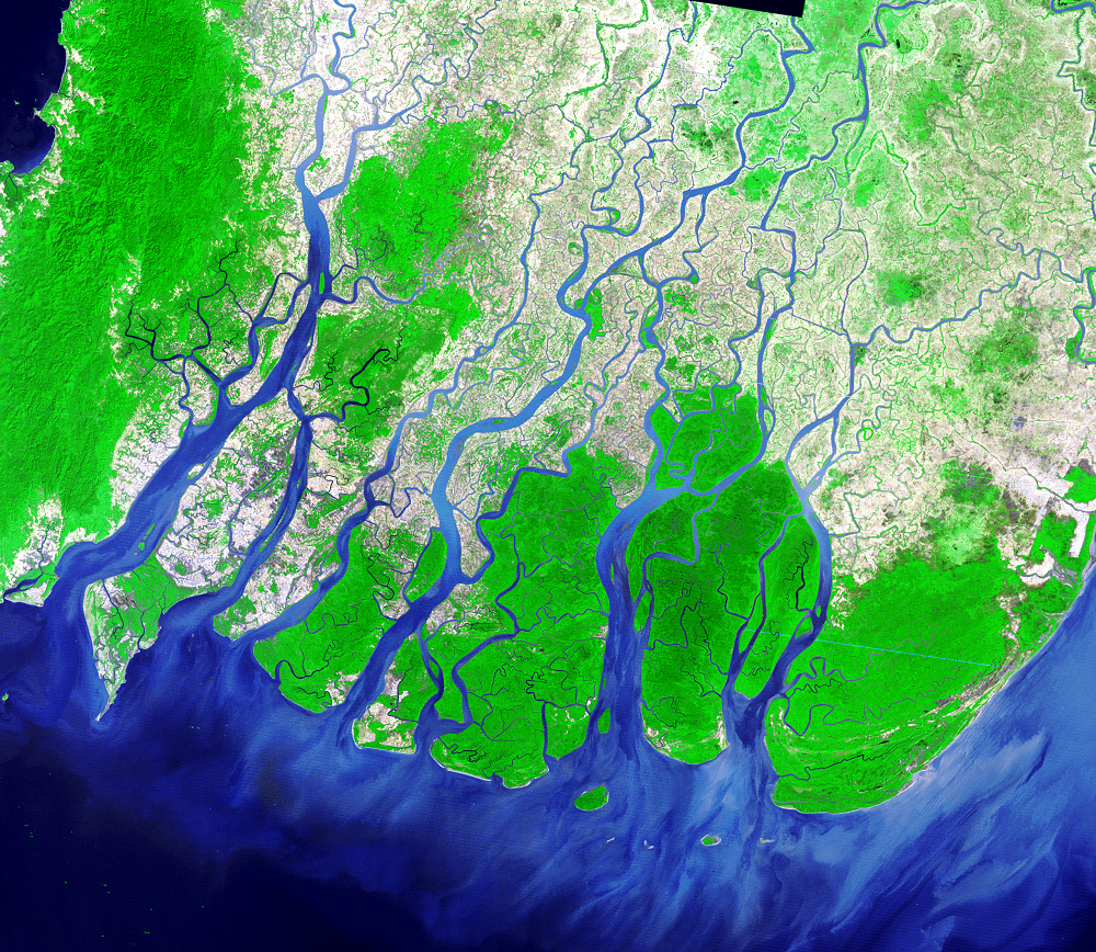
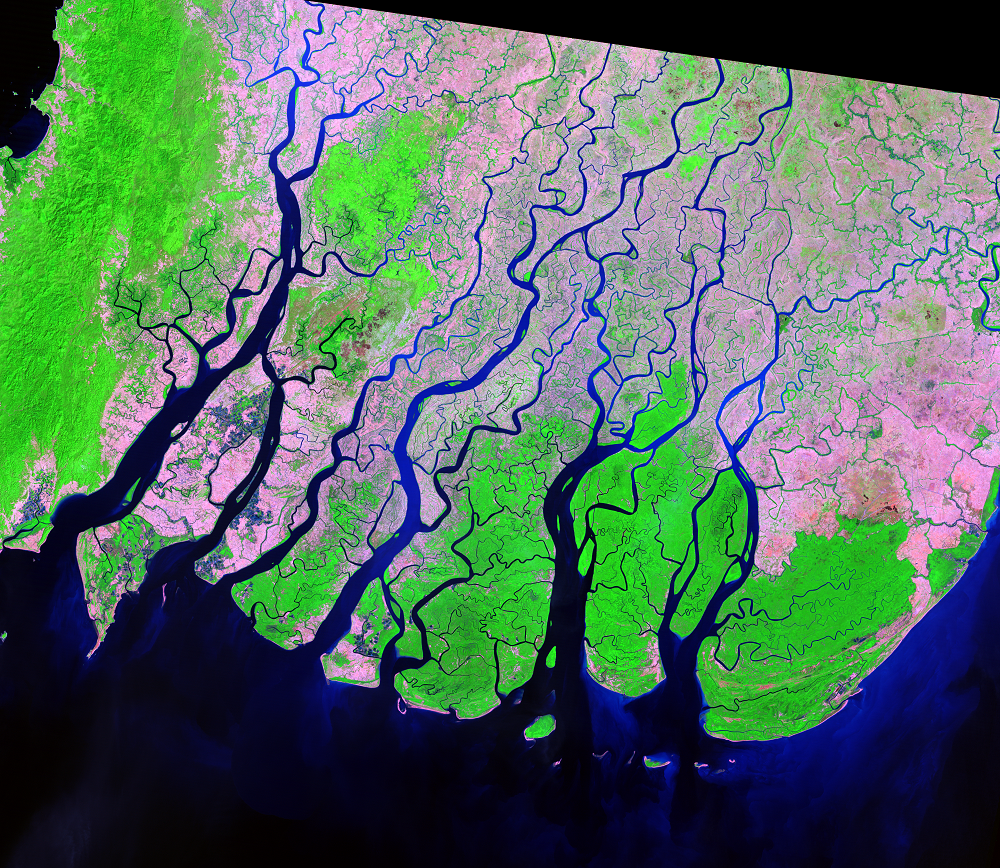
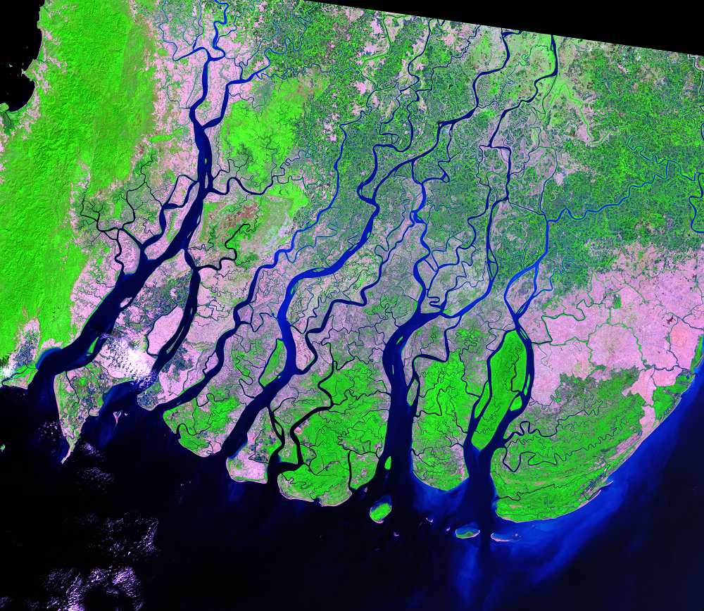
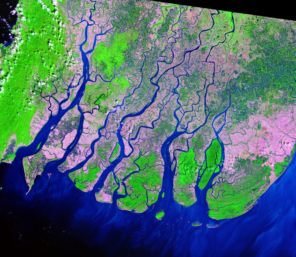
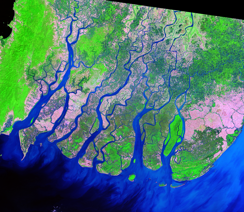
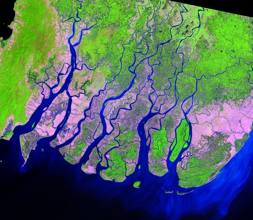
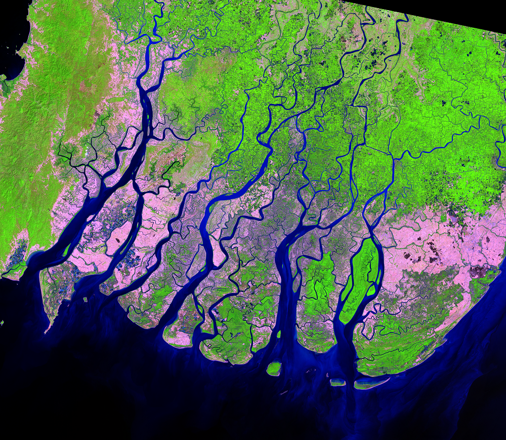
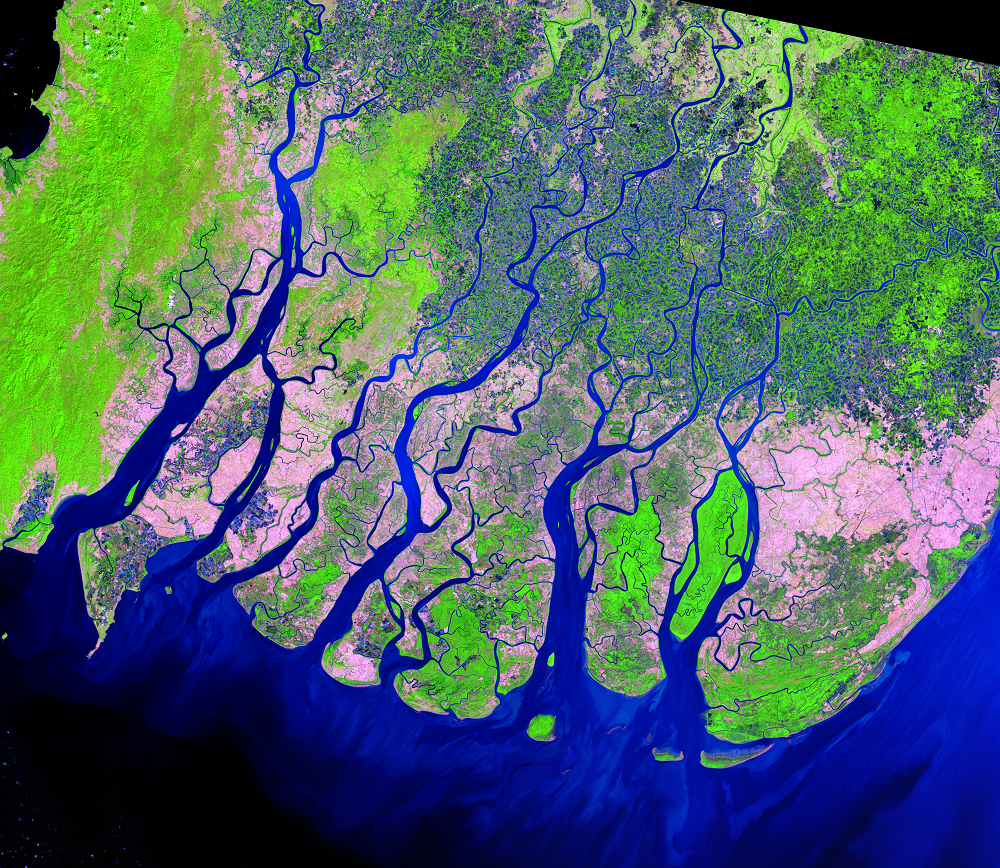
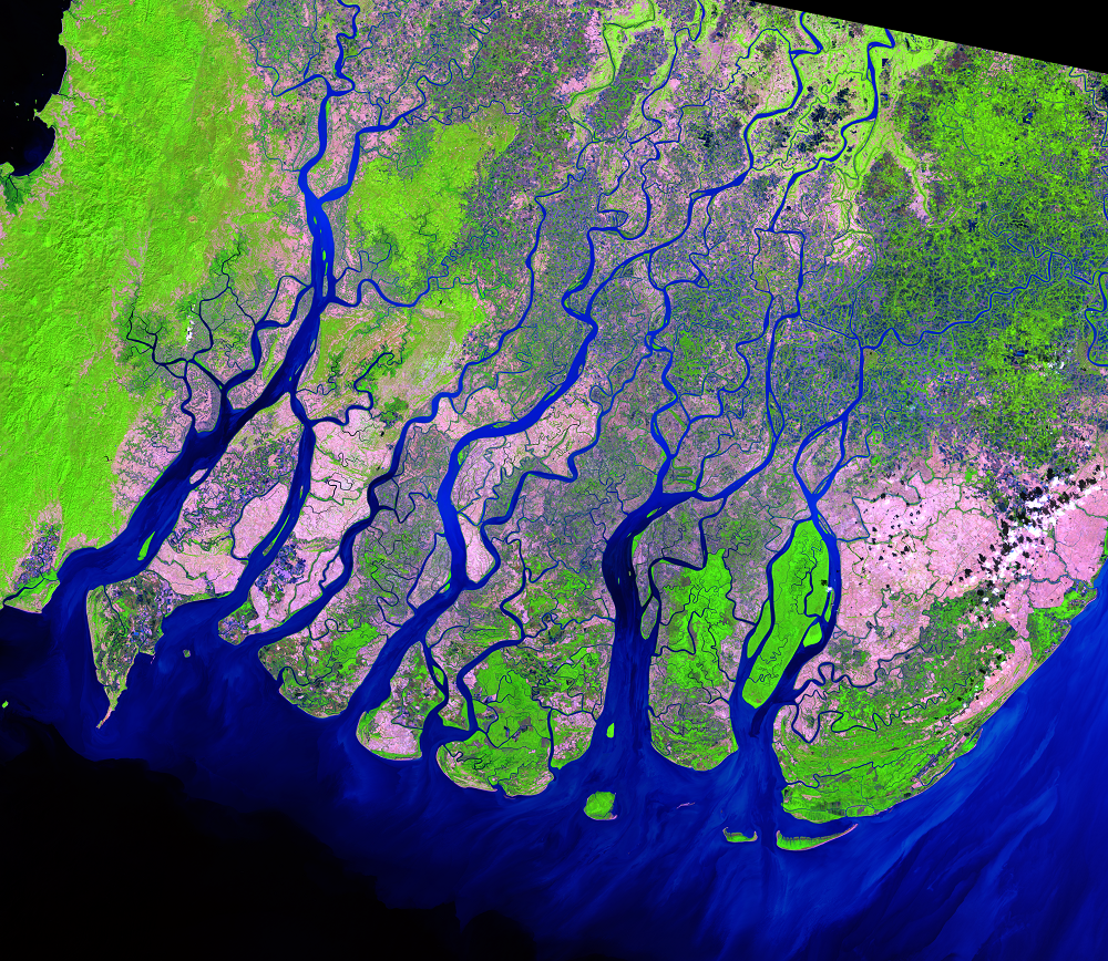
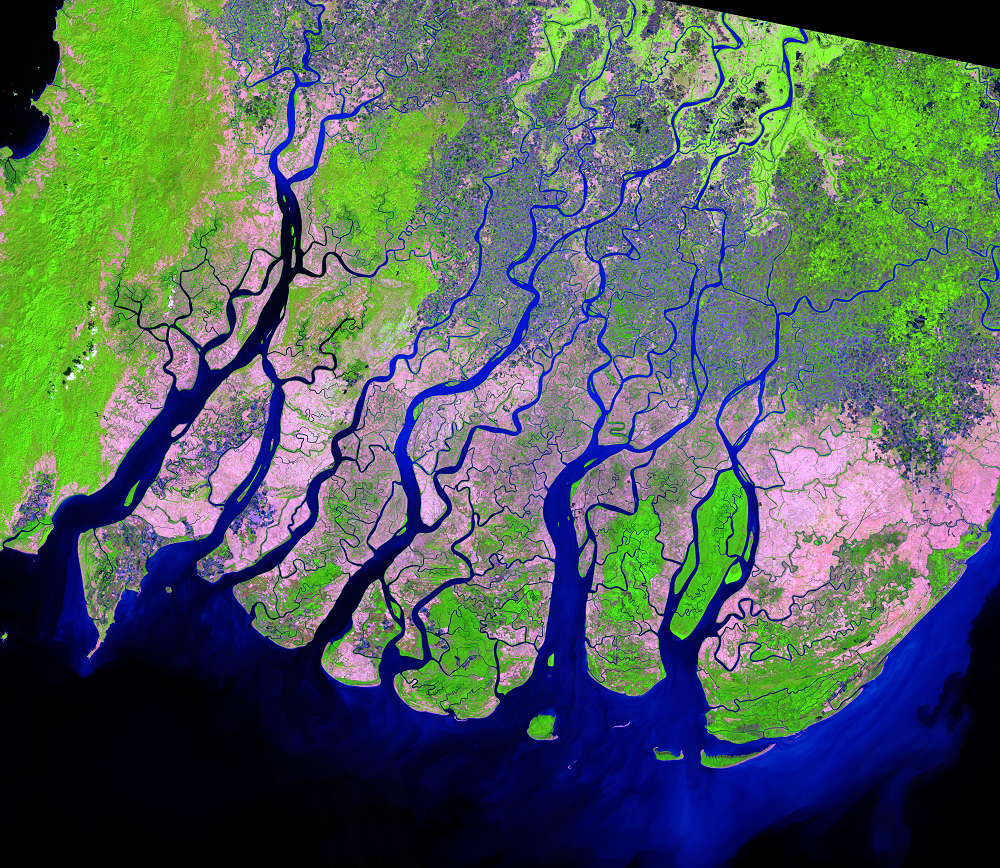
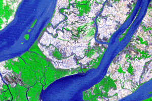
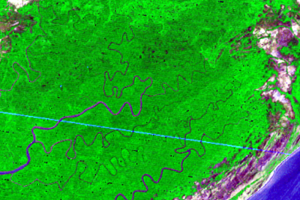
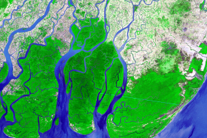
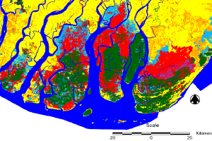
The Ayeyarwady Delta—also called the Irrawaddy Delta—is a vast alluvial floodplain. The delta spans over 35,000 km2 (13,500 mi2) and was once home to an extensive tract of mangrove forests, but deforestation has changed the landscape. One scientific study estimated that the delta lost 1,685 km2 (651 mi2) from 1978 to 2011. This 50-year sequence of Landsat images shows the relatively rapid loss of mangrove forest.
Imagery
Every picture has a story to tell
Correlated
Additional story information
Downloads
Aung, T.T., Mochida, Y., and Than, M.M., 2013, Prediction of Recovery Pathways of Cyclone-disturbed Mangroves in the Mega Delta of Myanmar: Forest Ecology and Management, v. 293, p. 103–113. (Also available online at http://dx.doi.org/10.1016/j.foreco.2012.12.034.)
Giri, C., Zhu, Z., Tieszen, L.L., Singh, A., Gillette, S., and Kelmelis, J.A., 2008, Mangrove forest distributions and dynamics (1975–2005) of the tsunami‐affected region of Asia: Journal of Biogeography, v. 35, no. 3, p. 519–528.
Giri, C., Ochieng, E., Tieszen, L.L., Zhu, Z., Singh, A., Loveland, T., Masek, J., and Duke, N., 2011, Status and Distribution of Mangrove Forests of the World Using Earth Observation Satellite Data: Global Ecology and Biogeography, v. 20, p. 154–159.
Lindsey, R., 2008, Irrawaddy Delta, Burma: NASA Earth Observatory, available at http://earthobservatory.nasa.gov/IOTD/view.php?id=8767. (Accessed August 11, 2014.)
Protectedplanet.net, 2014, Meinmahla Kyun Wildlife Sanctuary ASEAN Heritage Park: protectedplanet.net Web page at https://www.protectedplanet.net/8033. (Accessed August 11, 2014.)
Riebeek, H., 2009, Sinking River Deltas—Irrawaddy River: NASA Earth Observatory, available at http://earthobservatory.nasa.gov/IOTD/view.php?id=40257. (Accessed August 11, 2014.)
Webb, E.L., Jachowski, N.R.A., Phelps, J., Firess, D.A., Than, M.M., and Ziegler, A.D., 2014, Deforestation in the Ayeyarwady Delta and the conservation implications of an internationally-engaged Myanmar: Global Environmental Change, v. 24, p. 321–333. (Also available online at http://dx.doi.org/10.1016/j.gloenvcha.2013.10.007.)
Zaw, K., Lwin, N.N., Nyein, K.T., and Thandar, M., 2011, Agricultural Transformation, Institutional Changes, and Rural Development in Ayeyarwady Delta, Myanmar: in Intal, Jr., P. S., Oum, S., and Simorangkir, M.J.O. (eds.), Agricultural Development, Trade and Regional Cooperation in Developing East Asia:Jakarta, ERIA, p. 307–355.
Zöckler, C., Delany, S., and Barber, J., 2013, Scoping Paper—Sustainable Coastal Zone Management in Myanmar: ArcCona Ecological Consultants, Cambridge, UK, 72 p.
Other Stories
Related imagery and additional content
Aquaculture
Mangroves in the Ayeyarwady Delta are also being replaced by aquacultu...
Degradation
People are drawn to delta and coastal regions, and about 7.7 million p...
Mangrove Benefits
Mangroves are sturdy species. They can recover from storm disturbances...
Missing Mangroves
Scientists have been tracking the distribution of the mangrove forests...