

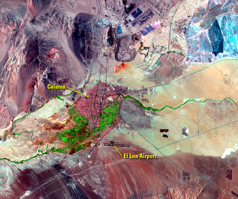
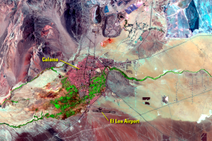
Calama
Earth Resources Observation and Science (EROS) Center - Earthshots
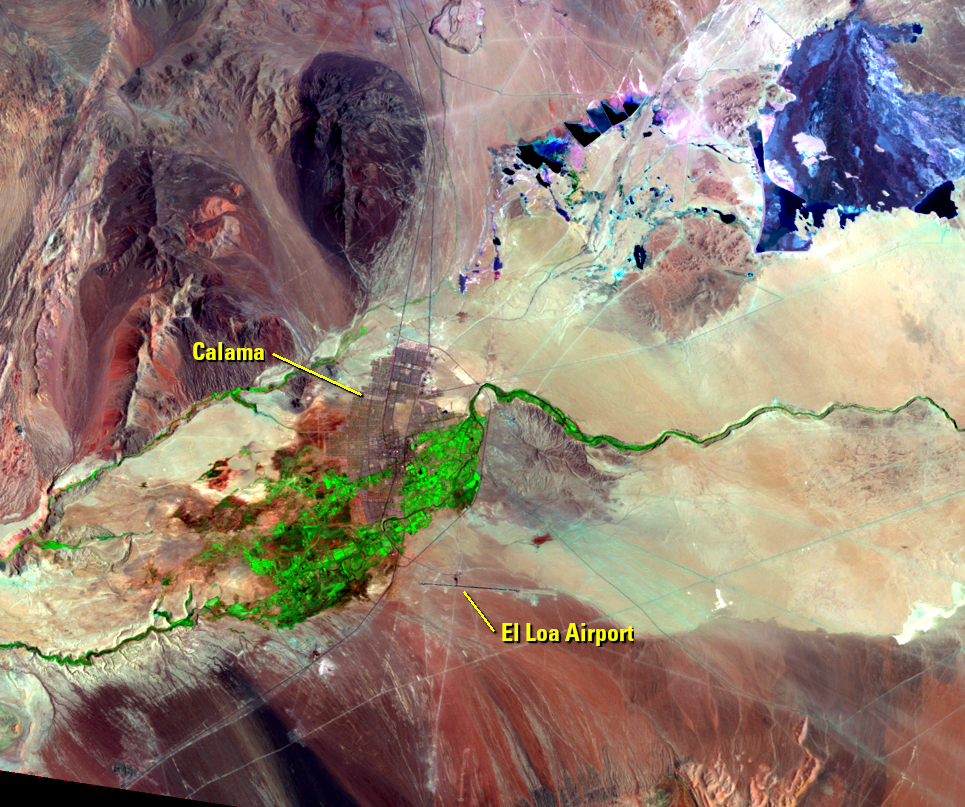
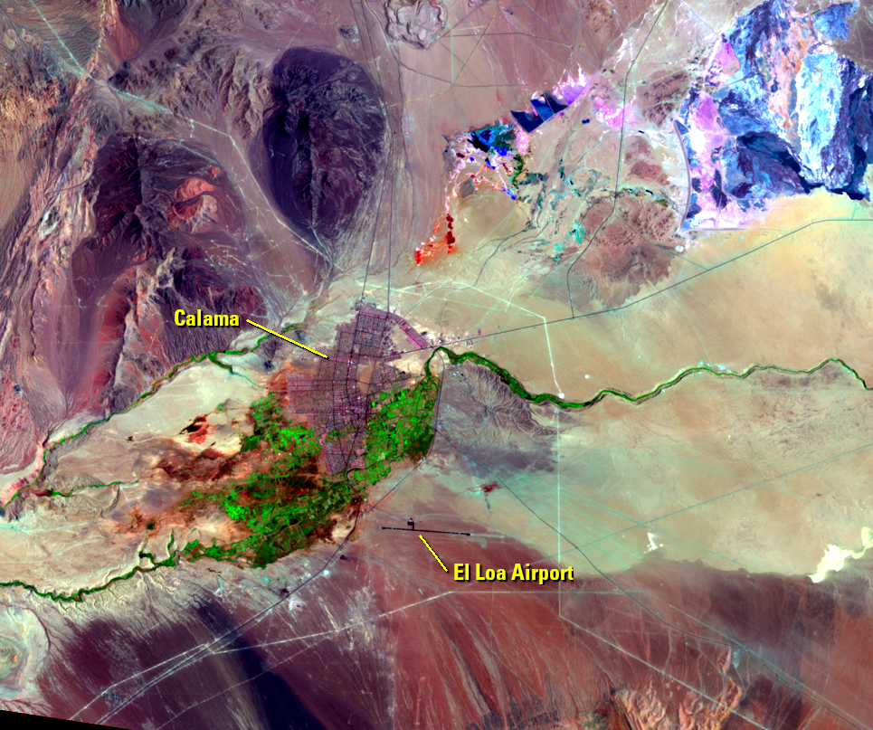
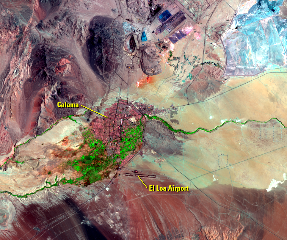
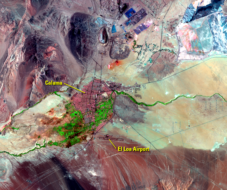
As expected in the Atacama Desert, Landsat doesn’t detect much vegetation—only some green along the Río Loa and next to the city of Calama. Calama has seen a rising population because of the influx of mine workers. The images show this visible urban area expansion. Notice the airport expansion that took place between the 2010 and 2016 images.
| Year | Population |
|---|---|
| 2020 | 190,336 |
| 2017 | 171,875 |
| 2012 | 160,794 |
| 2007 | 151,296 |
| 2002 | 142,211 |
Imagery


Downloads
Related Content
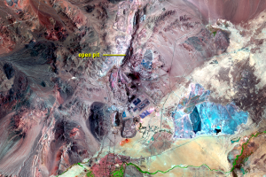
Chuquicamata Mine, Chile
The Atacama Desert of northern Chile has minimal vegetation. But it ha...
Calama
As expected in the Atacama Desert, Landsat doesn’t detect much vegetat...
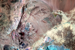
Mining
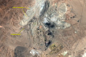
As part of the mining, huge amounts of material are dug up and removed...
Moving a Town
The town of Chuquicamata was established as a mining camp when mining ...