

Checkerboard Pattern
Earth Resources Observation and Science (EROS) Center - Earthshots
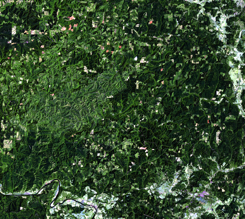
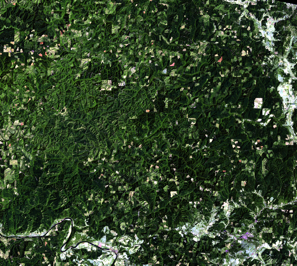
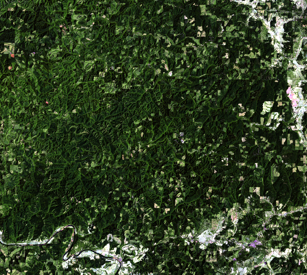
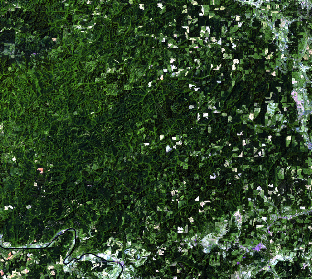
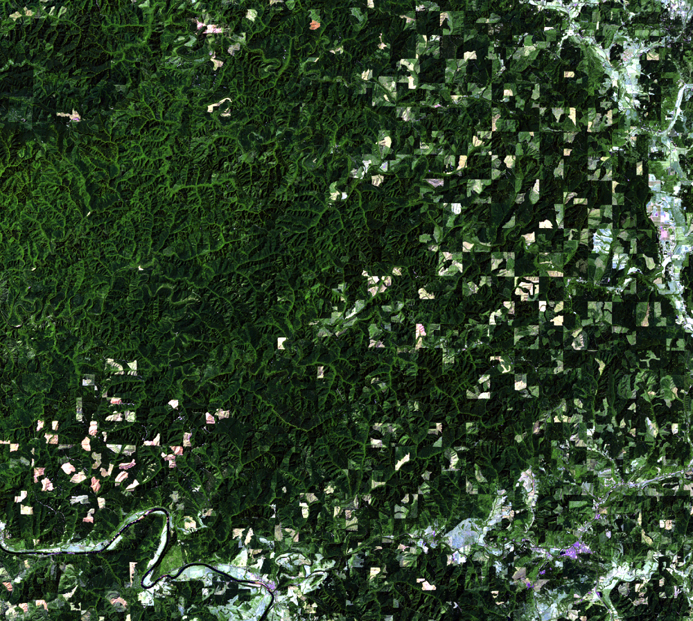
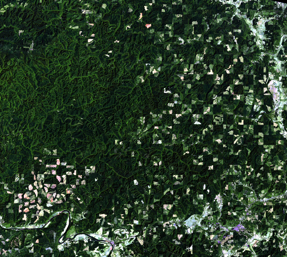
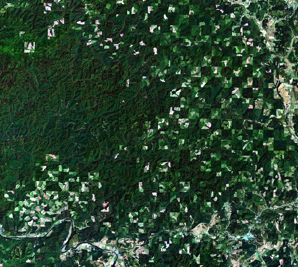
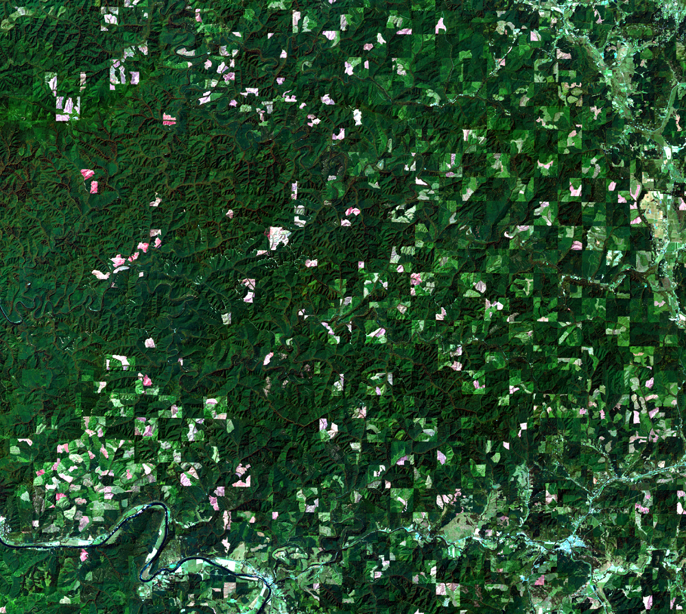
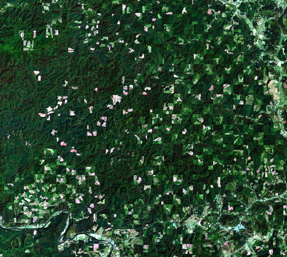
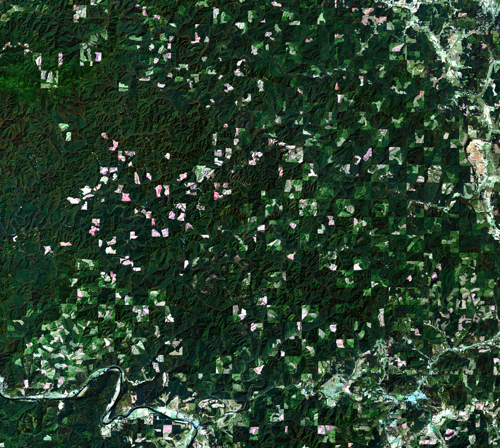
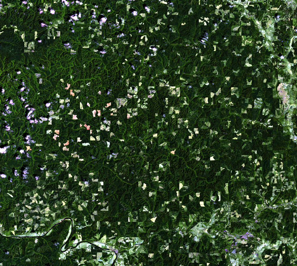
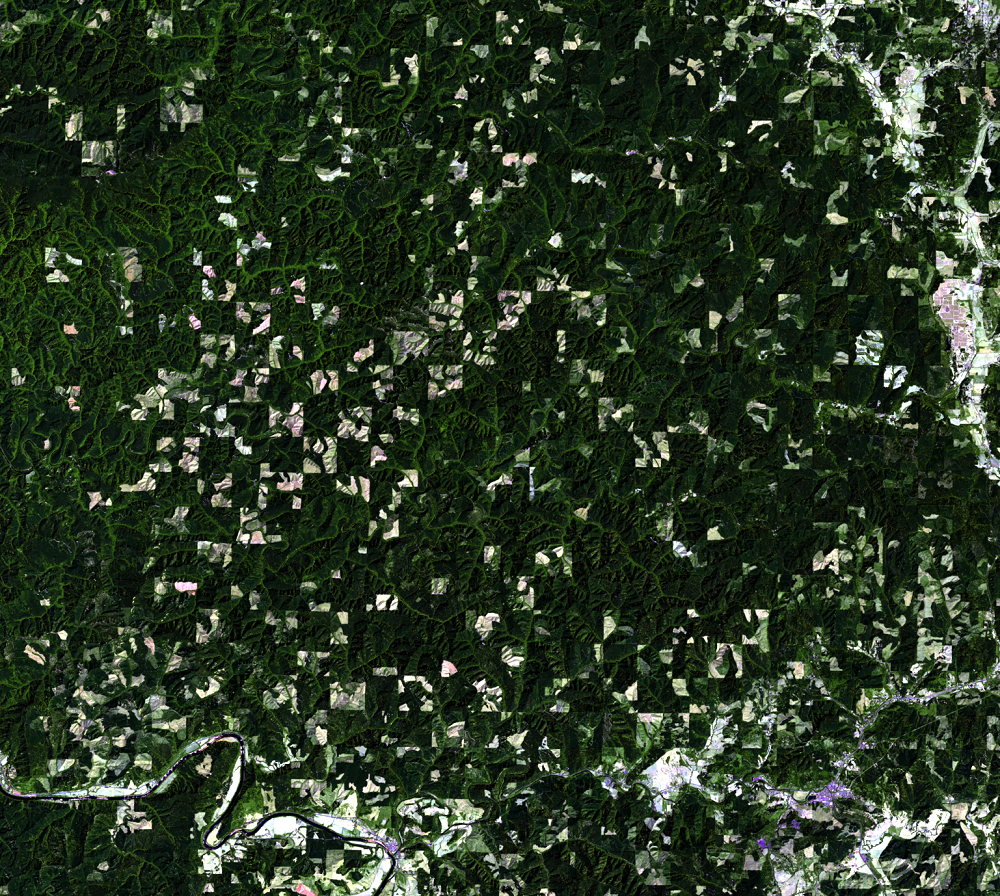
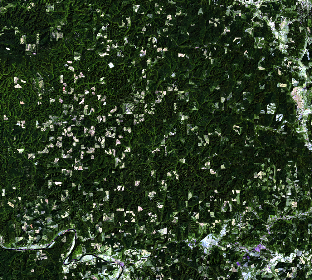
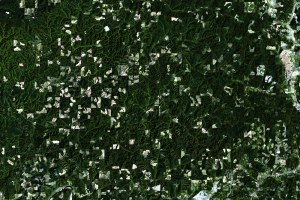
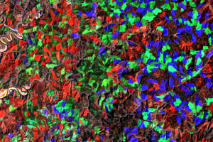
The close-up Landsat images that accompany this section show an obvious checkerboard pattern in the forest. These lands are known as “O&C” lands, which stands for Oregon and California Railroad. Land granted to O&C in 1866 was every other square mile, which formed the checkerboard pattern seen in the imagery. These lands now belong to the federal government, managed by the Bureau of Land Management (BLM).
In these images, the squares that remain dark green generally are lands that belong to the BLM. In some of those squares, there is clearcutting and regrowth taking place in this time frame. Adjacent squares, however, have a more noticeable change in tan or white spots, indicating more frequent clearcuts in the logging/reforestation cycle.
View an animation of this area to see the changes as they happen.
Imagery
Downloads
Related Content
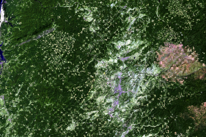
Logging in Oregon, USA
Every year, it takes one tree, 16 inches in trunk diameter and 100 fee...
Checkerboard Pattern
The close-up Landsat images that accompany this section show an obviou...
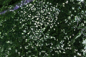
Clearcutting
A logging strategy that’s easy to spot in the Landsat imagery is clear...
Colorful Composites
On Earthshots we typically show “multispectral composites”—single-date...

Interpret the Images
A more up-close look in the Landsat images helps you to see the progre...