

Cougar Creek Fire, Washington, USA
Earth Resources Observation and Science (EROS) Center - Earthshots
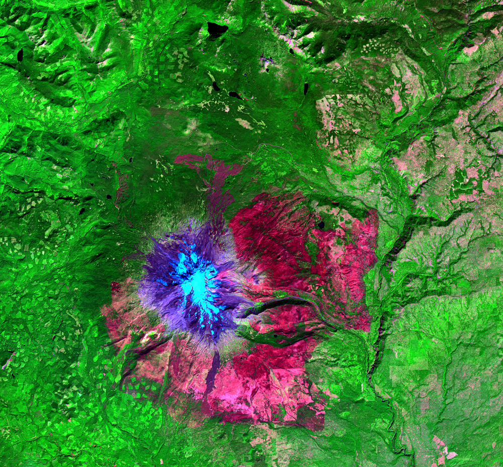
Wildland fires can leave behind scorched mountainsides with no trees or other vegetation to stop rain-driven mudslides or dangerous debris flows. When such potential exists, the shortwave infrared (SWIR) and near-infrared (NIR) spectral bands of the Landsat satellite sensors help to identify those possibilities quickly.
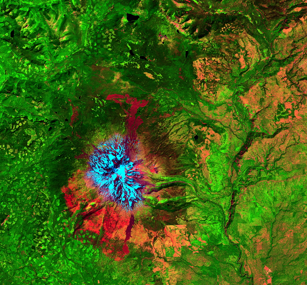
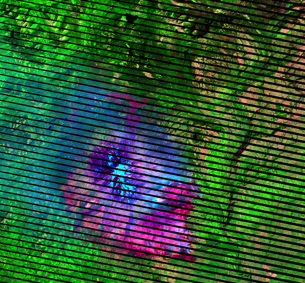
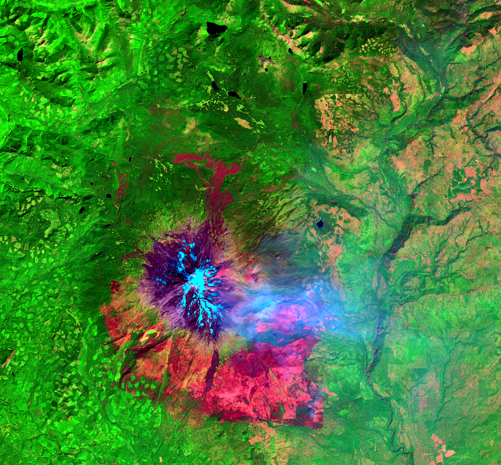
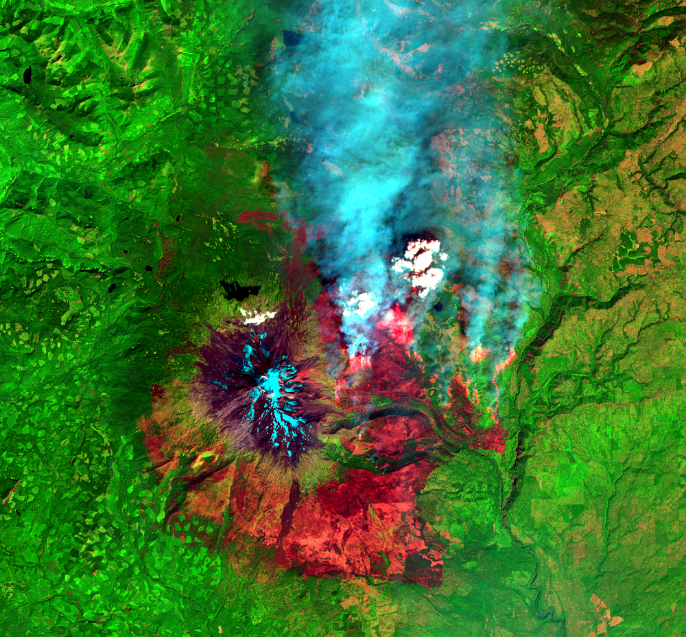
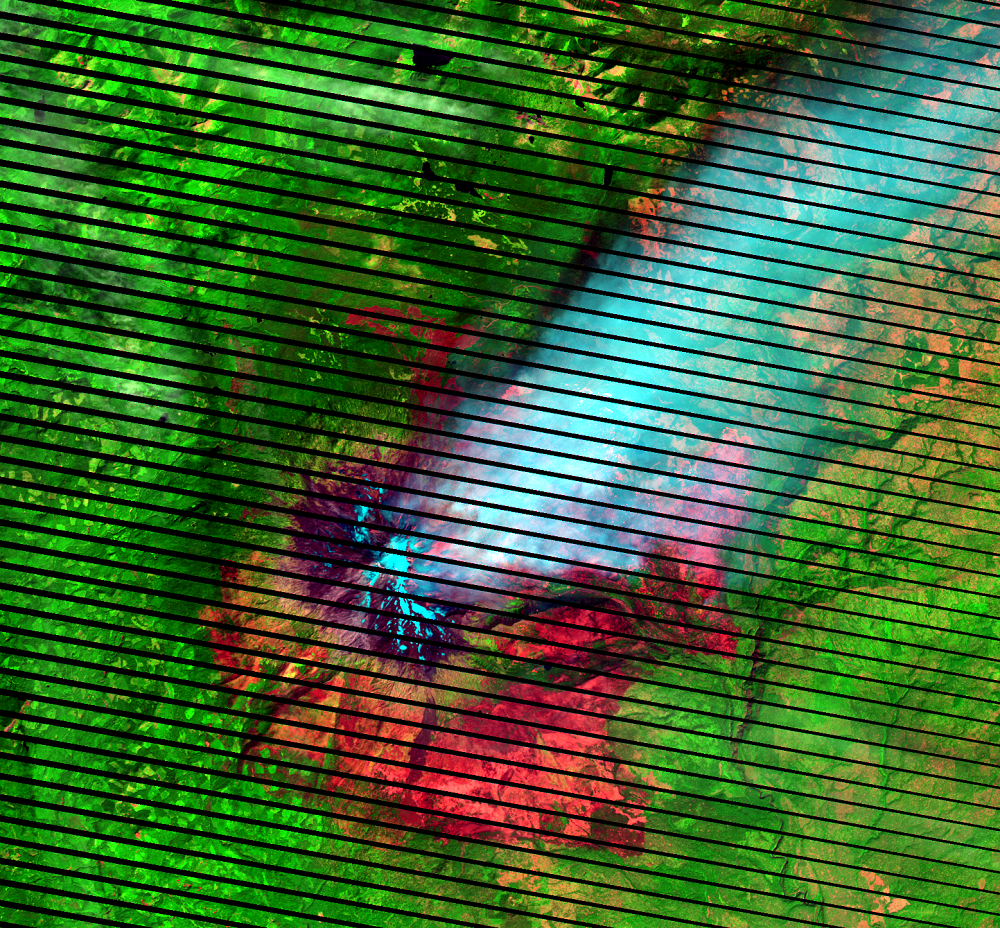
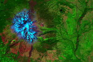
The six images displayed show prefire conditions in 2014 and the progression of the Cougar Creek Fire in Washington on the eastern slopes of Mount Adams over the several days that it burned in 2015. Lightning started the fire on August 10, 2015, and it was not contained until mid-September. While it’s interesting to see the progression of the fire, it’s the prefire and postfire images that are really important for burn severity mapping.
(Black stripes run through the Landsat 7 images because of the Scan Line Corrector failure on Landsat 7 in May 2003.)
Imagery
Every picture has a story to tell
Correlated
Additional story information
Downloads
InciWeb, 2015, Cougar Creek—Incident Information: Incident Information System, accessed on October 18, 2016, at http://inciweb.nwcg.gov/incident/4484/.
McKinley, R., 2012, Remote Sensing Support for Burned Area Emergency Response Teams: U.S. Department of Interior, accessed on September 26, 2016, at https://eros.usgs.gov/doi-remote-sensing-activities/2012/remote-sensing-support-burned-area-emergency-response-teams.
Monitoring Trends in Burn Severity (MTBS), 2016, Mapping Burn Severity for Burned Area Emergency Response (BAER) and Monitoring Trends in Burn Severity (MTBS): MTBS, accessed on September 26, 2016, at https://www.mtbs.gov/baer.
U.S. Forest Service, [n.d.], Frequently Asked Questions: Remote Sensing Applications Center, accessed on September 26, 2016, at http://www.fs.fed.us/eng/rsac/baer/barc.html.
U.S. Geological Survey, 2016, When wildfire damage threatens humans, Landsat provides answers: U.S. Geological Survey Fact Sheet 2016–3044, 2 p., http://dx.doi.org/10.3133/fs20163044.
Other Stories
Related imagery and additional content
Burn Mapping
After a wildland fire, scientists at the USGS EROS Center quickly begi...