

Deltas
Earth Resources Observation and Science (EROS) Center - Earthshots
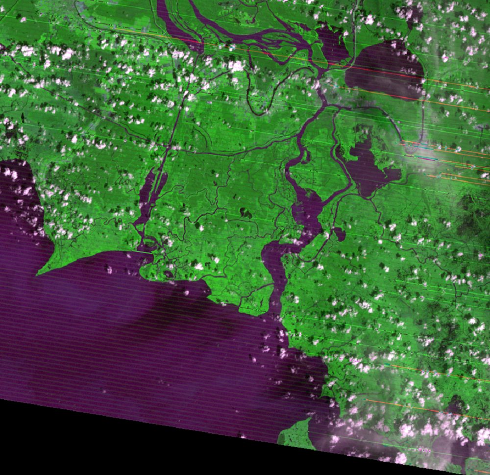
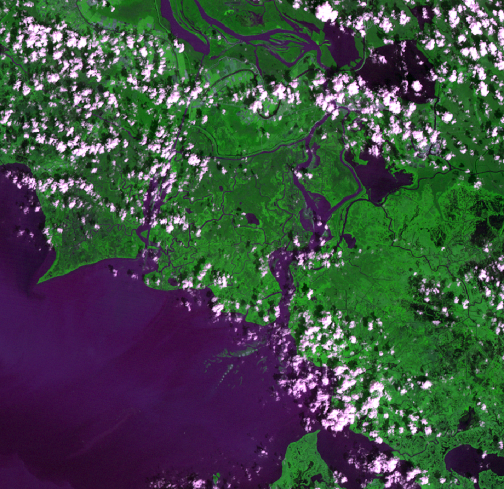
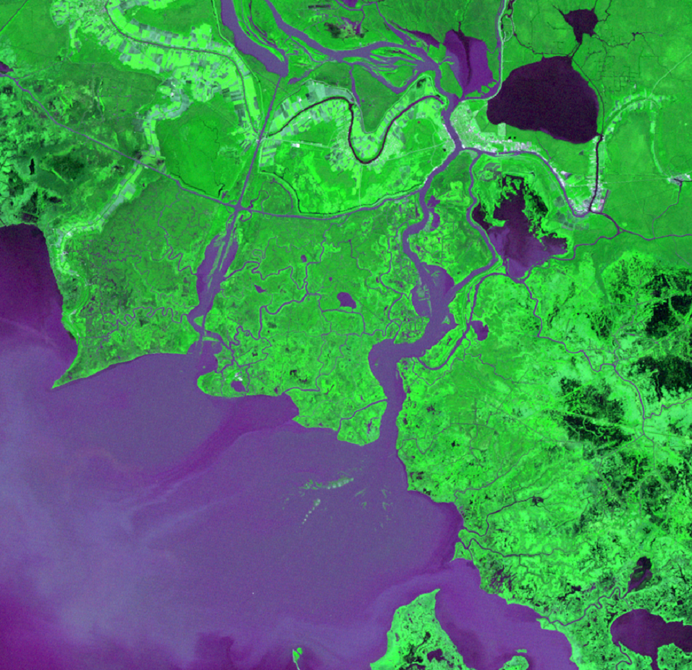
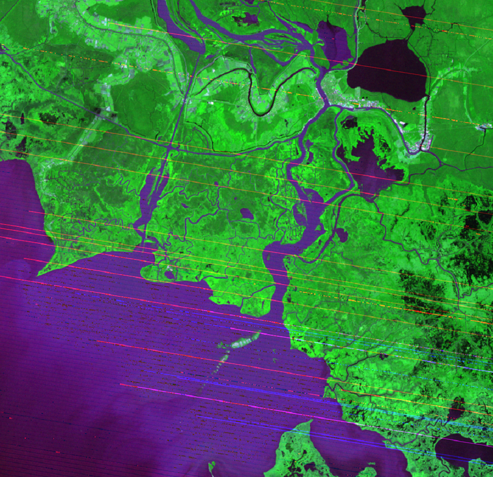
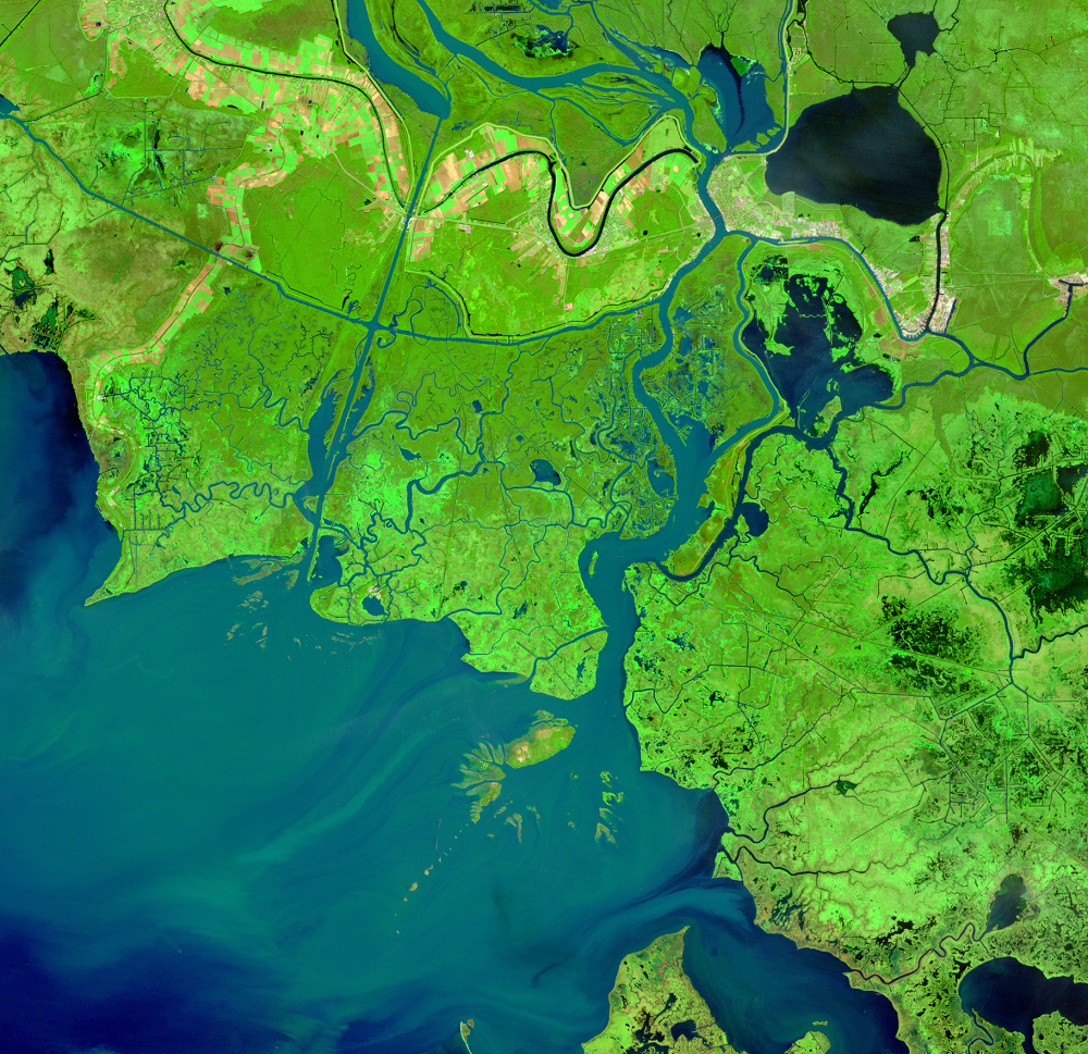
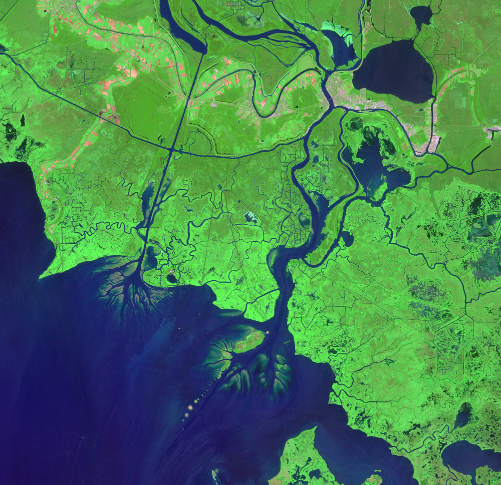
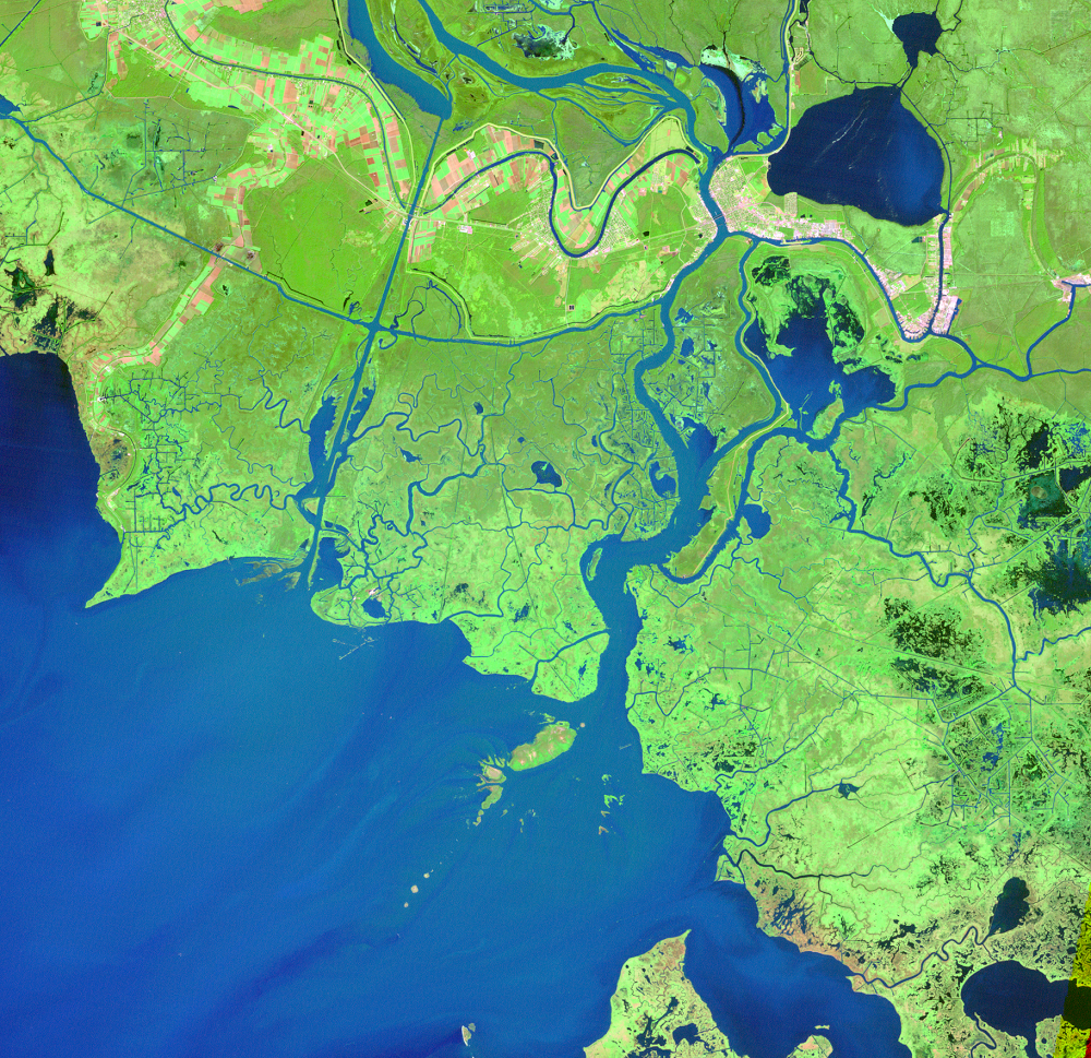
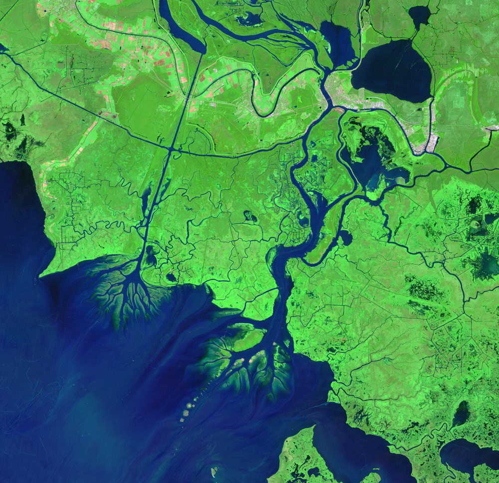
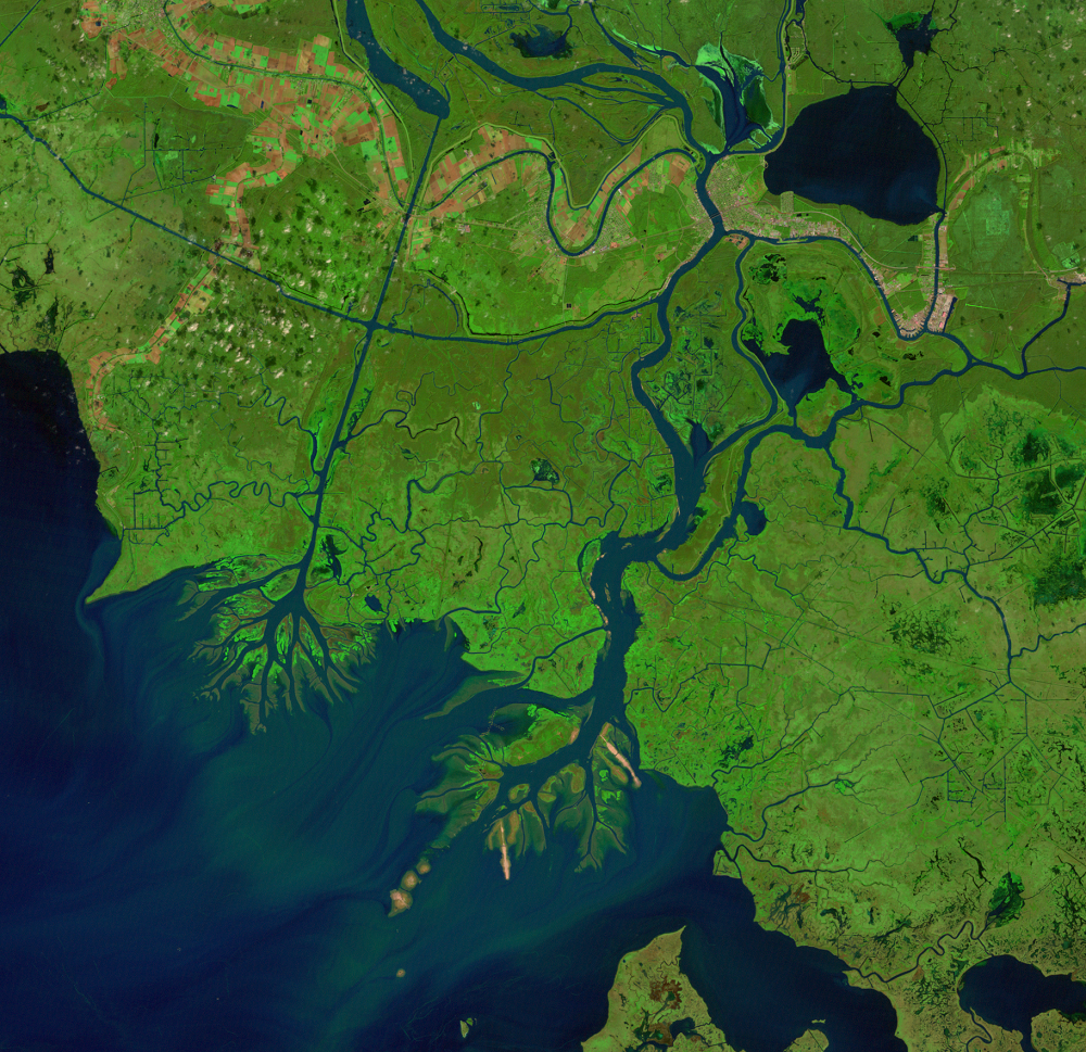
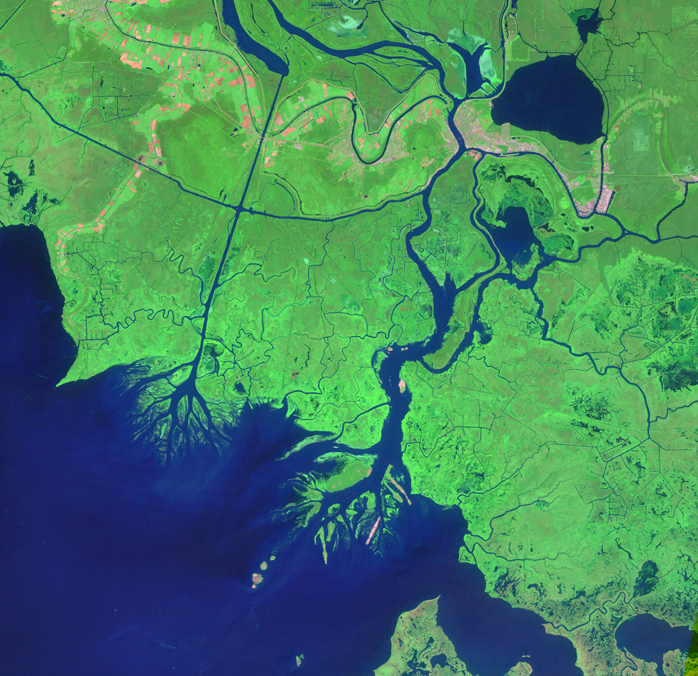
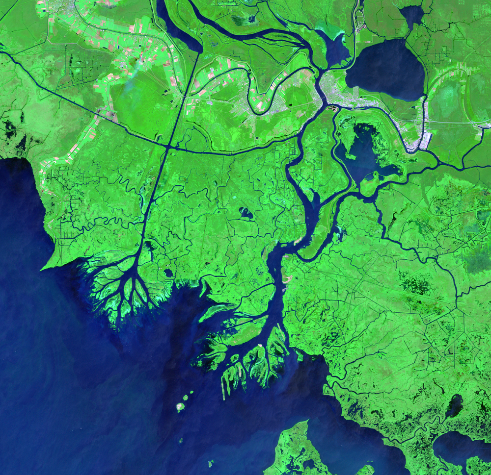
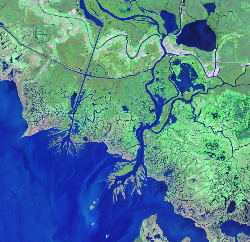
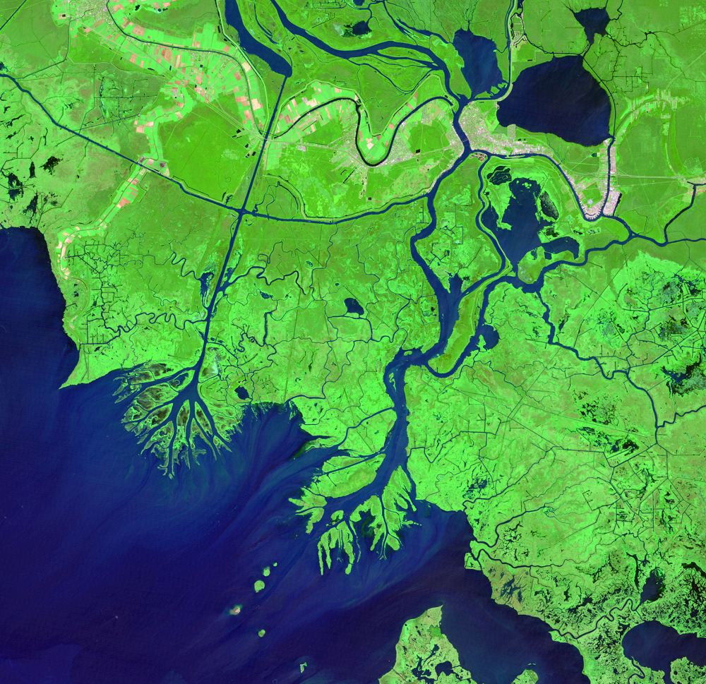
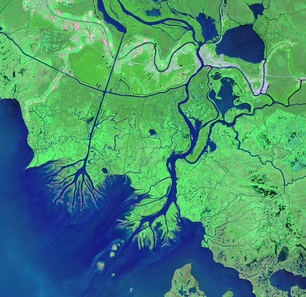
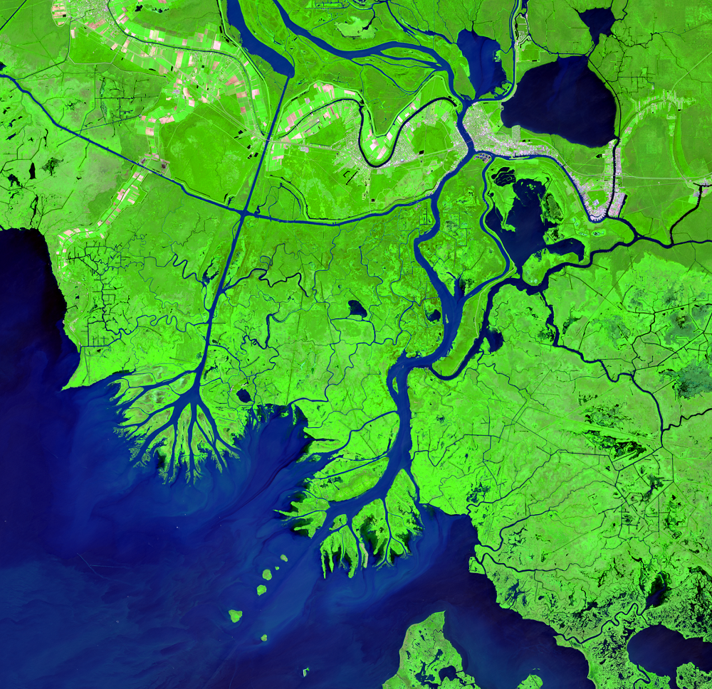
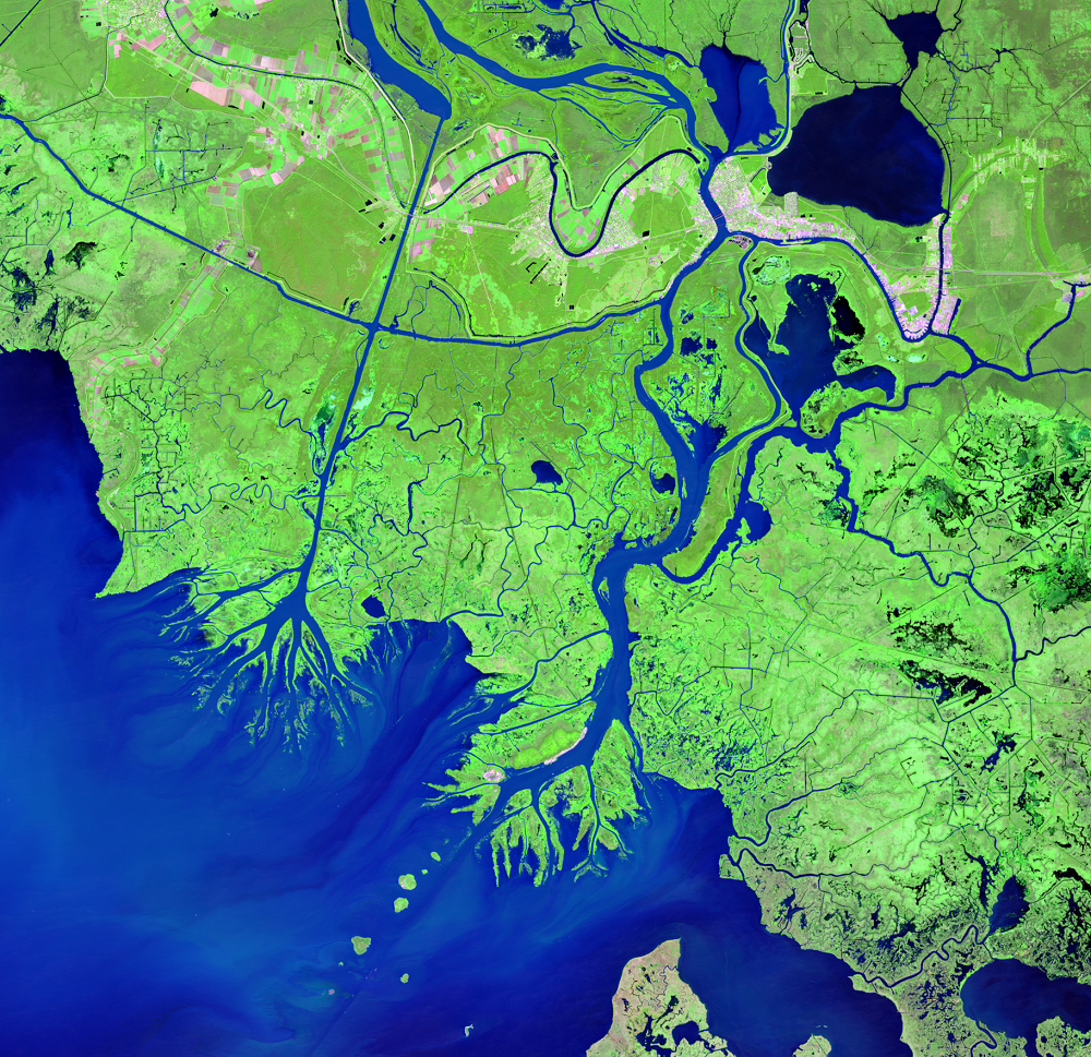
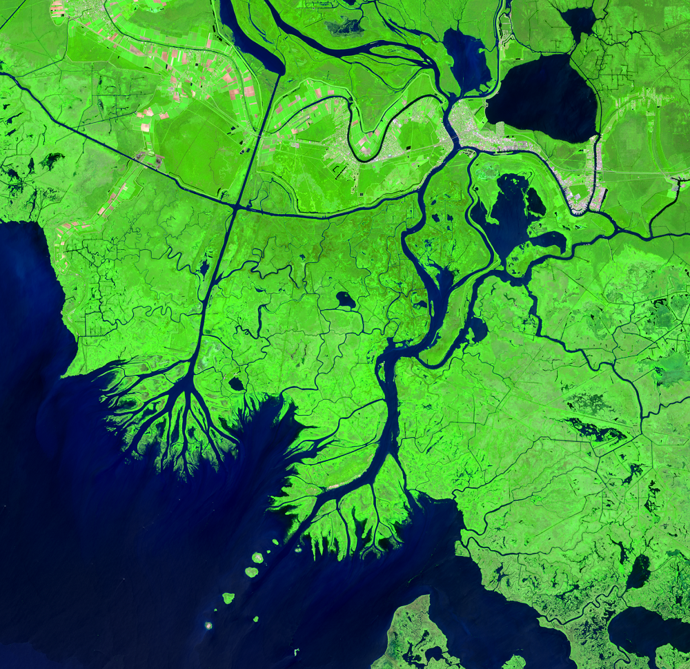
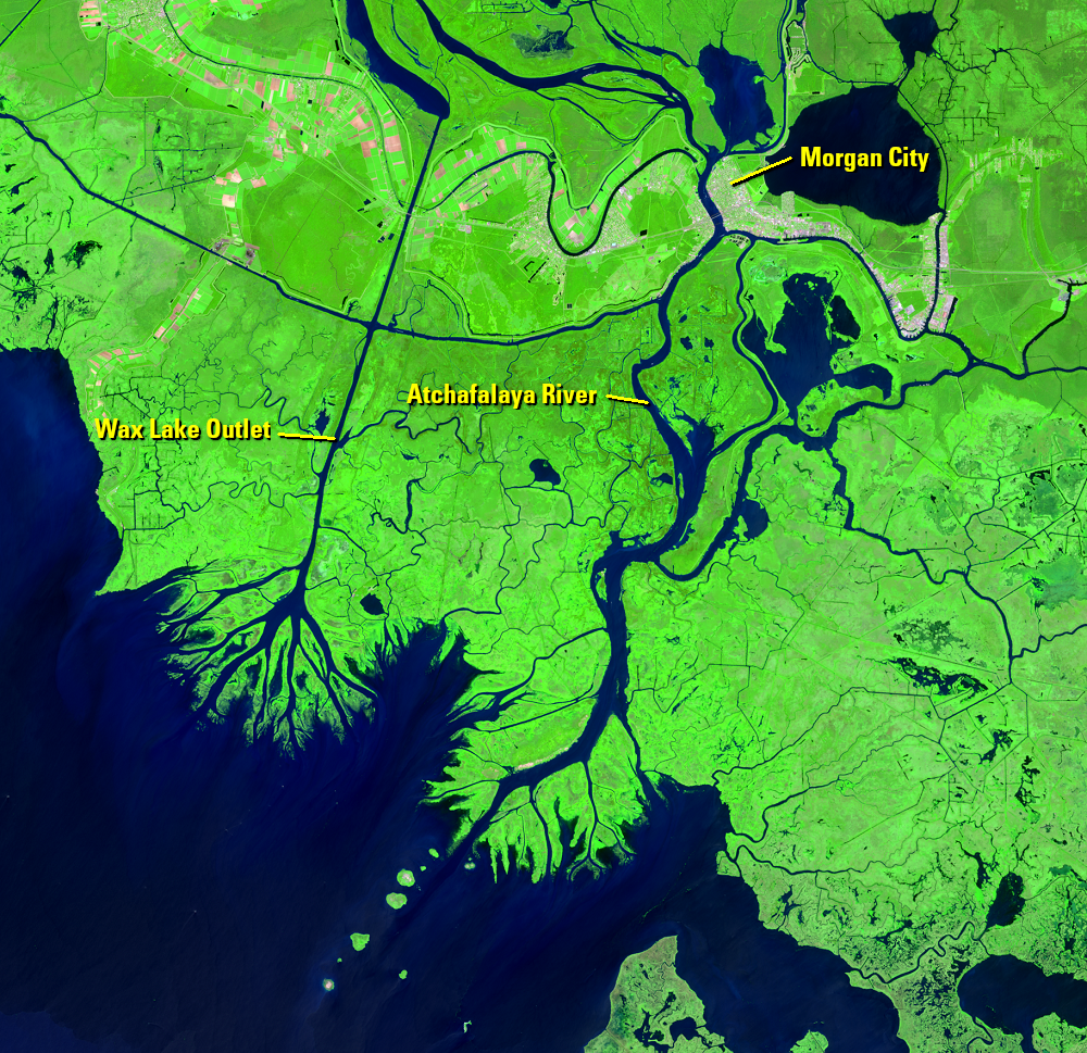
The Wax Lake Outlet is a prominent north-south waterway. This artificial channel begins just upstream of Morgan City and carries water straight down to the Gulf. The U.S. Army Corps of Engineers dug the outlet in 1941 to prevent severe floods.
After the Wax Lake Outlet was created, water carried sediment to its mouth and began to build a delta, all of it underwater at first.
After flooding in 1973, caused by an unusually cold winter and above average spring rain, extra sediment rushed through the Wax Lake Outlet and, for the first time, its delta became visible. Reeds and willows began to grow and stabilize the new land. Their roots hold on to the sediment to keep the ground stable.
A little less than half of the Atchafalaya River flows through the Wax Lake Outlet. The rest also flows south to the Gulf a little to the east and is building a delta there.
The rest of the Louisiana coastline is retreating because Mississippi River water flows through narrow channels that don’t allow sediment to settle—the sediment-rich water speeds directly into the Gulf. The Atchafalaya carries sediment more slowly, which allows it to settle in the broad, shallow basin and maintain the marshes.
Imagery
Every picture has a story to tell
Correlated
Additional story information
Downloads
Other Stories
Related imagery and additional content

Deltas
The Wax Lake Outlet is a prominent north-south waterway. This artifici...
Old River Control Structure
The Mississippi River Delta has naturally meandered and migrated over ...