

Desertification
Earth Resources Observation and Science (EROS) Center - Earthshots
The word desertification, if split into its roots, logically would mean the event of non-desert land becoming desert, but it is not quite so simple. Desertification is usually defined as a process that happens to land that is already normally arid (dry) or semiarid and it's not just caused by drought. In fact, the crucial factor is a decline in the biological productivity of the land—the amount of vegetation that grows (either naturally or that people have planted)—as well as the animal life supported by the plants. If desertification continues, eventually the land becomes a desert, with increased wind and water erosion, decreased soil fertility, and decreased water-retention capacity. Plant and animal communities decline in number and diversity, as many species can no longer survive.
Desertification is usually a patchy development, spreading outward from pockets of land where the vegetative cover has been harmed or destroyed, so that sandy dry soil begins to drift and vegetation is unable to reestablish itself.
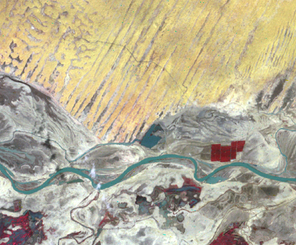
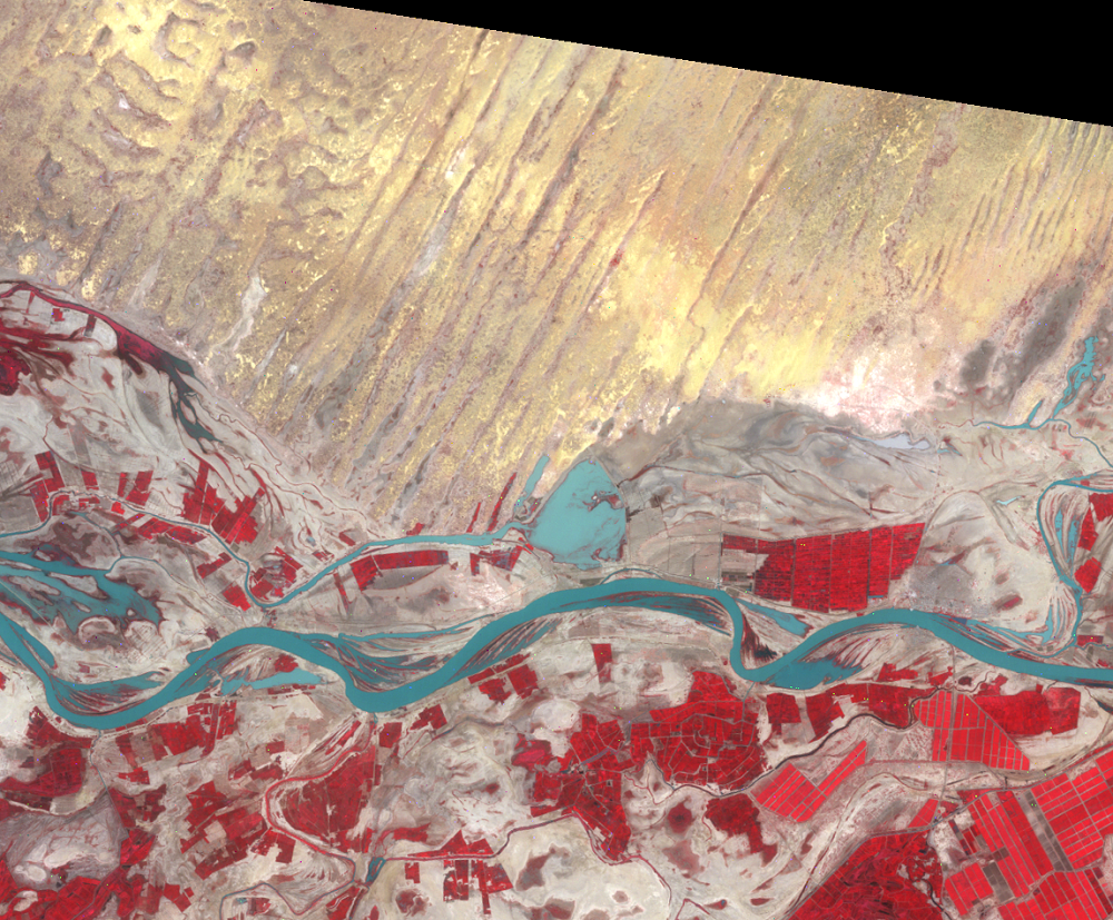
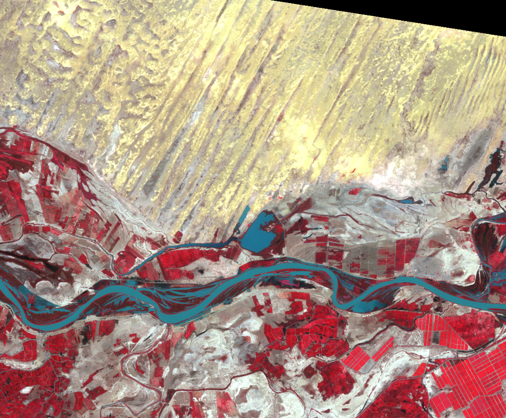
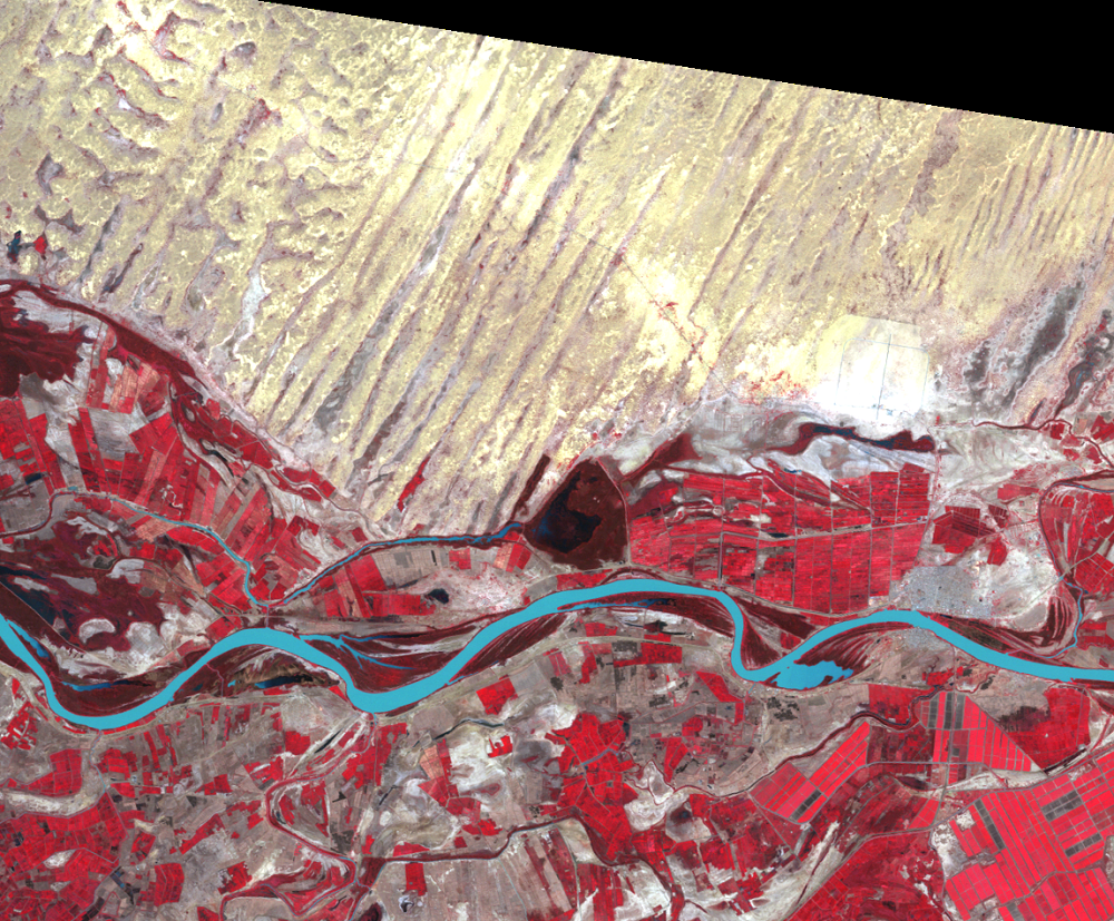
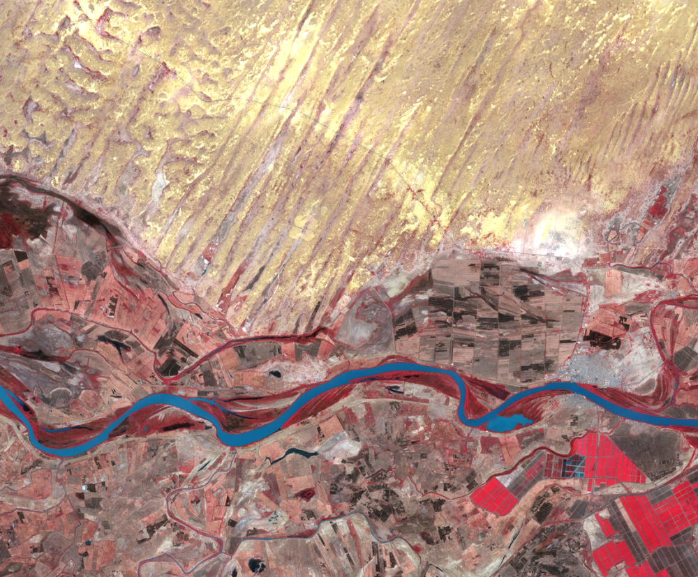
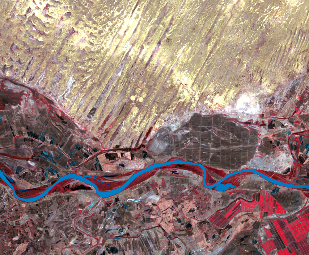
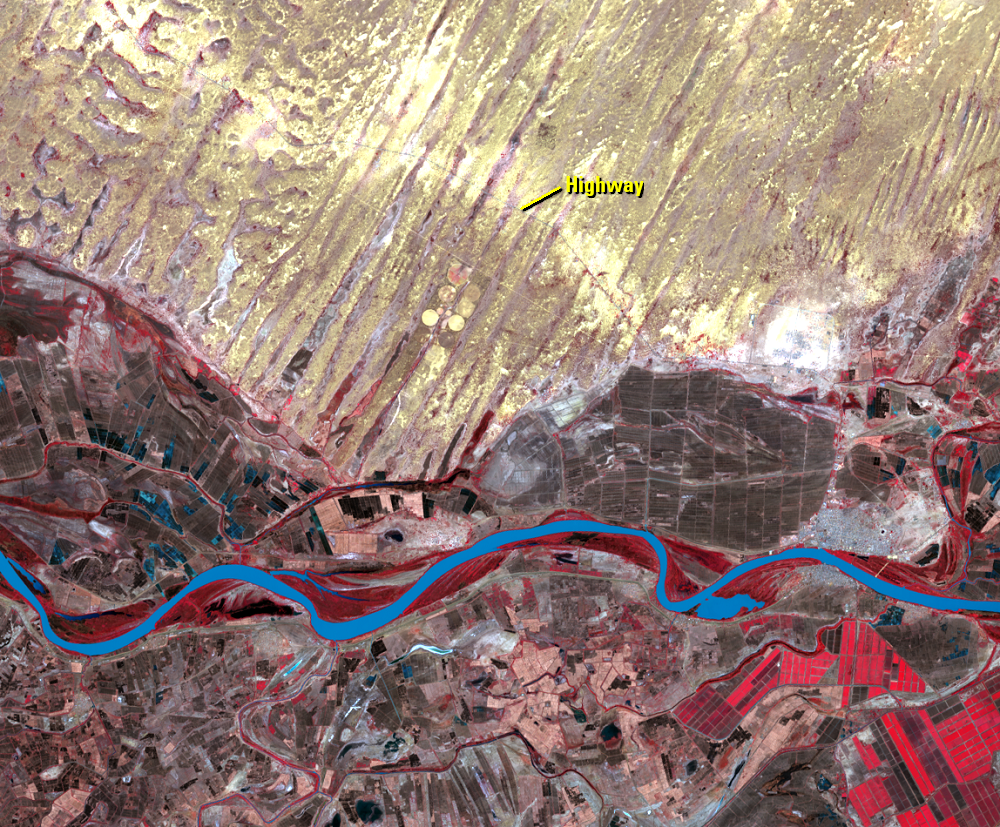
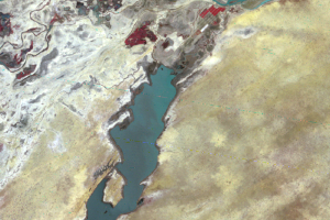
In western Africa, boreholes (water wells) are often the points of this vegetation disturbance, because they attract livestock, which overgraze the land nearby. But in this example, the point of disturbance is a paved highway that was built to connect Nouakchott, the national capital of Mauritania, with the regional capital Rosso. Besides travel and transportation, the highway also encourages building and settlement. All of these activities consume vegetation for grazing, fuel, and building material. The vegetative cover becomes disturbed, some sandy soil begins to drift, and the process of desertification is underway.
In these images, the disturbances the highway causes become evident. The 1972 image shows the highway slicing across the desert's sand dunes. The other images show a widened corridor, the brighter tones that follow the highway.
Imagery
Every picture has a story to tell
Correlated
Additional story information
Downloads
Other Stories
Related imagery and additional content
Desertification
The word desertification, if split into its roots, logically would mea...
Irrigation
There has been irrigation along the Senegal River in the Richard Toll,...