

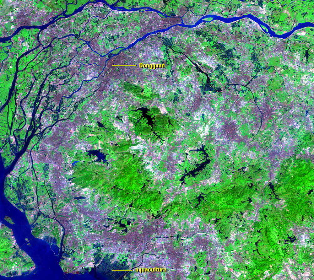
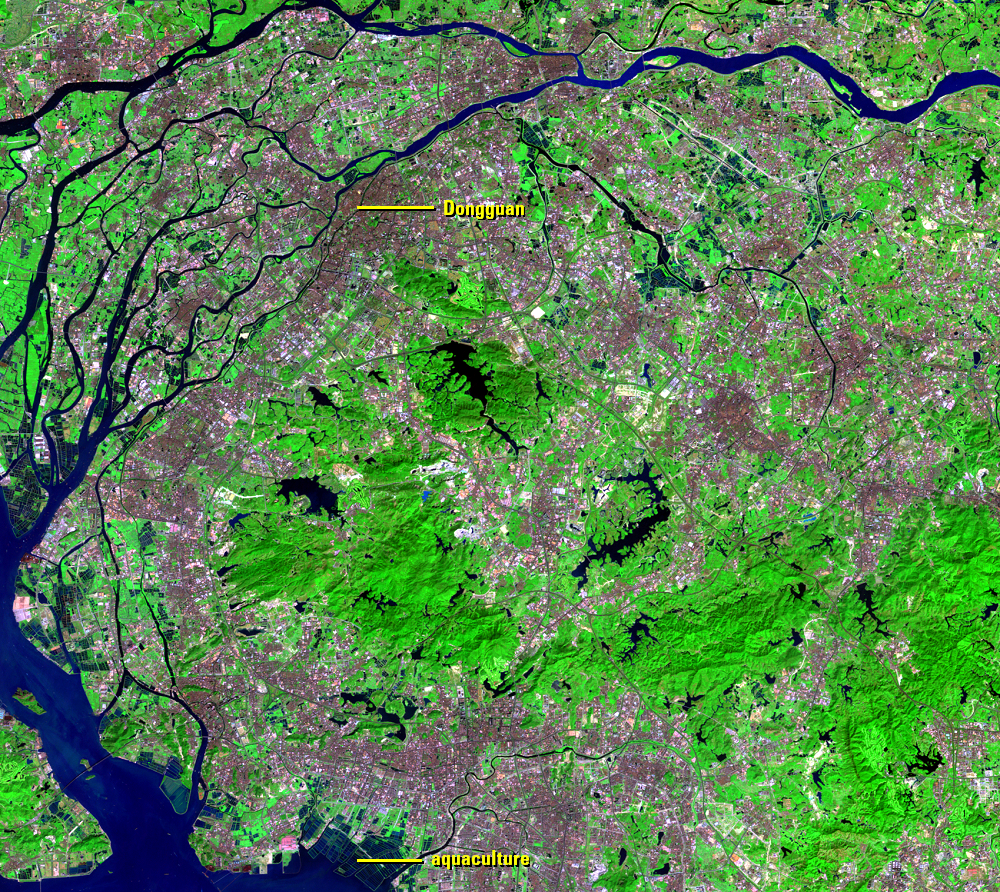
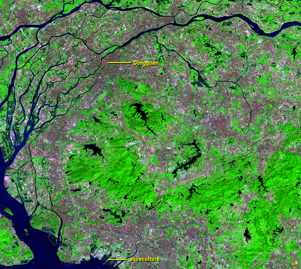
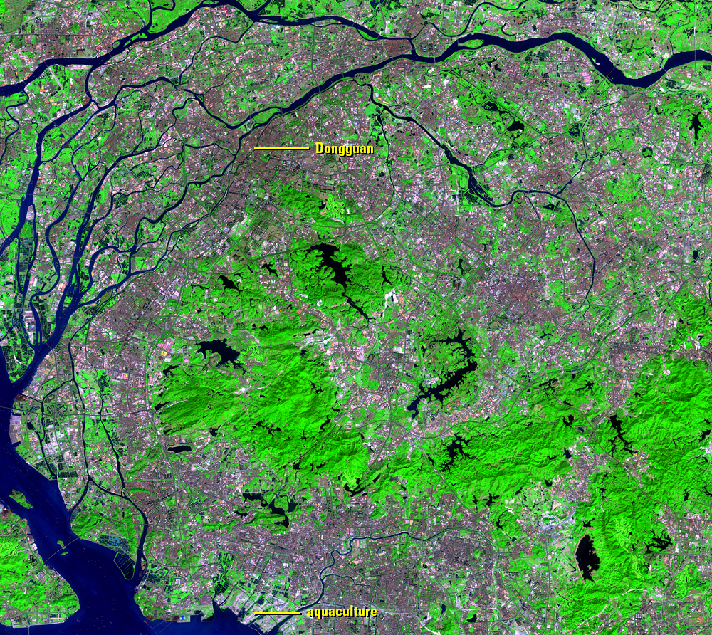
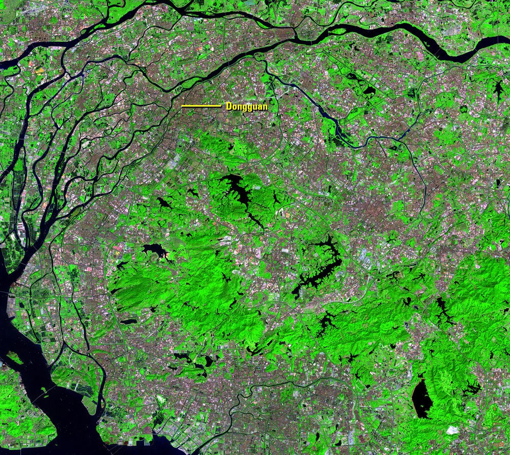
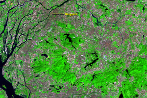
Dongguan
Earth Resources Observation and Science (EROS) Center - Earthshots
The urban growth in the PRD is vast. There are no longer any clear urban centers—a different growth trajectory from other large cities in China such as Beijing and Shanghai that have grown around defined historical urban centers.
Buildings and paved surfaces replaced vegetation at a rapid pace over the past three decades. Housing, factories, and the highway system all increased mostly at the expense of farmland.
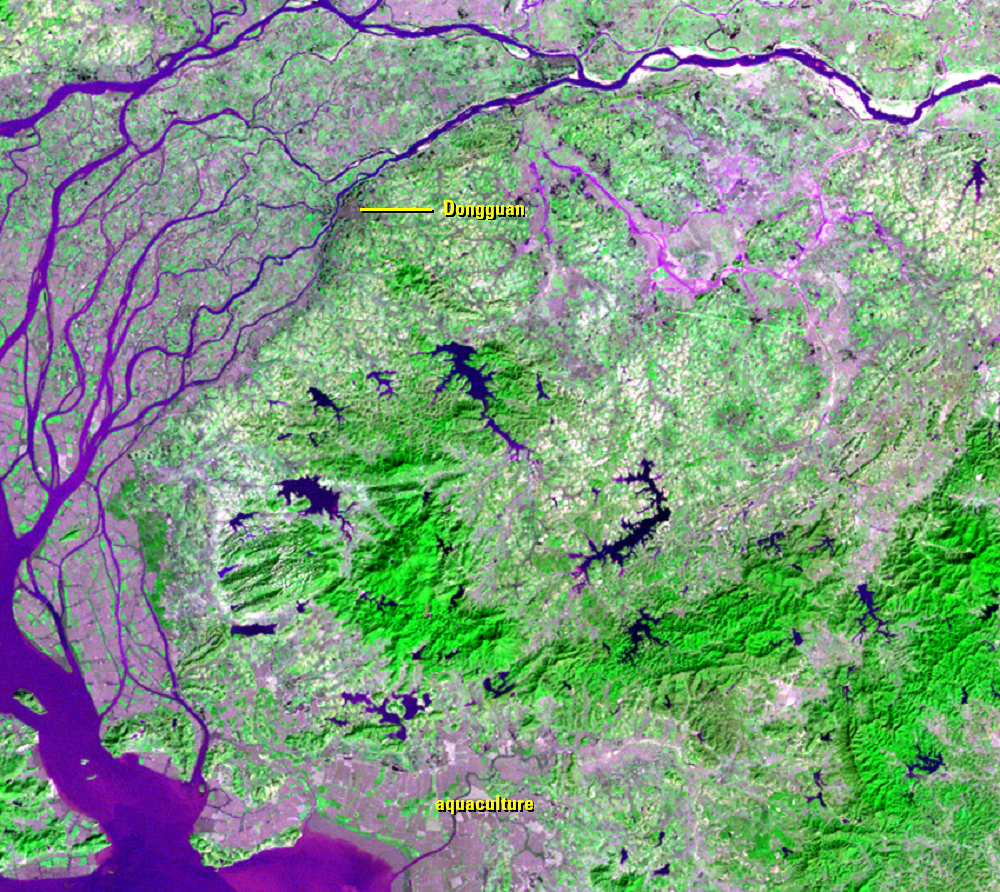
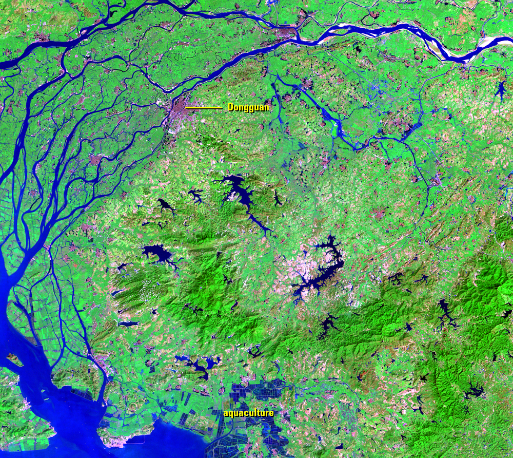
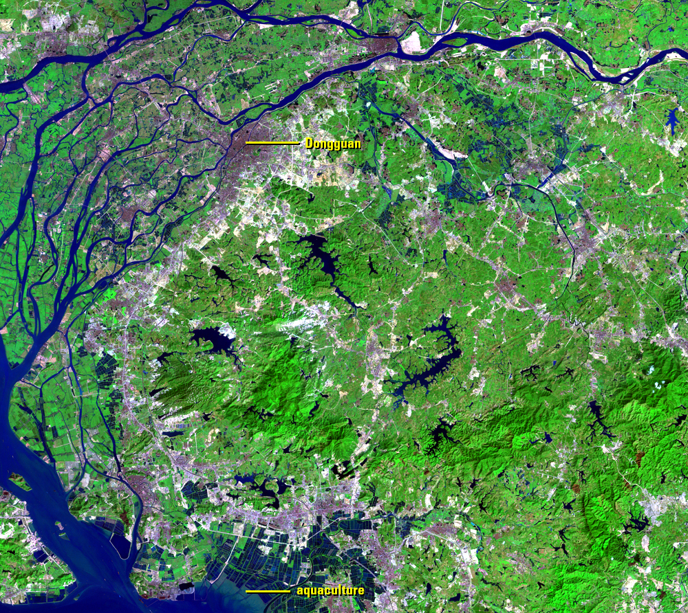
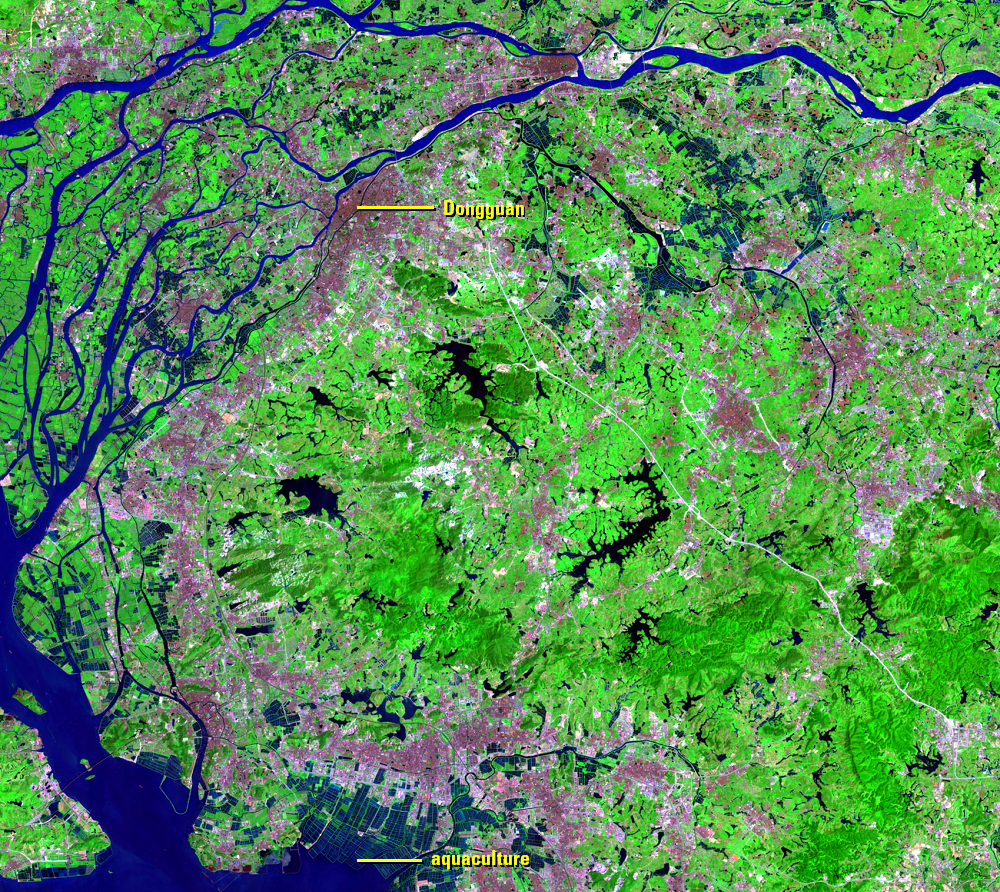
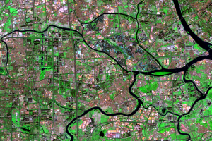
In the early images of this series, cities are pink areas, separate from one another, among the green forested and agricultural areas. The largest city in this set of images is Dongguan. A noticeable change by the 1994 image is a road network beginning to connect those cities. The urban area soon begins filling in the former agricultural areas and surrounds the hilly forested areas.
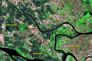
In the southern part of the images, blue rectangles are aquaculture, and they are gradually pushed toward the coast by the expanding urban areas.
Imagery
Downloads
Related Content
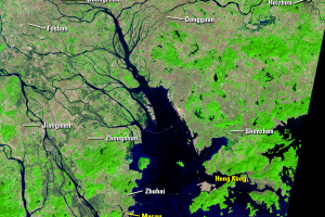
Pearl River Delta, China
In 1978, the Pearl River Delta (PRD) region in southern China had a po...
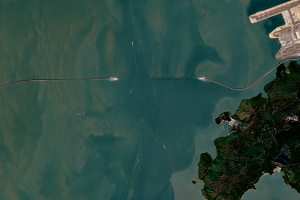
Bridge
Cities that are growing this rapidly must also show accompanying infra...
Dongguan
The urban growth in the PRD is vast. There are no longer any clear urb...
Guangzhou and Foshan
As an example of how the cities of the region have merged after the 19...
Industry
The PRD was mostly rural before the 1978 reforms began. The major indu...