

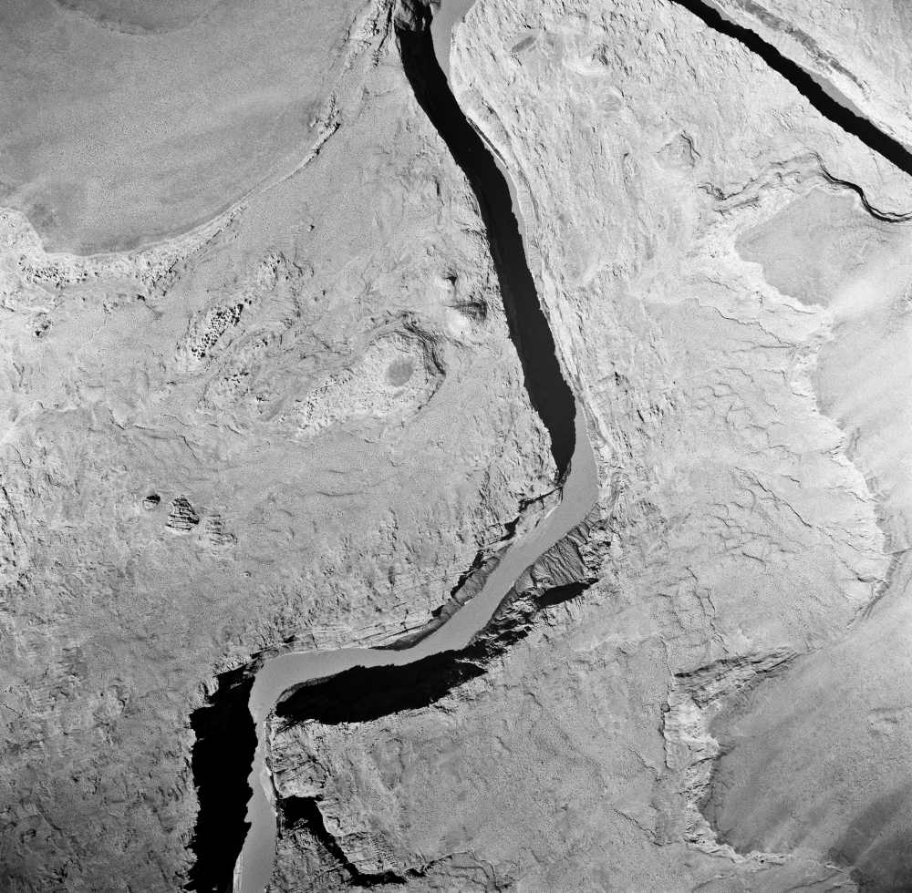
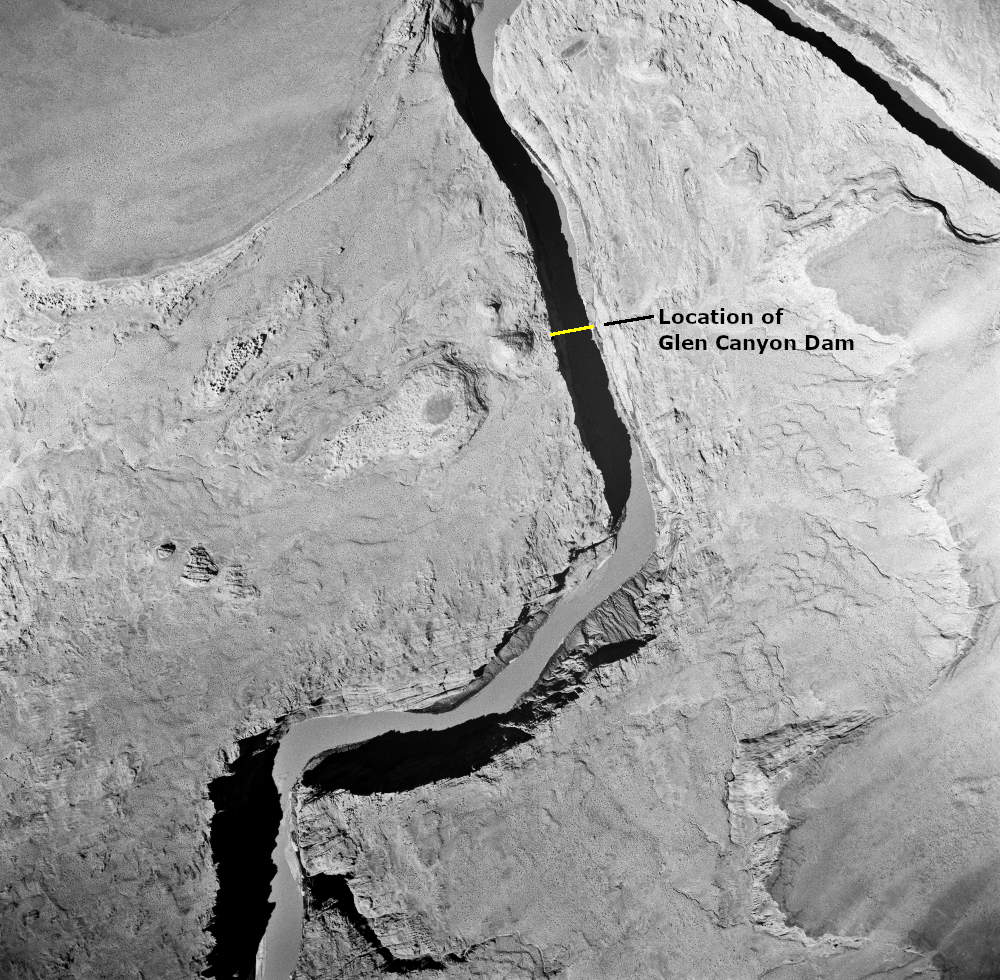
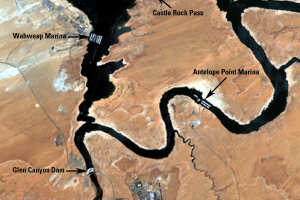
Glen Canyon Dam
Earth Resources Observation and Science (EROS) Center - Earthshots
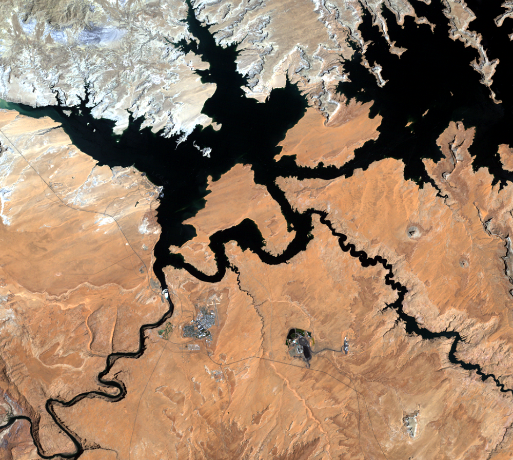
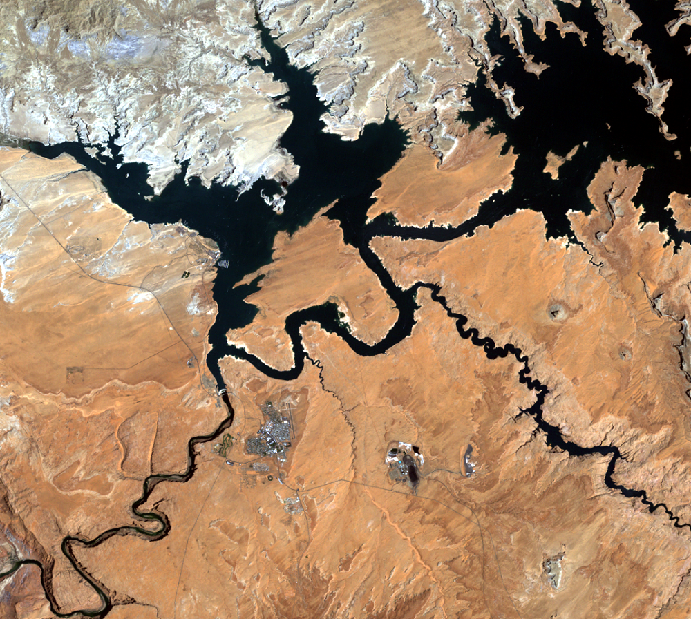
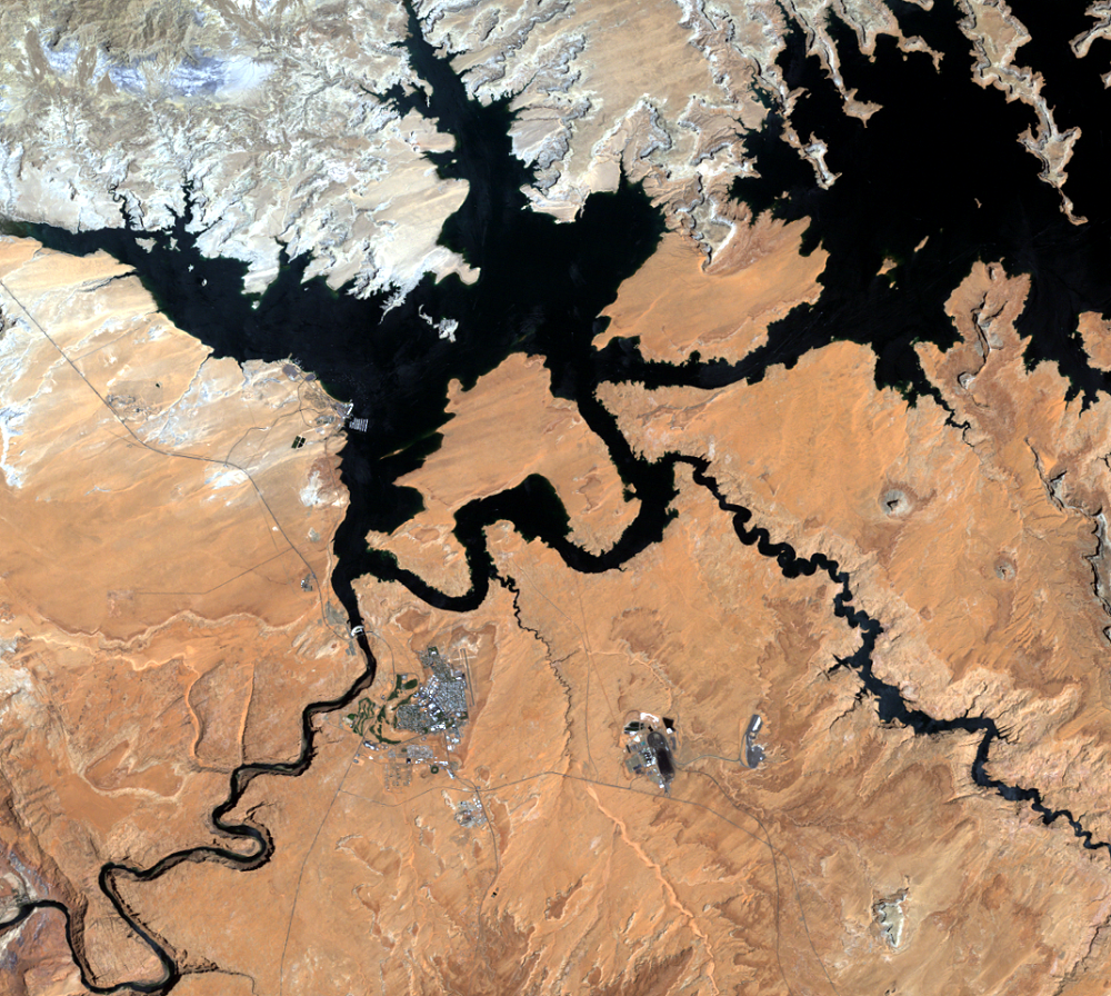
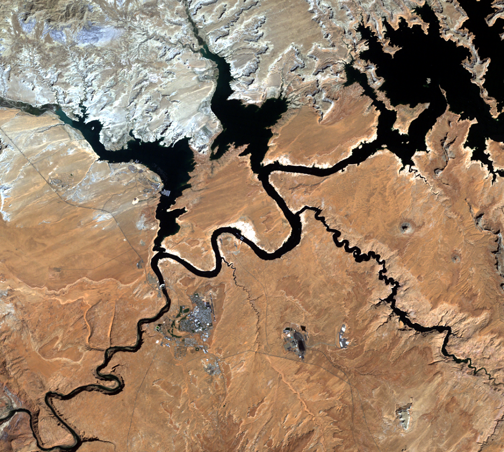
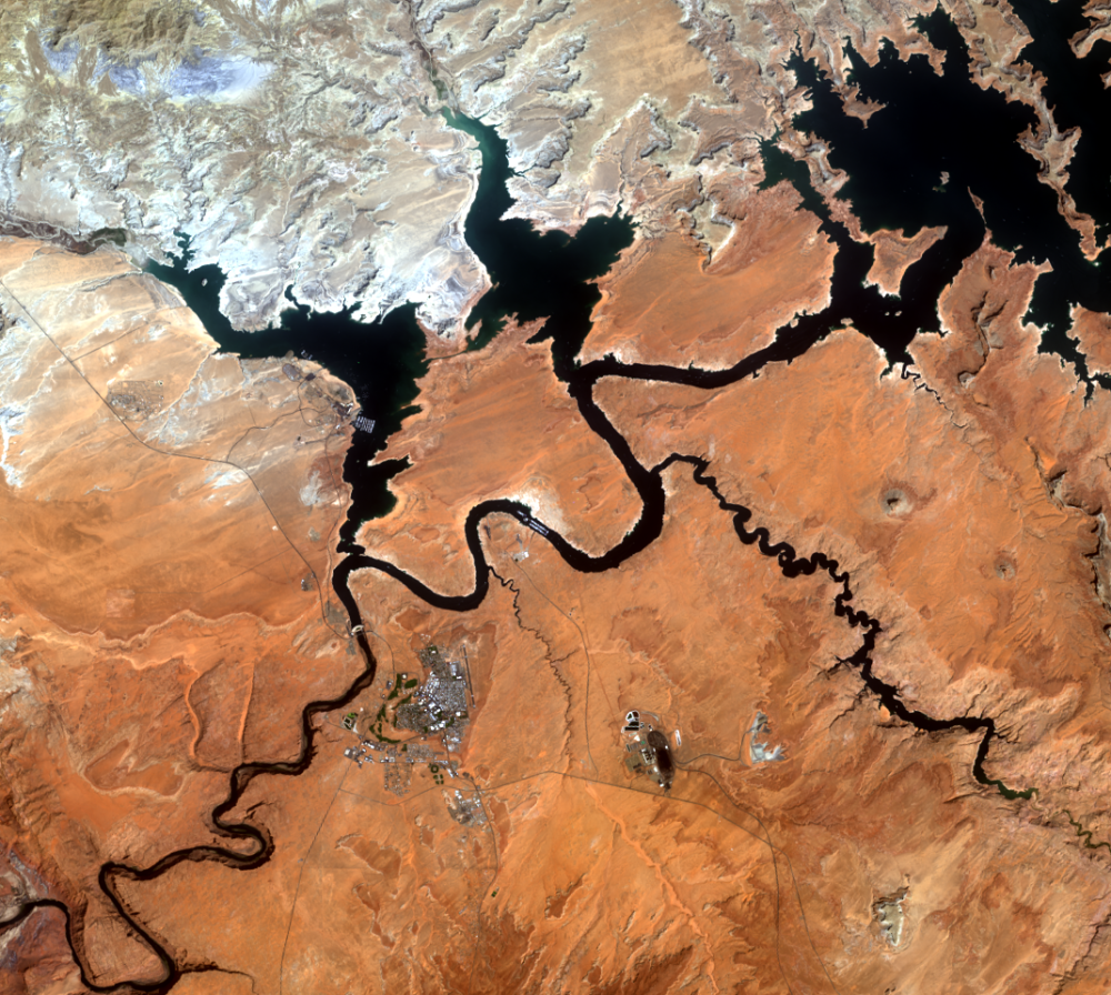
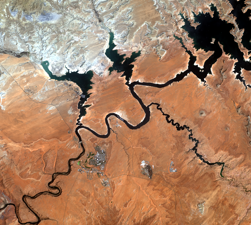
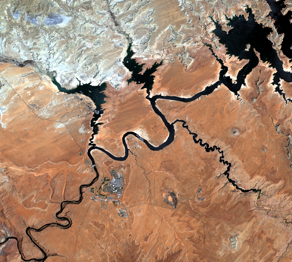
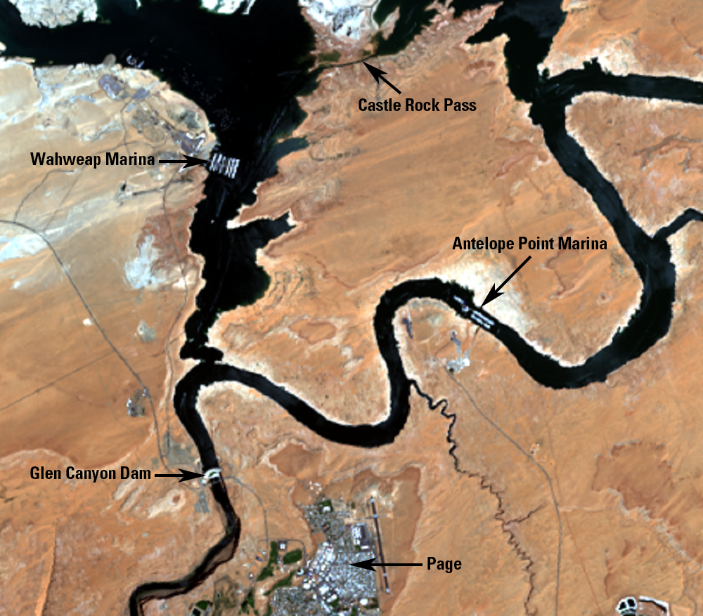
Glen Canyon Dam near Page, Arizona, creates Lake Powell. The 710-foot-high dam was completed on September 13, 1963, about 9 years before the first clear Landsat 1 images were acquired. The dam also generates electricity. From 1980 to 2013, its average annual gross electricity generation was about 5 billion kwh. (kwh = kilawatt-hours, a measure of a power station’s electricity output.) Its electricity generation varies based on the amount of water that flows into the lake, which is influenced by precipitation.
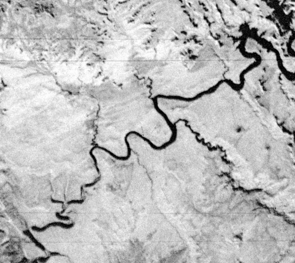
In the Landsat series of images shown here, we begin with 1972 when the lake was still filling. In 1984, the lake was at one of its highest water levels.
Near the dam is the city of Page, Arizona, which began in 1957 as a housing camp for workers building the dam. Page is now a major resort area. Its 2021 population was 7,375.
At various marinas on the lake, tourists can rent houseboats and other recreational watercraft. Wahweap is the largest marina on Lake Powell. This marina needs to move based on the lake’s water level. Antelope Point is the newest marina on Lake Powell, established in 2004.
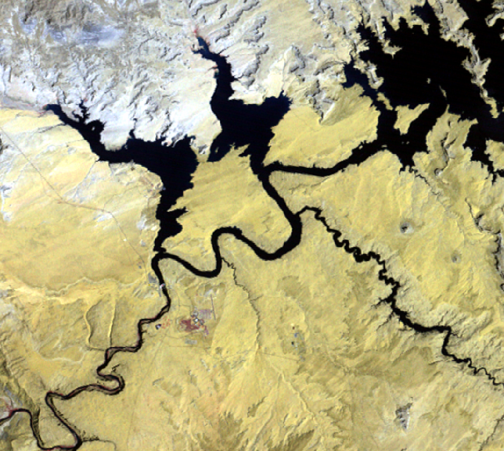
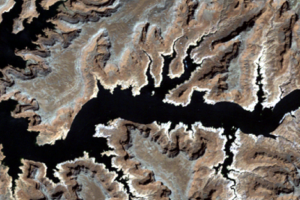
Antelope Island is in the center of these images. It looks a lot less like an island in the later low water level images. The National Park Service dug a channel on the island’s north end called Castle Rock Pass. Even though it begins to look more like a peninsula by the 2005 image, it is still called Antelope Island. The channel around the north side of the island is navigable when the lake’s water level is 3,620 feet or higher.
Imagery
Downloads
Related Content

Lake Powell, Utah and Arizona, USA
Glen Canyon Dam on the Colorado River was completed in 1963. It create...
Bathtub Ring
Comparing the 1984 (high water level) and 2005 (low water level) image...
Glen Canyon Dam
Glen Canyon Dam near Page, Arizona, creates Lake Powell. The 710-...
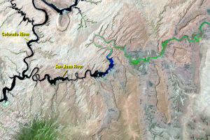
San Juan River
Farther upstream, the San Juan River flows into the Colorado River. In...
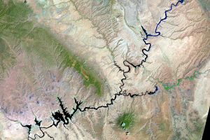
Water Levels
Drought combined with water withdrawals has caused a drop in the lake’...