

Growth of Nucleos
Earth Resources Observation and Science (EROS) Center - Earthshots
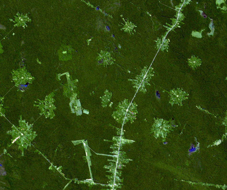
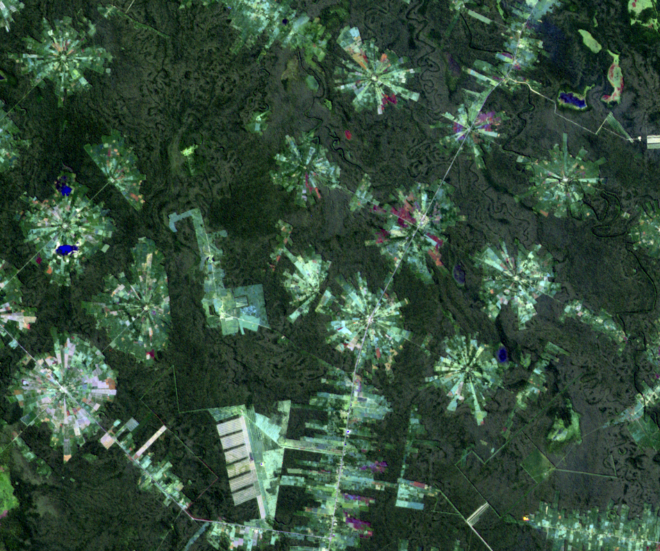
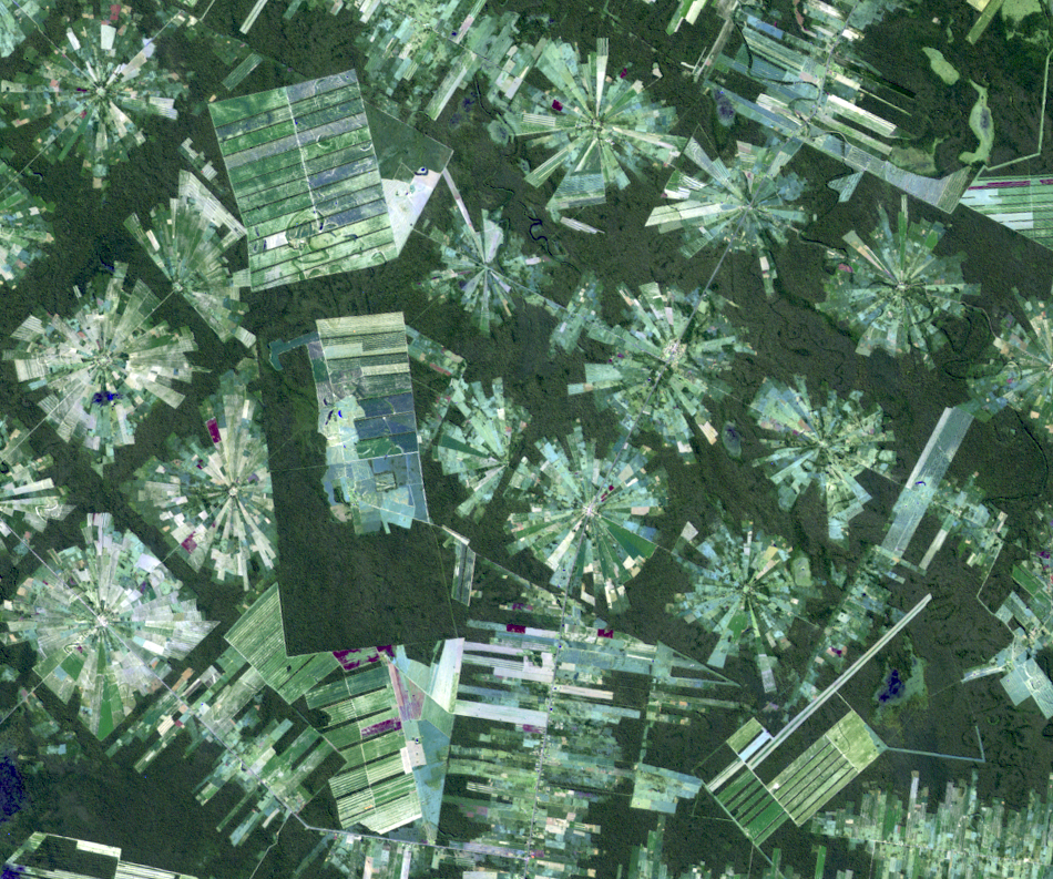
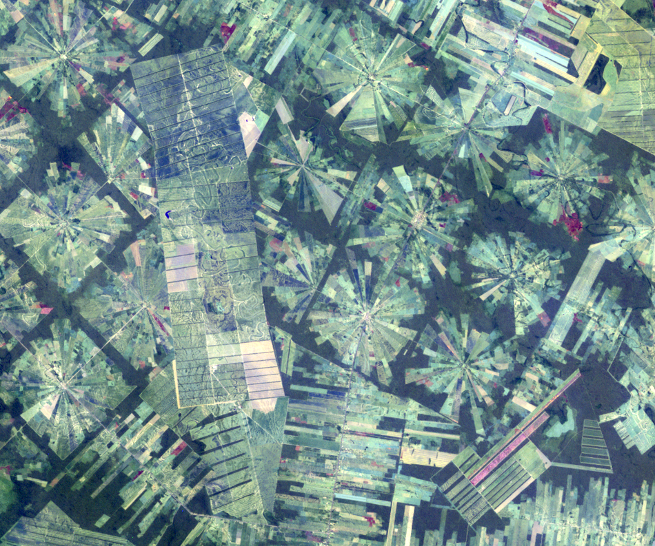
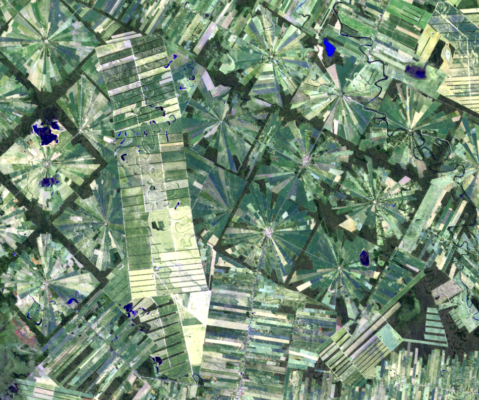
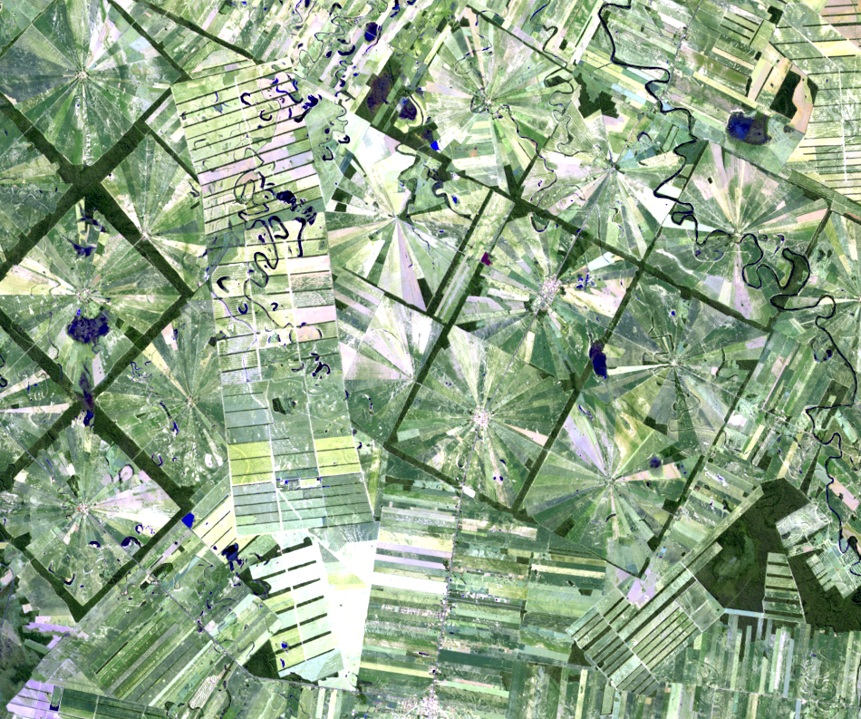
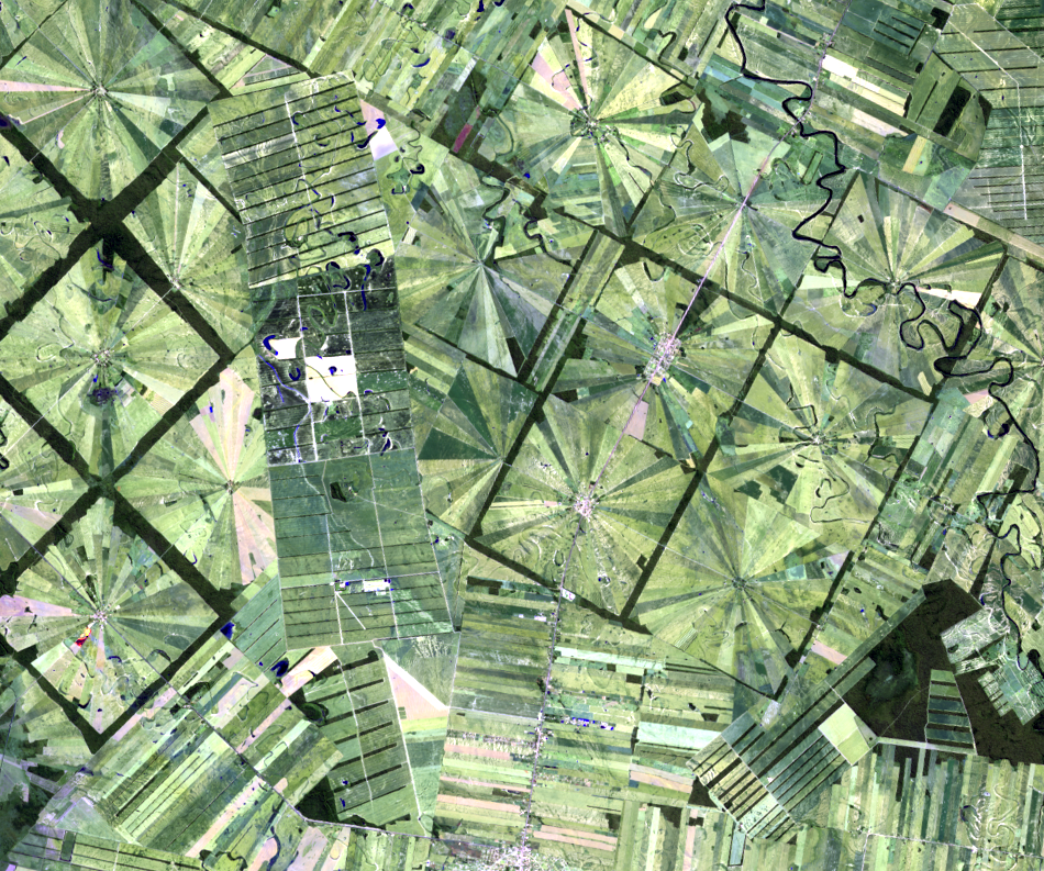
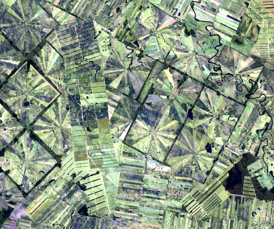
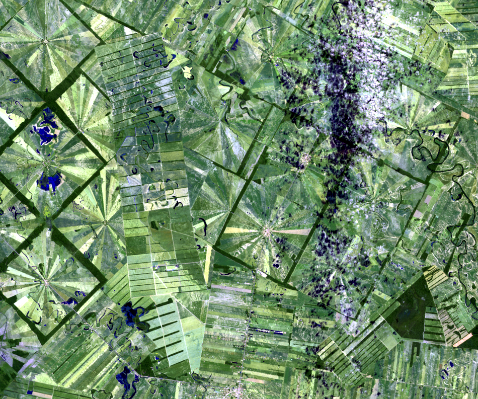
In the 1975 image, the initial clearing for the San Julian settlements is visible along the highway—the pink line heading north-south. Later images show a well-defined 3x3 box pattern with roads connecting them. The United States Agency for International Development (USAID) helped fund new roads along with wells and community center clearing.
In the middle of the two groupings of nucleos is a clearing of a different pattern. This is the Zapito private farm, which is not part of the San Julian colonies.
Imagery


Downloads
Related Content
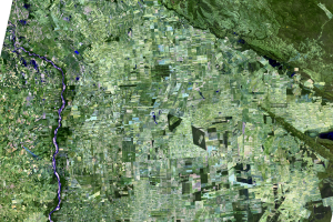
Santa Cruz, Bolivia
In the 1960s, San Julian, Bolivia, was nearly inaccessible, located de...
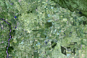
Deforestation
Every year in Bolivia, a swath of forest two-thirds the size of Delawa...
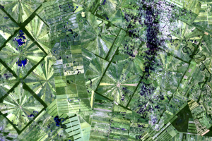
Growth of Nucleos
In the 1975 image, the initial clearing for the San Julian settlements...
San Julian
Taking a closer look at the San Julian settlements reveals the pattern...