

Hailstorm at EROS, Sioux Falls, SD, USA
Earth Resources Observation and Science (EROS) Center - Earthshots
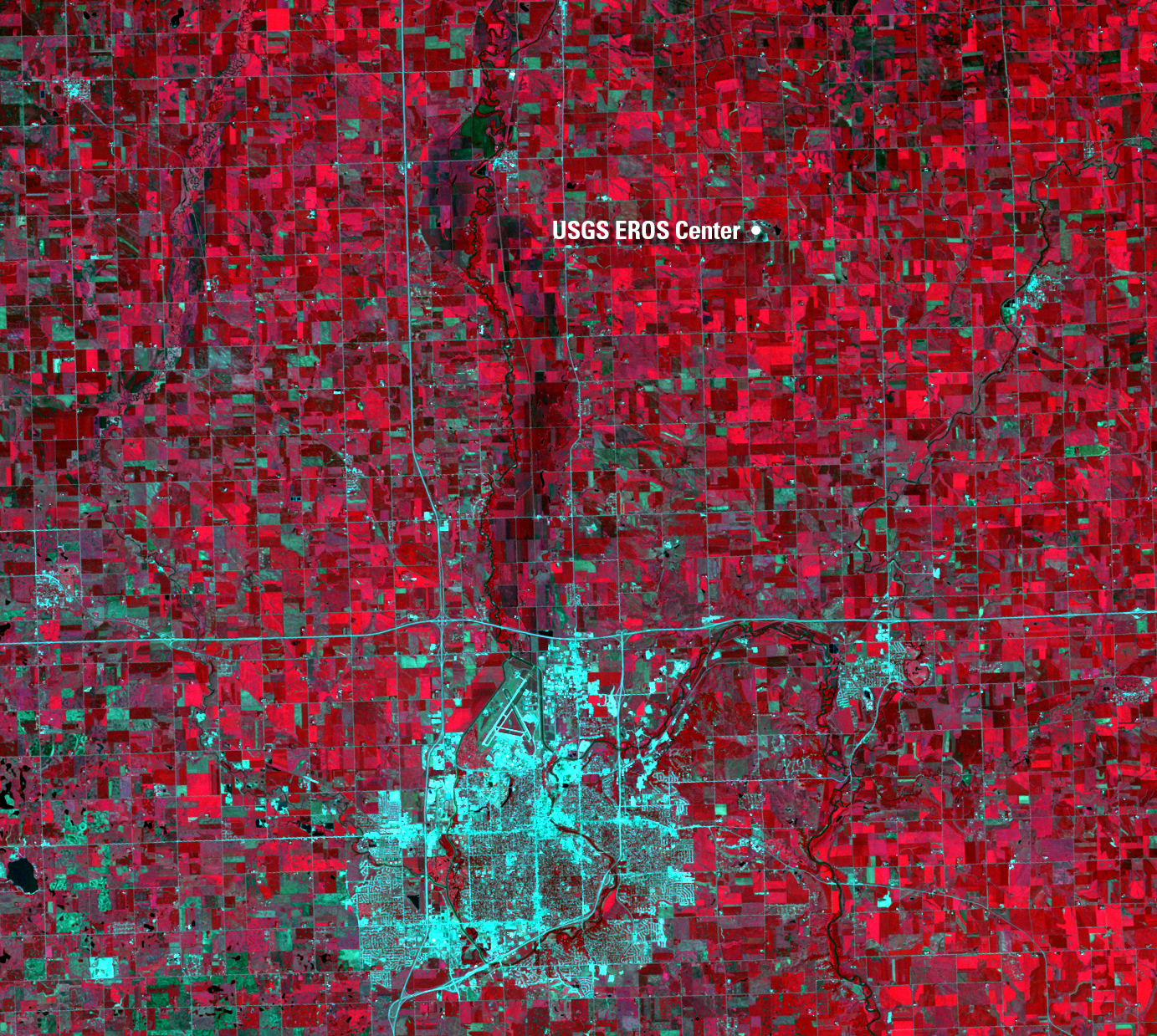
These images show the location of the USGS Earth Resources Observation and Science (EROS) Center, about 10 miles north of Sioux Falls, South Dakota. On Sunday, July 13, 1997, an unusually severe hailstorm blasted through the area, missing Sioux Falls but hitting EROS head-on. The storm pounded EROS with 20 minutes of baseball- to softball-sized hail. Landsat 5 passed overhead three days later and documented the aftermath.
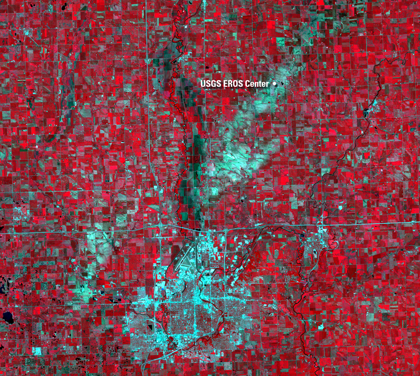
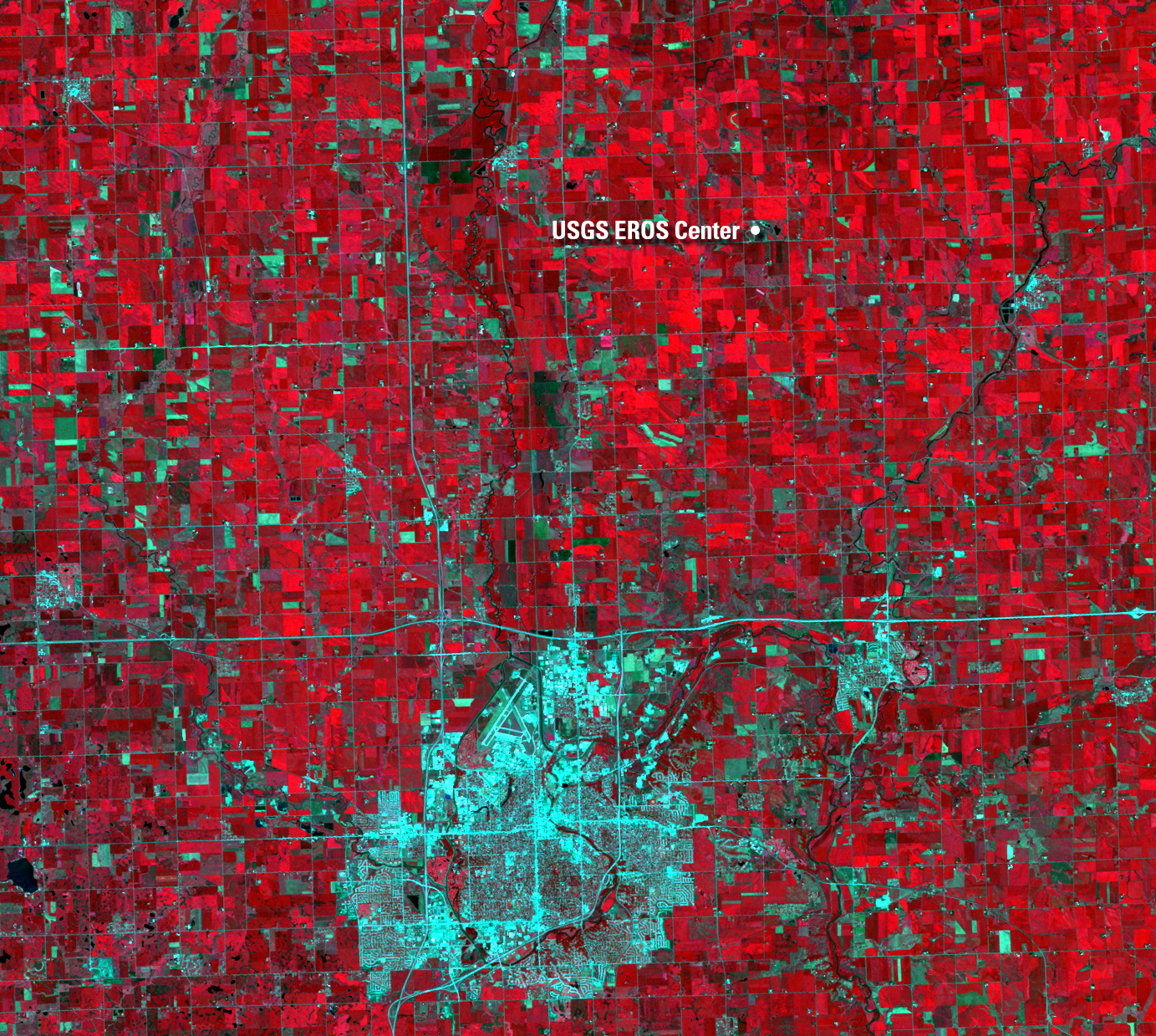
Healthy crops normally surround Sioux Falls. The healthy crops appear bright red because red represents the near-infrared light (that human eyes can’t see) that is highly reflected by healthy vegetation. Most of the crops grown in this area are soybeans and corn. Some of those fields turned gray in the 1997 image, where the hailstorm converted the cropland into bare soil. The conversion was temporary, however, as the Landsat 5 image from 1998 demonstrates. The cropland is back to the expected red, indicating healthy crops.
Imagery
Every picture has a story to tell
Correlated
Additional story information
Downloads
Other Stories
Related imagery and additional content
The Storm's Cost
The storm cost EROS over $1.2 million in damage. Vehicles were smashed...