

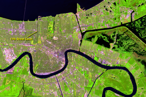
Hurricane Katrina, New Orleans, Louisiana, USA
Earth Resources Observation and Science (EROS) Center - Earthshots
Hurricane Katrina was one of the most intense and costliest hurricanes to hit the United States. On August 28, 2005, Katrina was a category 5 storm (on the Saffir-Simpson scale) in the middle of the Gulf of Mexico. It made landfall the next morning as a strong category 3 storm with sustained winds of 125 miles (200 kilometers) per hour.
Flooding in New Orleans began early that morning, and water continued pouring into the city until September 1. State health departments estimate that Hurricane Katrina caused about 2,000 deaths, most occurring in Louisiana. About 75 percent of the New Orleans metropolitan area was flooded. The storm caused an estimated $80 billion in damage.
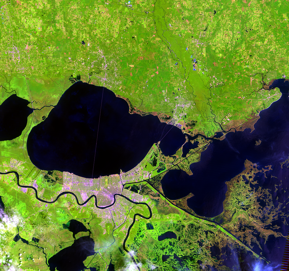
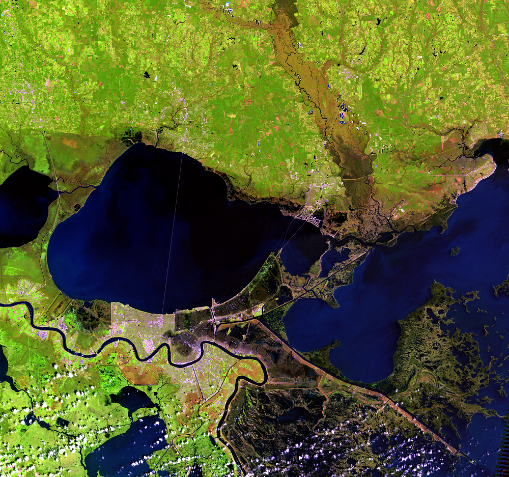
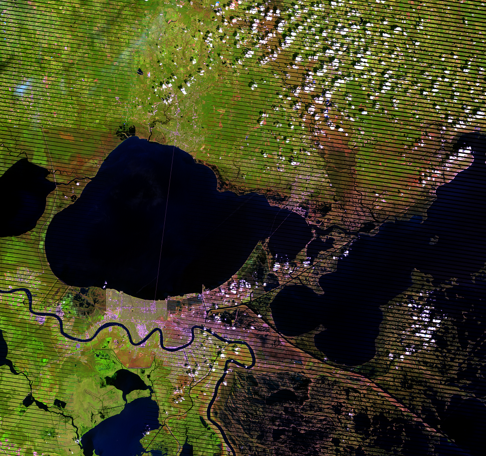
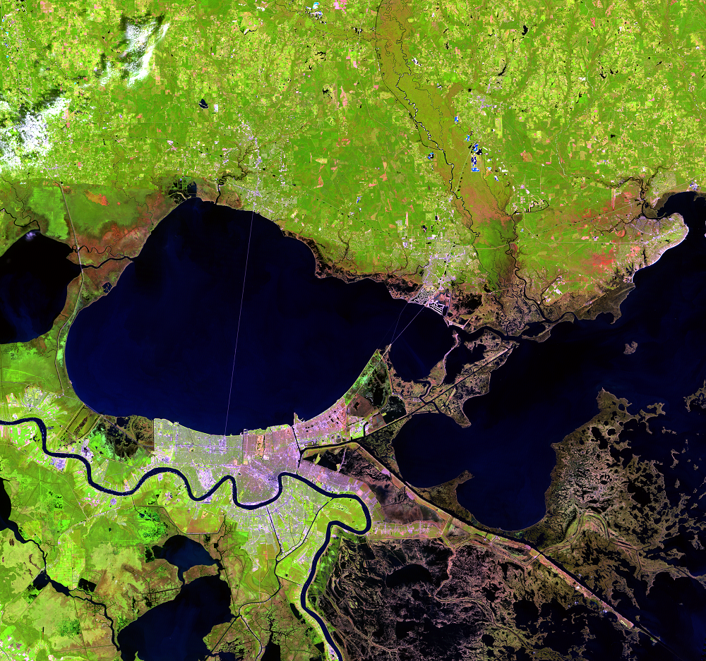
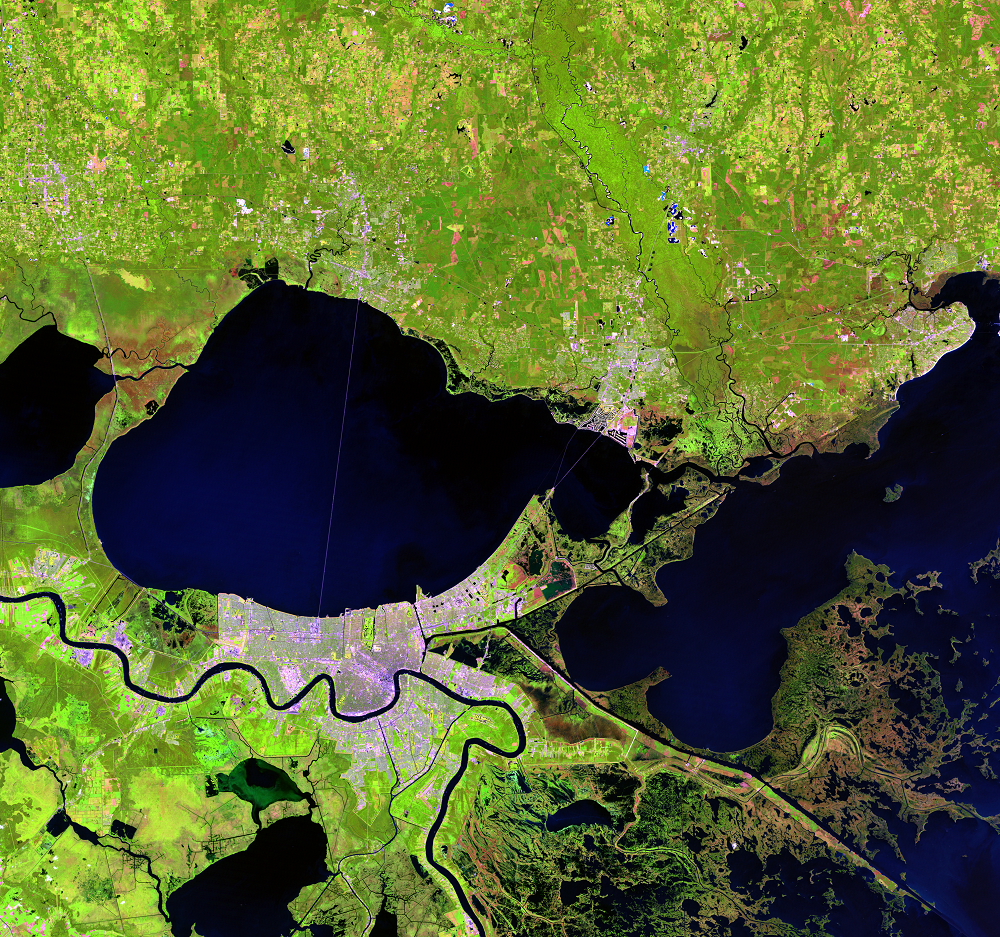
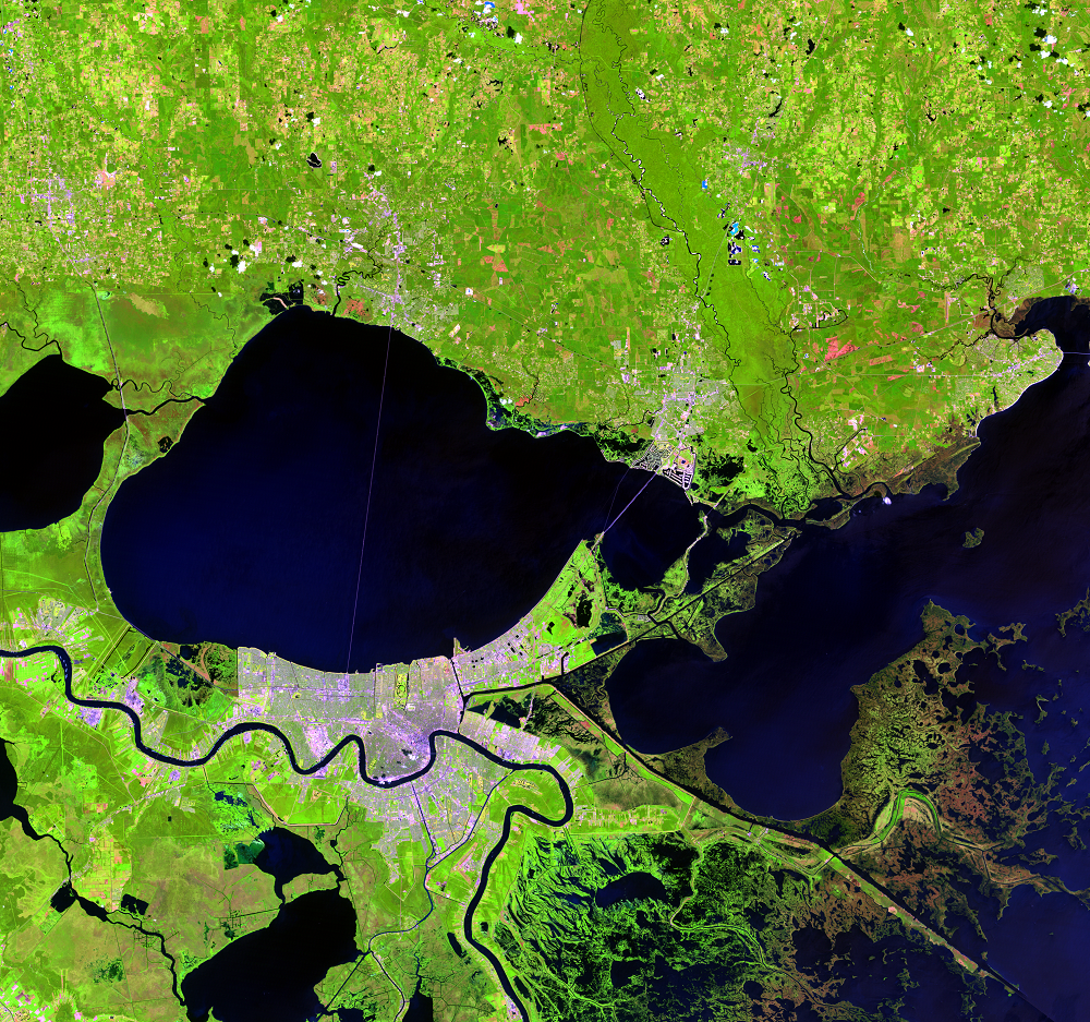
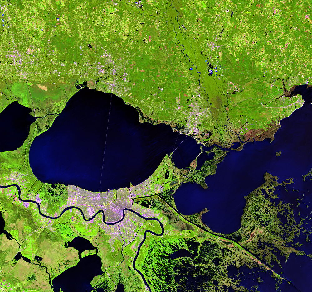
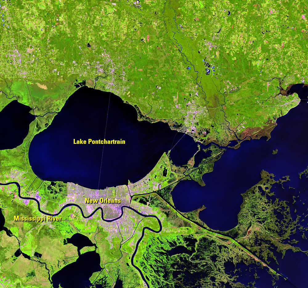
Landsat recorded the devastation and continues to monitor the region’s wetlands. New Orleans, Louisiana, is near the bottom of the images along the Mississippi River. The city lies just south of Lake Pontchartrain. Hundreds of square miles of wetlands were lost after Katrina. Some marshlands became permanent water bodies. Some projects now aim to bring back marshlands because of their value in defending the coastline from storms.
(Black stripes run through the Sep. 15, 2005, images because of the Scan Line Corrector failure on Landsat 7 in May 2003.)
Imagery
Downloads
Bourne, J.K. Jr., 2007, New Orleans—A Perilous Future: National Geographic, August 2007.
Chandler, K., 2012, Seven Years Later: Hurricane Katrina and MRGO: Restore the Mississippi River Delta Web page at http://www.mississippiriverdelta.org/blog/2012/08/28/seven-years-later-hurricane-katrina-and-mrgo/. (Accessed April 28, 2015.)
Farris, G.S., Smith, G.J., Crane, M.P., Demas, C.R., Robbins, L.L., and Lavoie, D.L., eds., 2007, Science and the storms—the USGS response to the hurricanes of 2005: U.S. Geological Survey Circular 1306, 283 p. (Available online at http://pubs.usgs.gov/circ/1306/.)
Israel, B., 2010, 5 Years after Katrina, Gulf Ecosystems on the Ropes: livescience Web page at http://www.livescience.com/8505-5-years-katrina-gulf-ecosystems-ropes.html. (Accessed May 22, 2015.)
Kayen, R., Collins, B., and Gibbons, H., 2006, USGS Scientists Investigate New Orleans Levees Broken by Hurricane Katrina: Sound Waves, U.S. Geological Survey Coastal and Marine Research Web page at http://soundwaves.usgs.gov/2006/01/index.html. (Accessed April 28, 2015.)
Kestenbaum, D., 2006, Why Did the 17th Street Canal Levee Fail? NPR Web page at http://www.npr.org/templates/story/story.php?storyId=5418521. (Accessed April 28, 2015.)
NASA, 2005, Hurricane Katrina Floods New Orleans: NASA Earth Observatory, available at http://earthobservatory.nasa.gov/NaturalHazards/view.php?id=15445. (Accessed April 28, 2015.)
NASA, 2005, Hurricane Katrina Floods the Southeastern United States: NASA Earth Observatory, available at http://earthobservatory.nasa.gov/NaturalHazards/view.php?id=15441. (Accessed April 28, 2015.)
Nelson, S.A., 2012, Why New Orleans is Vulnerable to Hurricanes Geologic and Historical Factors: Tulane University Web page at http://www.tulane.edu/~sanelson/New_Orleans_and_Hurricanes/New_Orleans_Vulnerability.htm. (Accessed April 28, 2015.)
Palaseanu-Lovejoy, M., 2013, How Hurricanes Shape Wetlands in Southern Louisiana: Smithsonian Institution Web page at http://ocean.si.edu/blog/how-hurricanes-shape-wetlands-southern-louisiana. (Accessed May 22, 2014.)
Swenson, D., 2015, Anatomy of a flood—How New Orleans flooded during Hurricane Katrina: The Times-Picayune, accessed April 19, 2018, at http://www.nola.com/katrina/index.ssf/2015/08/katrina_flooding_map.html.
U.S. Army Corps of Engineers, [n.d.], History of MRGO: U.S. Army Corps of Engineers Web page at http://www.mvn.usace.army.mil/Missions/Environmental/MRGOEcosystemRestoration/HistoryofMRGO.aspx. (Accessed April 28, 2015.)
USGS, 2014, Coastal Change Hazards—Hurricanes and Extreme Storms—Hurricane Katrina: U.S. Geological Survey St. Petersburg Coastal and Marine Science Center Web page at http://coastal.er.usgs.gov/hurricanes/katrina/. (Accessed April 28, 2015.)
Related Content
New Orleans
Lake Pontchartrain covers the northern part of these Landsat images. T...
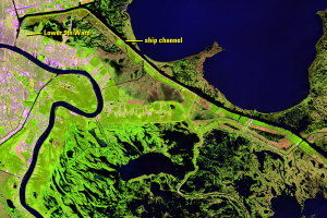
St. Bernard Parish
The Mississippi River Gulf Outlet (MRGO) was built in the 1950s and 19...