

IJsselmeer, Netherlands
Earth Resources Observation and Science (EROS) Center - Earthshots
For centuries, people living in what is now the Netherlands have used various strategies to control the water levels in this low-lying country. The alteration of this landscape continues as residents work to improve farmland and protect inhabited areas from flooding.
Beginning in 1932, Dutch engineers created a series of dikes to drain water from an inlet of the North Sea. The reclaimed land increased the land area of the Netherlands that could be used for agriculture.
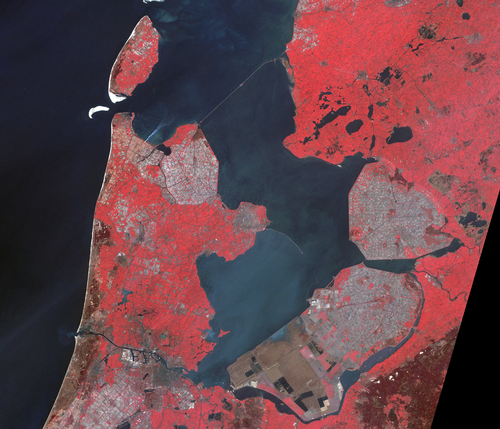
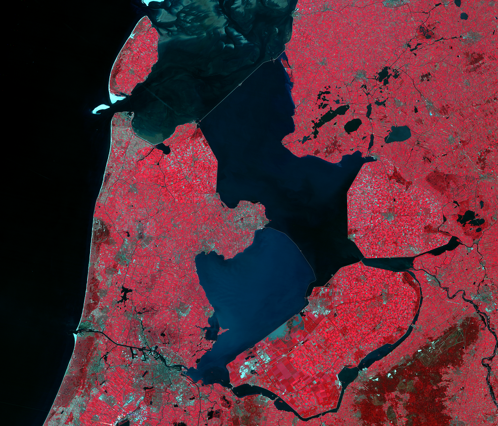
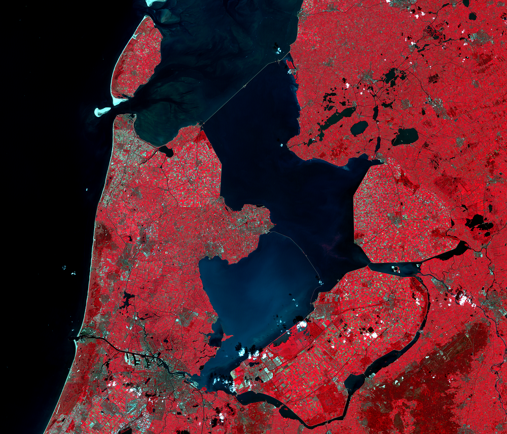
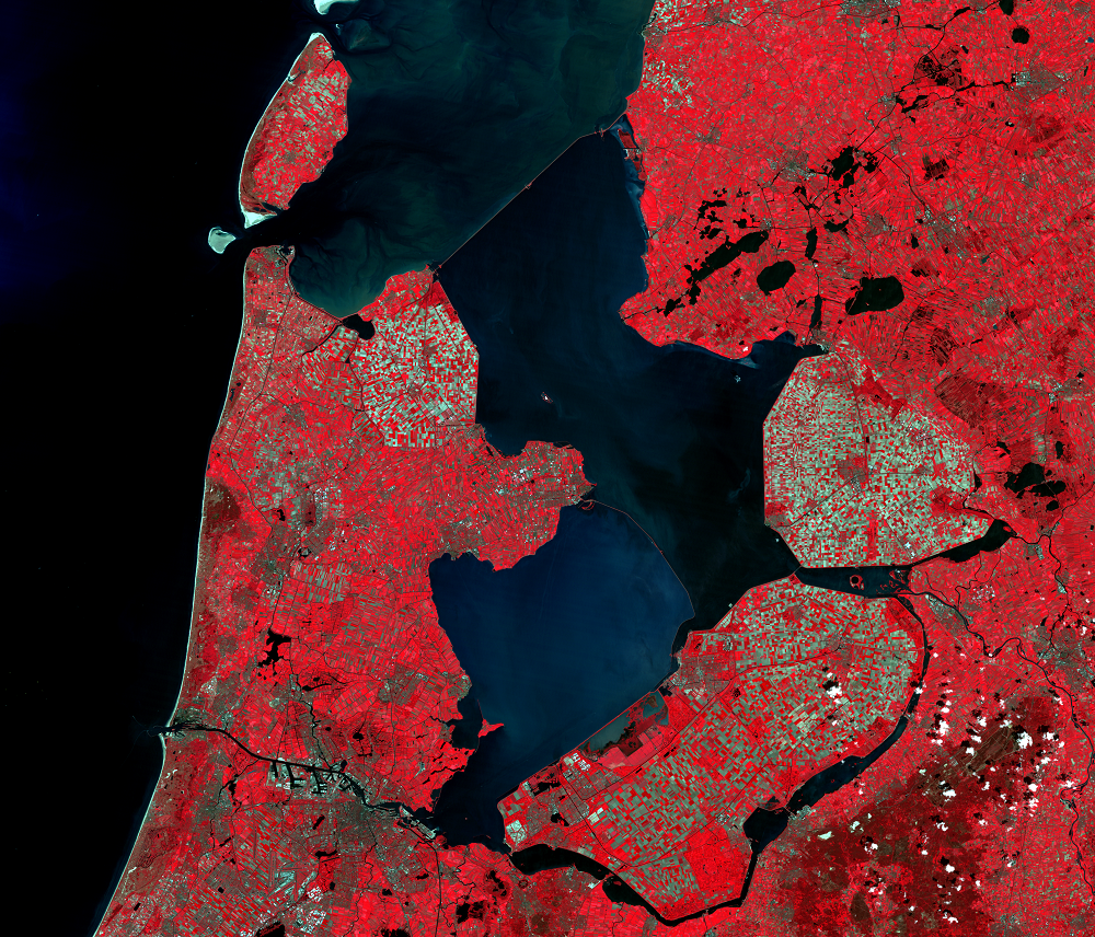
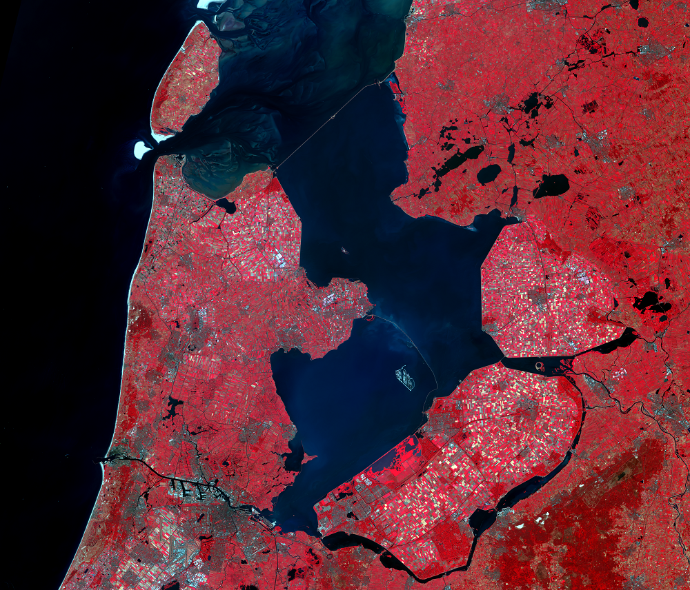
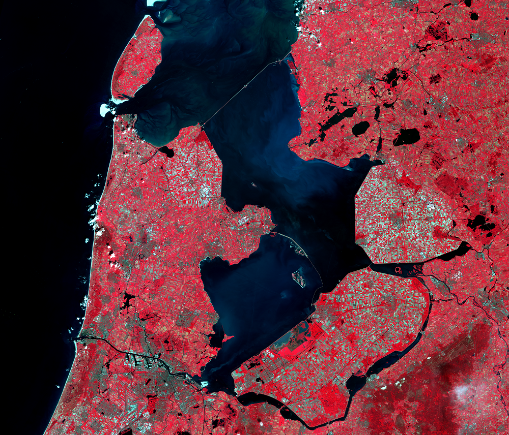
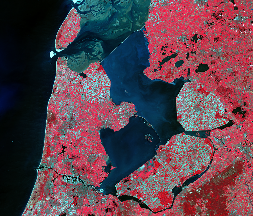
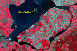
These images illustrate the progress of the Netherlands' diking and draining of the IJsselmeer region. The IJsselmeer is a lake on the coast of the Netherlands. (This lake, or meer, is named after the IJssel River and is pronounced EYE-ssel-mare.) In the satellite images, water appears blue-black, and vegetation appears red. Highly reflective areas like pavement or bare soil appear light blue or blue-green. Amsterdam can be seen in the lower left of the images.
Until 1932, this area was the Zuiderzee (pronounced ZIGH-dr-zee and meaning Southern Sea), simply a saltwater inlet of the North Sea. By 1968, the Dutch had transformed 1,979 km2 of the Zuiderzee into blocks of usable land, called polders. Here is how that typically happened:
- In 1932, the Dutch completed a dike across the mouth of the Zuiderzee, creating the IJsselmeer. This dike can be seen in the upper middle portion of these main images. The freshwater from the IJssel River flushed out the saltwater, creating a lake.
- Between 1930 and 1968, dikes were built around five portions of the IJsselmeer.
- The polders were drained using pumps.
- Reeds naturally grew on the former sea bottom. To help dry out the soil, the Dutch let the reeds grow. Transpiration moves water into the air faster than evaporation alone would.
- When the soil dried, the reeds were cleared and colza was planted. Colza is related to cabbage and turnips.
- The colza was cleared, and grain crops were planted.
- The polders were cultivated for up to five years before the land was ready to produce commercially.
- Land was then leased to commercial farmers, or towns were built.
The first of the five polders (Wieringermeer, in the northwest) was actually diked directly from the sea, not from the IJsselmeer. It was dry two years before the mouth of the Zuiderzee was closed off.
Imagery
Downloads
Boffey, D., 2019, Marker Wadden, the manmade Dutch archipelago where wild birds reign supreme: The Guardian, accessed August 14, 2019, at https://www.theguardian.com/world/2019/apr/27/marker-wadden-islands-netherlands-manmade-archipelago-wild-birds-eco-haven.
Boskalis, [n.d.], Cleaning up Ketelmeer: Boskalis Web page available at https://boskalis.com//about-us/projects/detail/cleanup-ketelmeer.html. (Accessed August 21, 2012.)
Hoeksema, R.J., 2006, Designed for dry feet—flood protection and land reclamation in the Netherlands: Reston, Va., American Society of Civil Engineers, 155 p.
Longyear, B., 2012, Ketelmeer: Durham Geo-Enterprises, Inc., available online at https://www.slopeindicator.com/stories/kettelmeer.php. (Accesses August 21, 2012.)
Ministry of Transportation and Public Works, [n.d.], Facts and Figures—The IJsselmeer Polders, Lelystad, Netherlands: Directorate Flevoland RWS Information Department, p. 2.
Ministry of Transportation and Public Works, [n.d.], A Profile—The IJsselmeer Polders Development Authority, Lelystad, Netherlands: IJsselmeer Polders Development Authority, p. 23.
Rewilding Europe, [n.d.], Marker Wadden Restoration Project: Rewilding Europe, accessed August 14, 2019, at https://rewildingeurope.com/rew-project/marker-wadden-restoration-project/.
Van Lier, H., 1982, A Review of the Zuiderzee Reclamation Works—An Example of Dutch Physical Planning: Landscape Planning v. 9, p. 35–59.
Xiong, L., and de Visser, R., 2018, Marker Wadden, the Netherlands—A Building-With-Nature Exploration: Landscape Architecture Frontiers, v. 6, no. 3, p. 58–75, https://doi.org/10.15302/J-LAF-20180307.
Related Content
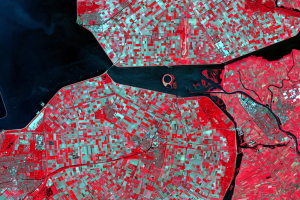
Lake Ketelmeer and the IJsseloog
The narrow lake east of IJsselmeer is Lake Ketelmeer. The lake receive...
Southern Flevoland and Markerwaard
Southern Flevoland, the southernmost of the polders, was the last to b...