

Illinois/Indiana, USA
Earth Resources Observation and Science (EROS) Center - Earthshots
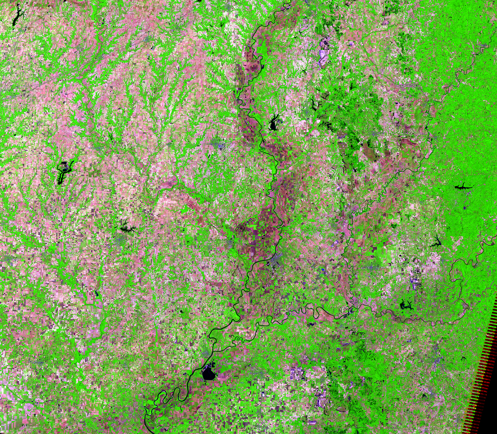
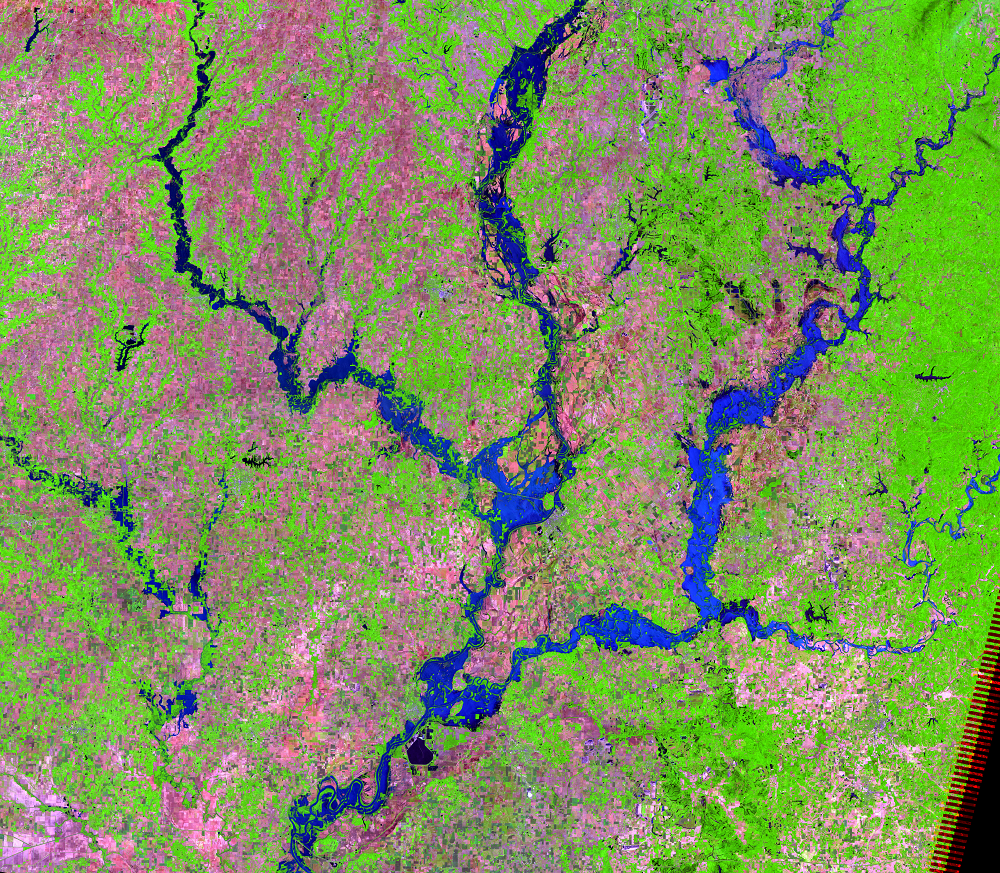
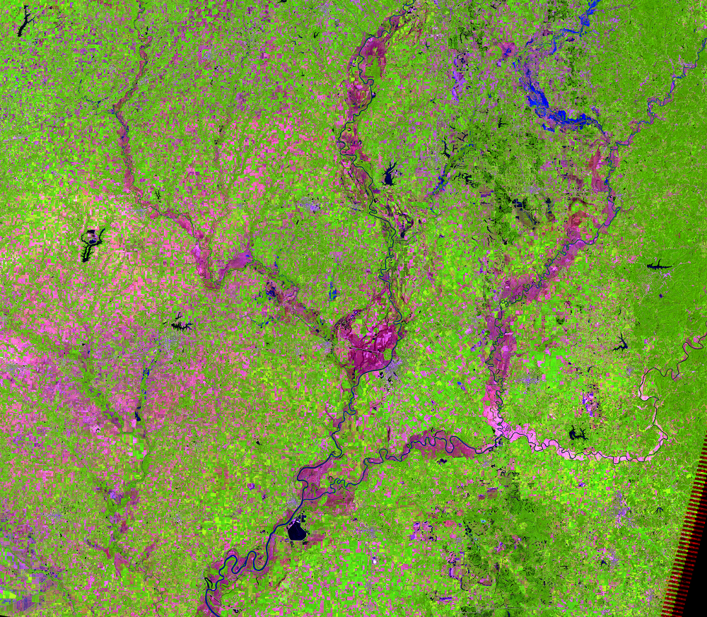
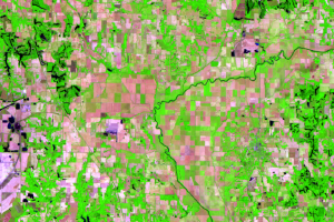
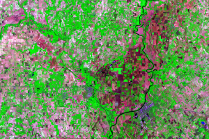
These three Landsat 5 images show several rivers in southern Illinois and Indiana, USA, during normal and flooded conditions. Peak flooding was observed in this area on June 10 and 11, 2008. The clear Landsat scene from June 11, 2008, and the clear image of “normal” conditions from June 9, 2007, allow us to compare the scenes and see exactly what damage a flood of this magnitude can cause.
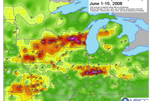
Rainfall amounts ranging from about 2 inches to more than 10 inches fell in this area on June 6–7, 2008. Spring was wetter than normal, so the heavy rain easily saturated the ground. The rivers quickly rose to exceed flood stage.
Satellite images can help authorities respond to disasters such as floods. The images can help local authorities see the amount of flooding and where there is damage to property. The extent of the flood can be mapped so that response teams can view where they are needed and respond quickly.
Imagery
Every picture has a story to tell
Correlated
Additional story information
Downloads
Ahlberg, L., 2011, Researchers’ chance viewing of river cutoff forming provides rare insight: News Bureau, University of Illinois, September 21, 2011. (Also available at http://news.illinois.edu/news/11/0921riversediment_BruceRhoads.html.)
Cox, E.T., 1869, First Annual Report of the Geological Survey of Indiana: accessed June 12, 2012, at https://scholarworks.iu.edu/dspace/handle/2022/3372.
Department of Geography, 2009, Illinois geographers study a river changing before their eyes: University of Illinois at Urbana-Champaign College of Liberal Arts and Sciences Office of Communications and Marketing, Fall 2009.
Hay, J., 2010, Wabash River cuts a new channel: accessed October 26, 2011, at http://www.riverlorian.com/wabashrivercutoff.htm.
Hayes, John L., 2009, Central United States Flooding of June 2008: National Weather Service, Service Assessment available online at ftp://ftp.library.noaa.gov/noaa_documents.lib/NWS/Assessments/Central-Flooding_2009.pdf. (Accessed April 24, 2014.)
Holmes, R.R., Jr., Koenig, T.A., and Karstensen, K.A., 2010, Flooding in the United States Midwest, 2008: U.S. Geological Survey Professional Paper 1775, 64 p. (Also available at http://pubs.usgs.gov/pp/1775/.)
Hussain, E., Kim, K., and Shan, J., 2009, Object-based image classification and web-mapping techniques for flood damage assessment, Annual Conference, Baltimore, Md., 9–13 March 2009, Proceedings: Bethesda, Md., American Society for Photogrammetry and Remote Sensing, unpaged CD-ROM.
Morlock, S.E., Menke, C.D., Arvin, D.V., and Kim, M.H., 2008, Flood of June 7–9, 2008, in central and southern Indiana: U.S. Geological Survey Open-File Report 2008–1322, 15 p., 3 app. (Also available at http://pubs.usgs.gov/of/2008/1322/).
Service Assessment Team, 2009, Service assessment—Central United States flooding of June 2008: Silver Spring, Md., National Oceanic and Atmospheric Administration, National Weather Service.
Shaw, R.E., 1990, Canals for a Nation—The canal era in the United States, 1790–1860: Lexington, University Press of Kentucky, 304 p.
Wilkinson, P., and Stoelting, N., 2008, Lower Eel River Watershed Management Plan: Clay County Soil & Water Conservation District, 109 p., accessed June 12, 2012, at http://www.in.gov/idem/nps/files/wmp_eelriver-lower_5-134.pdf.
Wilson, M., 2008, Floods shift Wabash River—new path at Mackey Bend: Evansville Courier & Press, July 13, 2008.
Zinger, J.A., Rhoads, B.L., and Best, J.L., 2011, Extreme sediment pulses generated by bend cutoffs along a large meandering river: Nature Geoscience, v. 4, p. 675–678. (Also available at http://www.nature.com/ngeo/journal/v4/n10/full/ngeo1260.html.)
Zinger, J.A., Rhoads, B.L., Best, J.L., and Johnson, K.K., 2013, Flow Structure and Channel Morphodynamics of Meander Bend Chute Cutoffs—A Case Study of the Wabash River, USA: Journal of Geophysical Research, v. 118, no. 4, p. 2468–2487. (Also available online at http://onlinelibrary.wiley.com/doi/10.1002/jgrf.20155/abstract.)
Other Stories
Related imagery and additional content
A New Cutoff
Floods are examples of short-term environmental change. They cause sub...
Eel River
Just west of Clay City, there is a large, nearly square-shaped area of...
Lawrenceville and Vincennes
In this area at near Lawrenceville, Illinois, and Vincennes, Indiana, ...
More about This Flood
The flooding that happened in summer 2008 in Indiana and Illinois star...
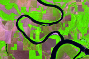
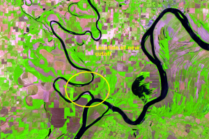
New Cutoff Close Up
Cutoffs are common on meandering rivers like the Wabash, but it’s rare...