

Impervious Surface
Earth Resources Observation and Science (EROS) Center - Earthshots
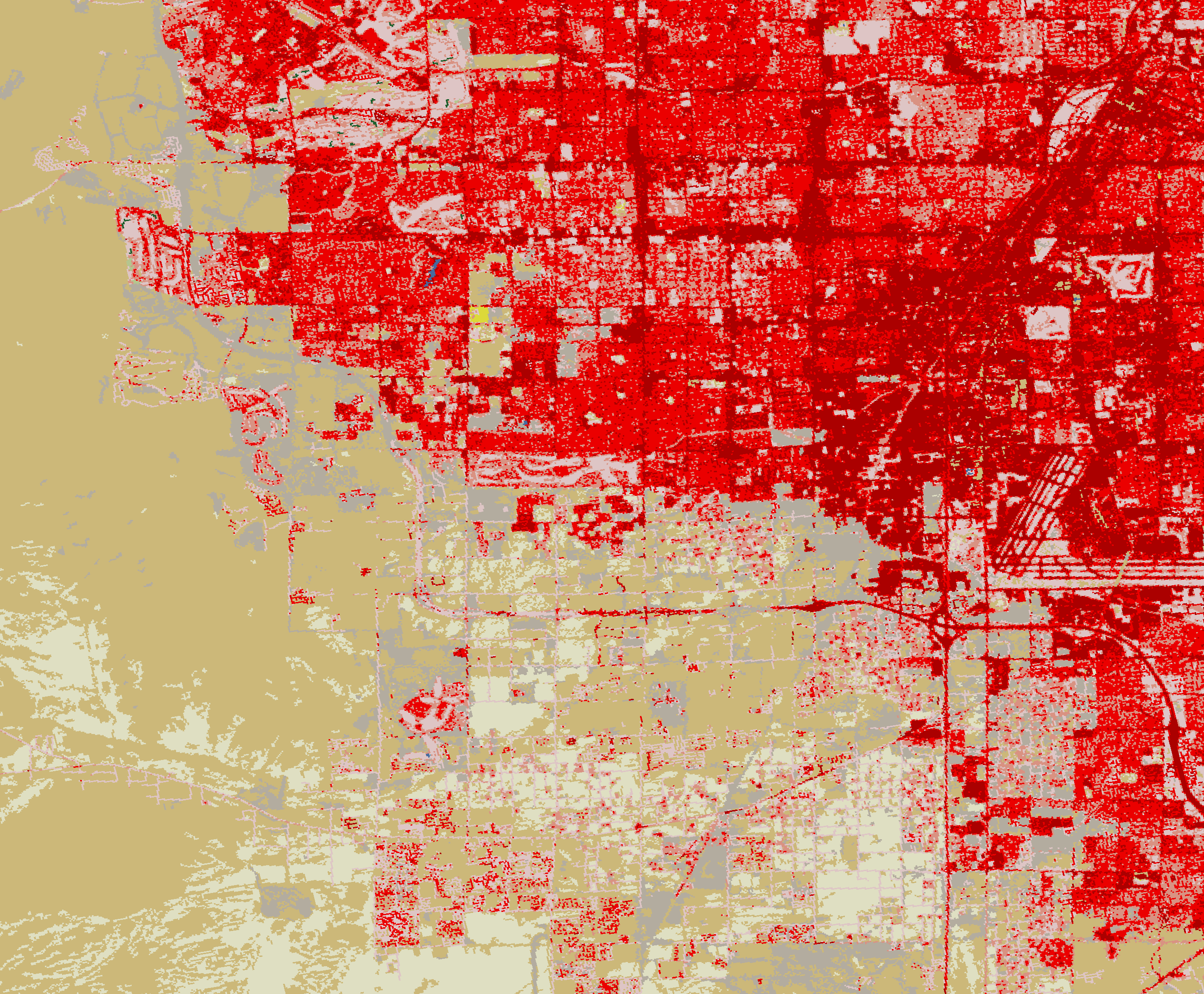
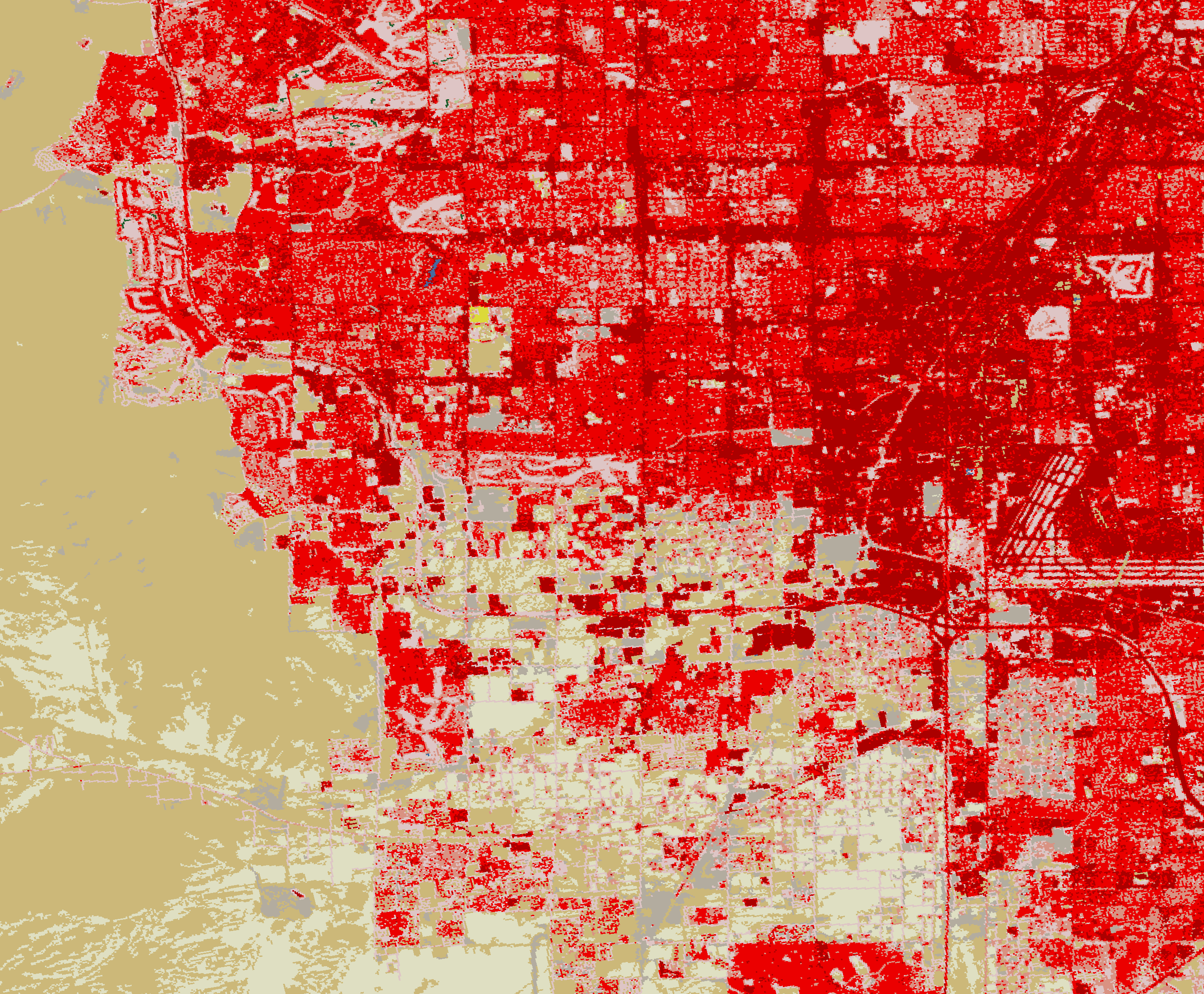
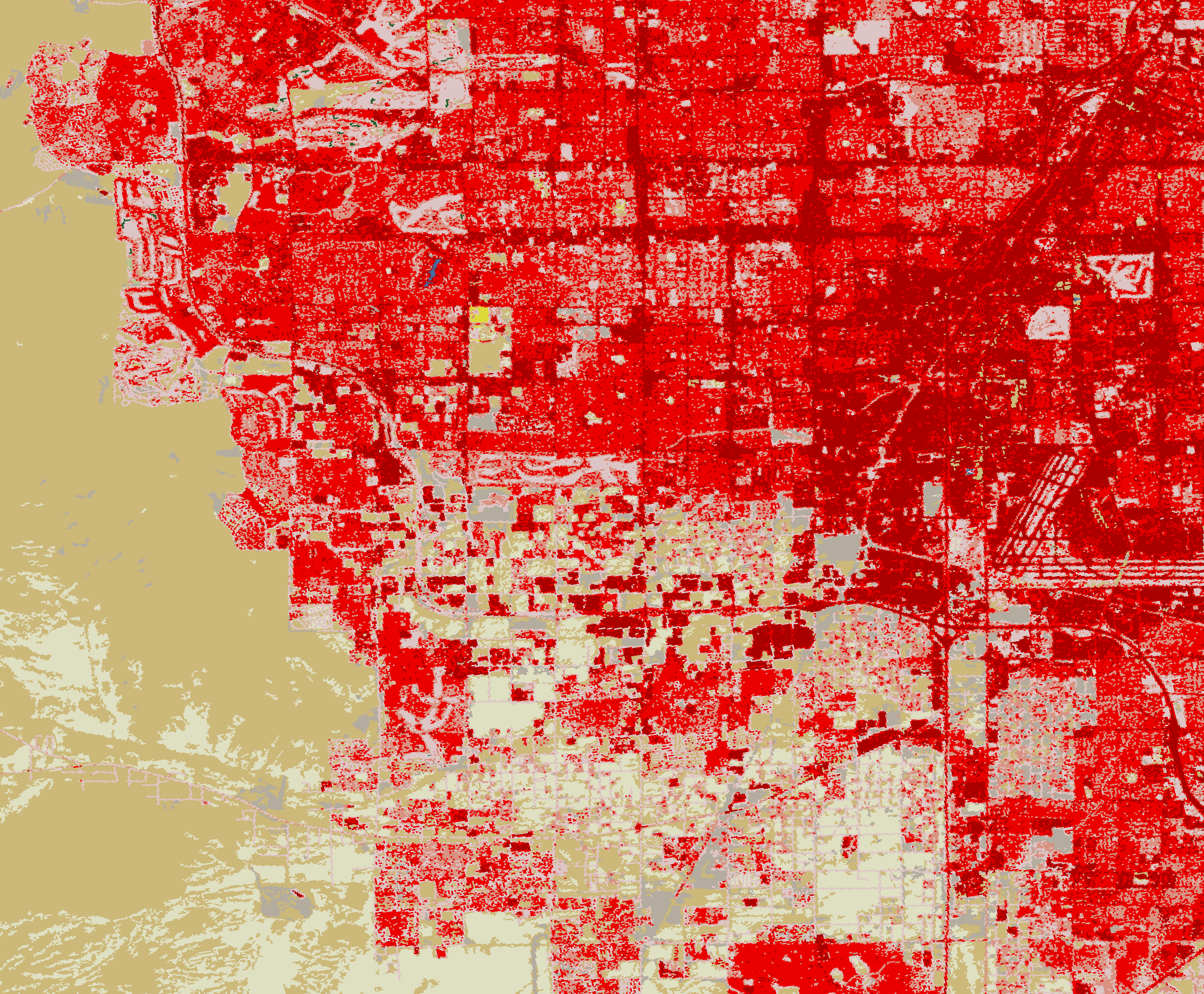
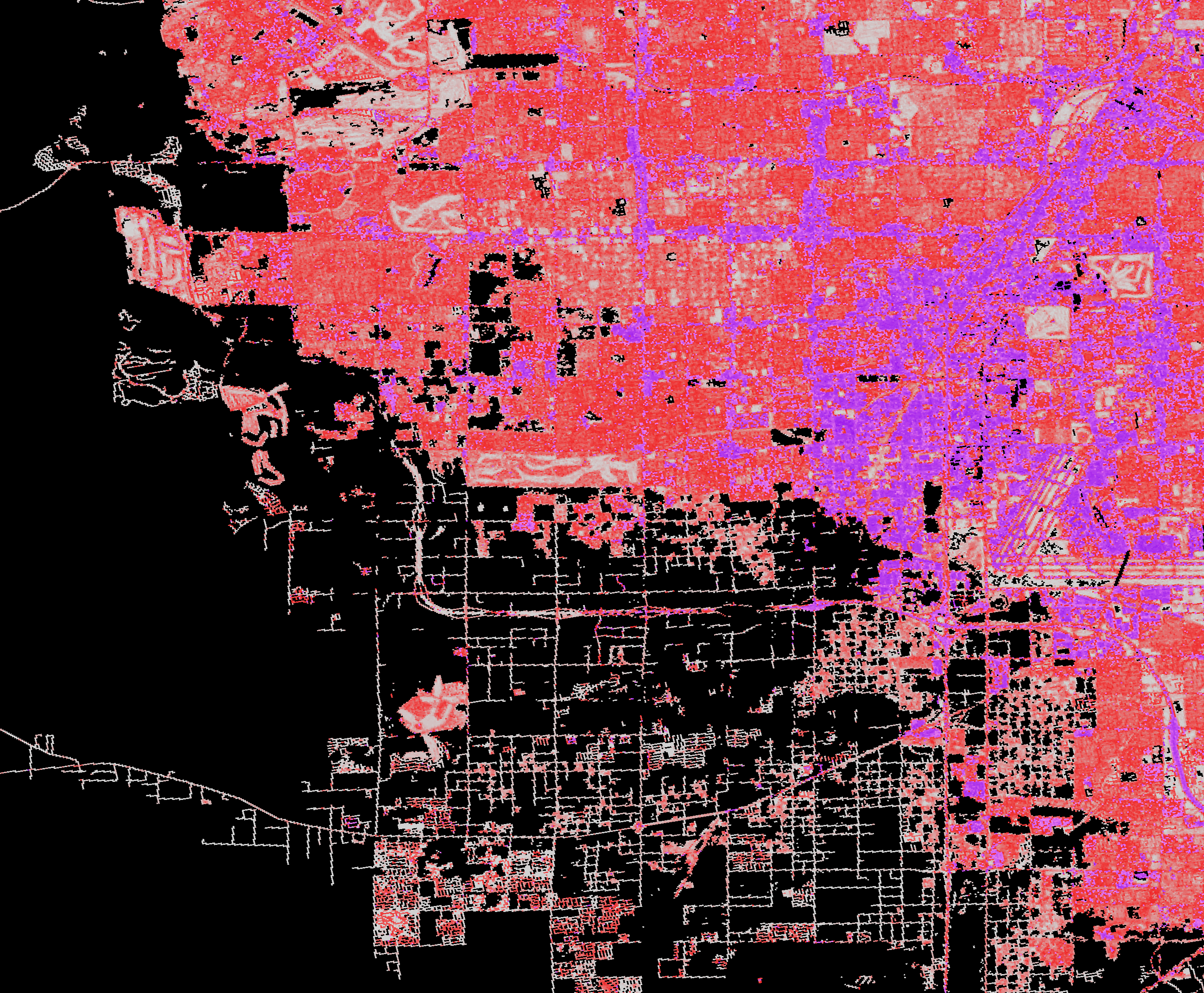
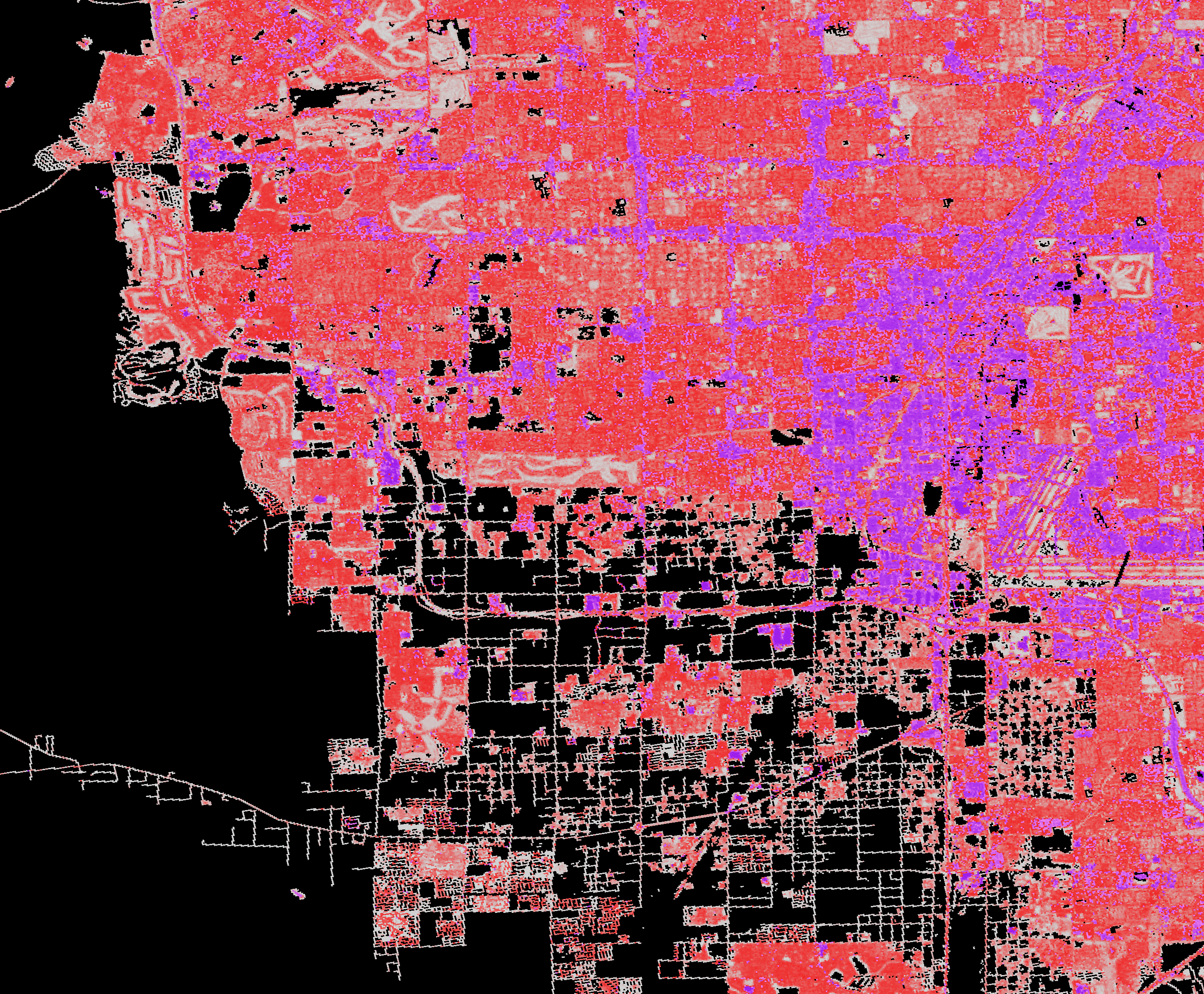
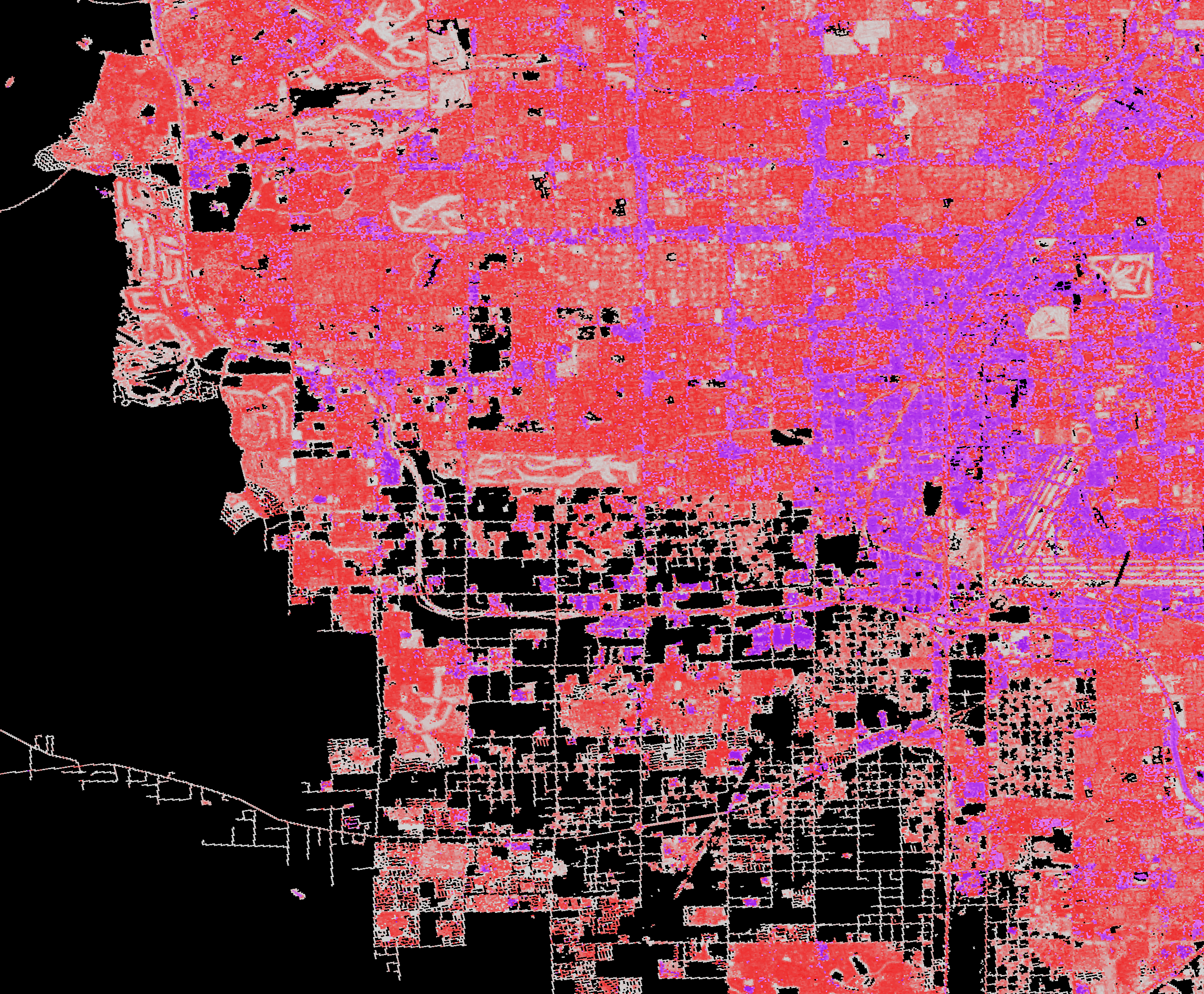
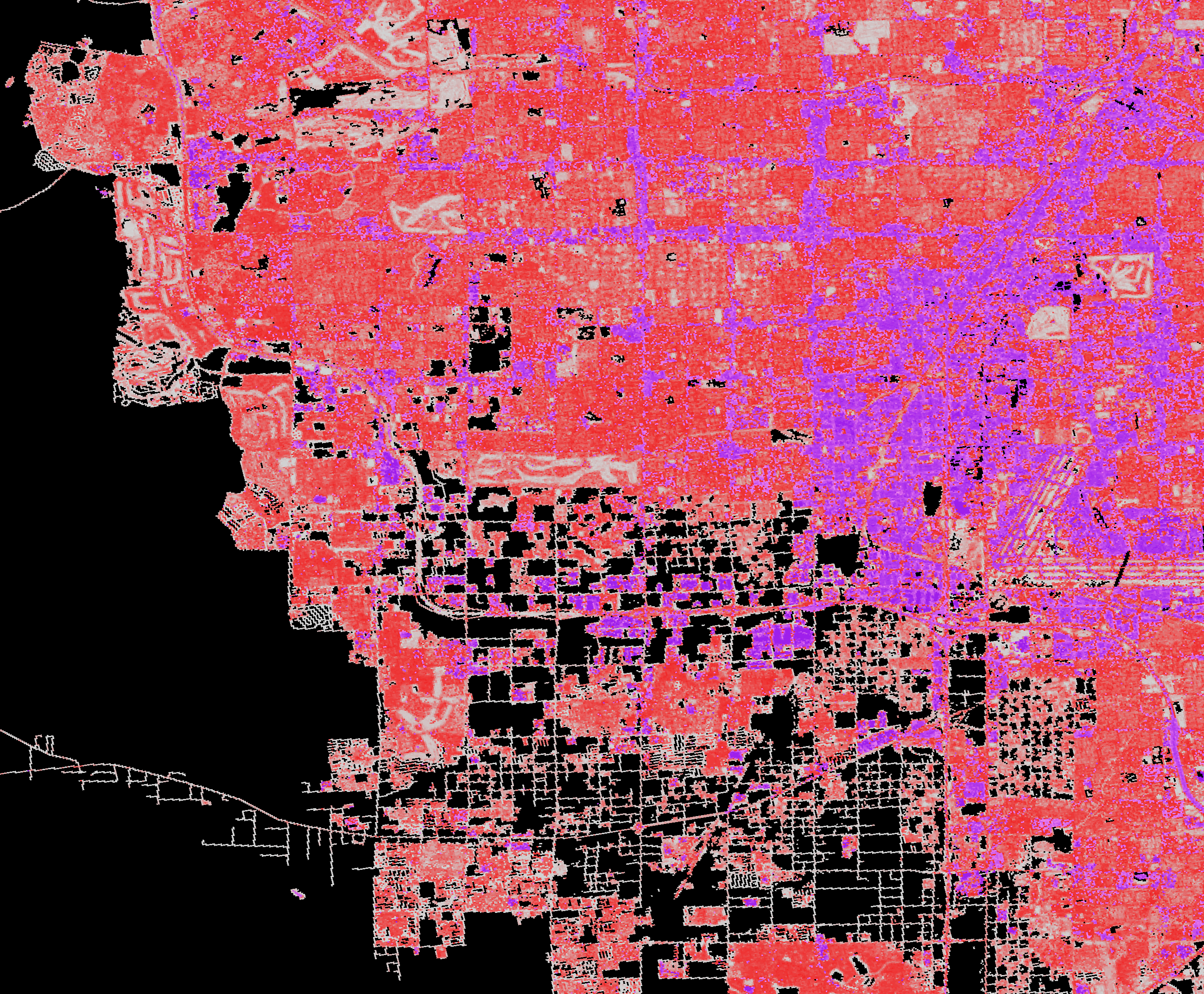
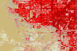
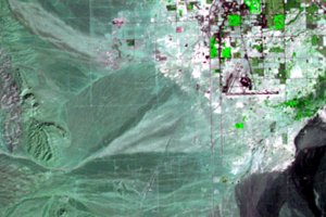
NLCD images of western Las Vegas show that much more urban expansion took place here between 2001 and 2006 than over the next 5 years. The land cover classes that expand noticeably in these images are the developed classes. With these classes, NLCD can be used to track changes to impervious surface.
Impervious surfaces include roads, buildings, and parking lots—surfaces that do not allow rainwater to soak into the ground. The extent and density of impervious surface can affect water quality and flooding severity in urban areas.
In a forested area, for example, most rainfall soaks into the soils and is stored as groundwater, slowing the discharge into streams. Flooding in these areas is less significant. In urban areas, however, much more water runs off into streams quickly and increases the likelihood of severe flooding.
Studying impervious surface change allows scientists to quantify the extent of developed land cover regionally and nationally. NLCD is widely used to evaluate effects on hydrological and ecological systems in many urban areas.
Impervious surfaces are best measured with satellites. They cannot be easily or cost-effectively measured on the ground.
Imagery
Every picture has a story to tell

Correlated
Additional story information
Downloads
Other Stories
Related imagery and additional content
Change Animation
If you could speed up time and watch a fast-growing city like Las Vega...
Impervious Surface
NLCD images of western Las Vegas show that much more urban expansion t...

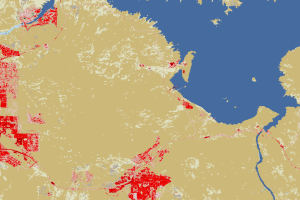
Lake Las Vegas
Between 1986 and 1992, a lake appeared east of the city, along La...
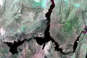
Lake Mead
How is Las Vegas getting enough water for its expanding population? Mo...
Land Cover Maps
The images displayed in this section show a different way of looking a...
Near Lake Mead
These close-up NLCD images show the water level changes to western Lak...
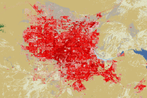
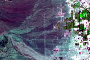
Southwestern Las Vegas
Zooming in on the southwestern portion of the city reveals further urb...
Western Urban Expansion
In these false-color images, bright green indicates vegetation. As the...