

Jurong
Earth Resources Observation and Science (EROS) Center - Earthshots
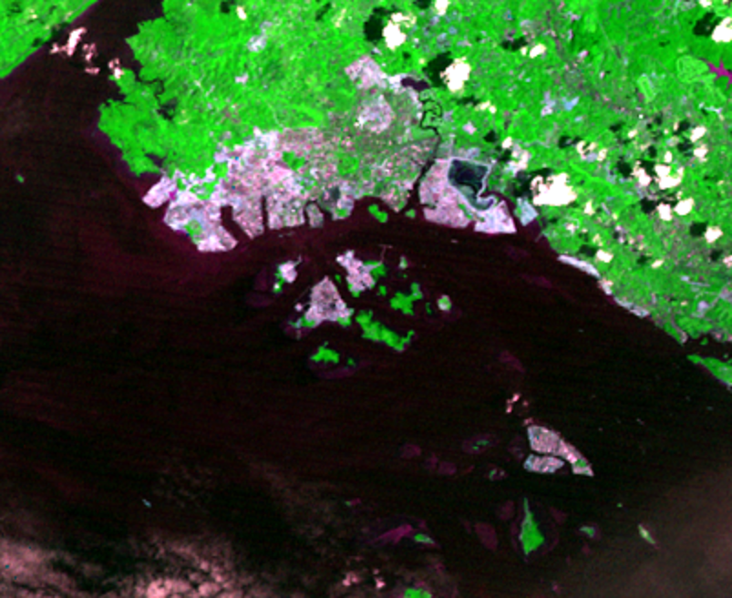
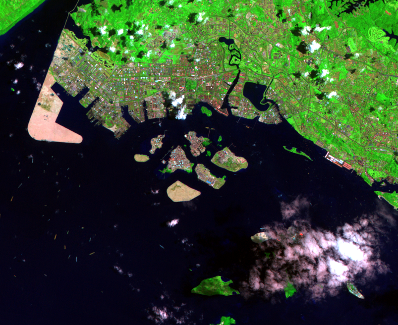
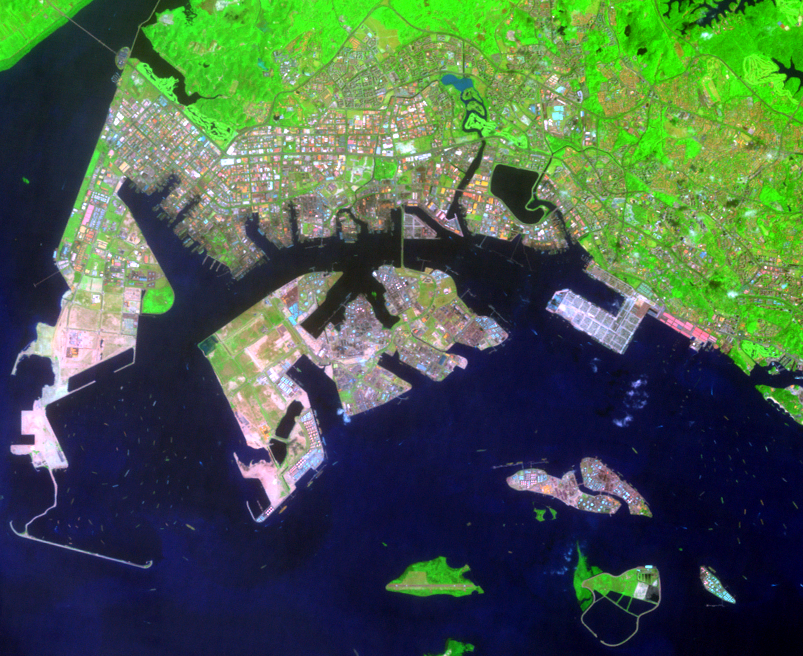
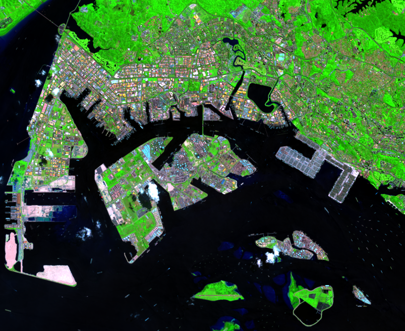
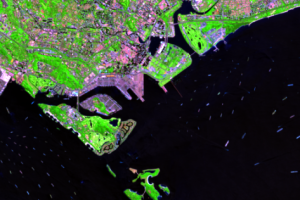
The symbol of the new Singapore may be on the island’s west end, the industrial New Town of Jurong. In 1962, the government began clearing the jungle and building docks by digging into the shore and by extending new land out into the sea. In the 1973 image, you can see cleared and filled expanses still lying bare and bright. By 1990, you can see Jurong’s streets and plantings filling in as it spreads inland. There are obvious land extensions, and the harbor is now busy with ships.
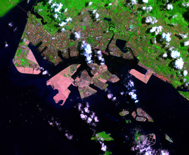
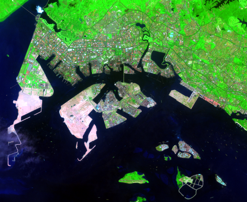
Much of Jurong’s shipping has been oil; by the 1990s, only the Gulf Coast and Rotterdam refined more. By the late 1960s, several plants were operating along the shore, and by 1973 you can see several more on the small islands offshore, squeezing out their forests and little fishing villages. By 1990, the islands are filled, and the oil companies have begun extending them. By 2000, the islands are gone, replaced by one large “chemical island” called Jurong Island, with its own new causeway to the mainland. Further development of Jurong Island is evident in the 2009 image.
Altogether, the government planned to increase Singapore’s area by 25 percent between independence and “Year X.” Year X was commonly interpreted as 2030, but many developments have pushed ahead of schedule. It appears that this extraordinary nation’s future, like its newest land, is far from settled.
Imagery
Downloads
Related Content
Singapore
“Buy land,” a wise man once said. “They’re not making any more.” Not s...
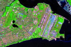
Changi Airport
The new shoreline extends east of the city all the way to the airport ...

Jurong
The symbol of the new Singapore may be on the island’s west end, the i...
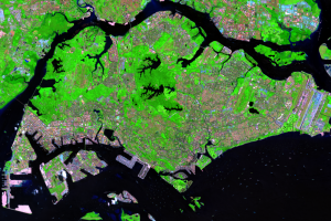
The Island Changes
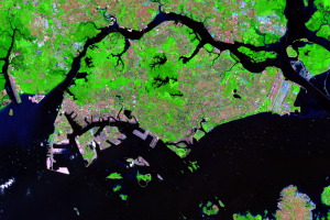
Landsats 1 through 8 recorded these post-independence changes, startin...
The Island Expands
The British started the expansion of Singapore within days of landing ...