

Lake Urmia, Iran
Earth Resources Observation and Science (EROS) Center - Earthshots
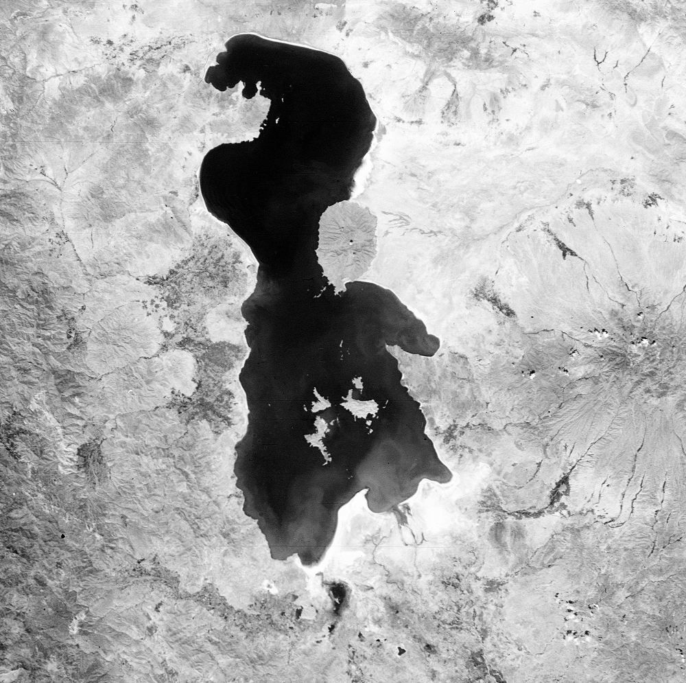
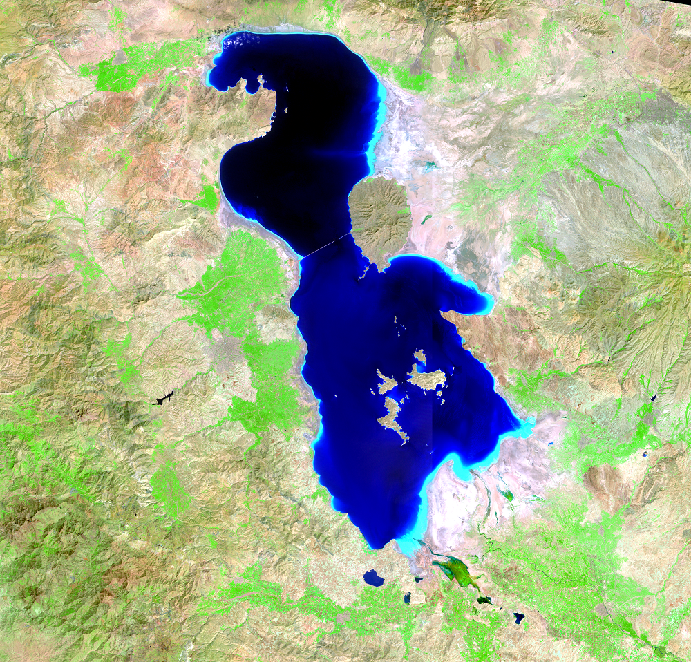
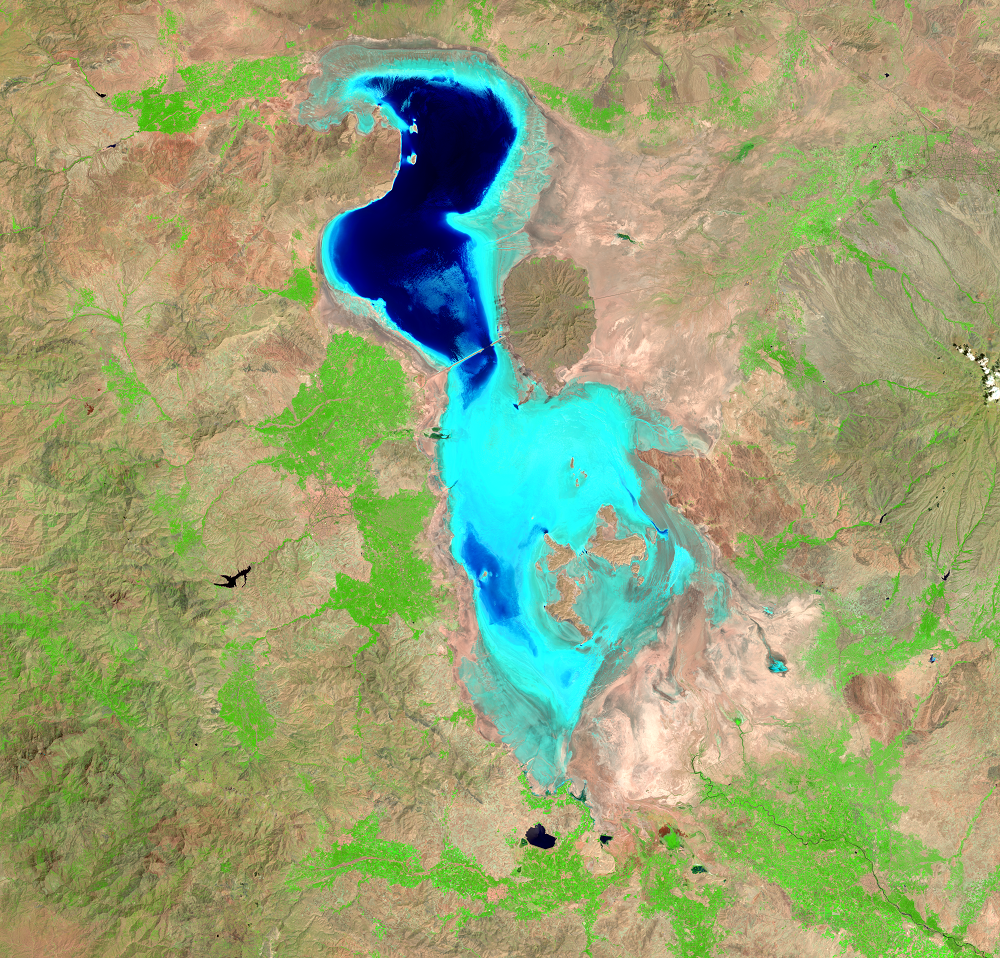
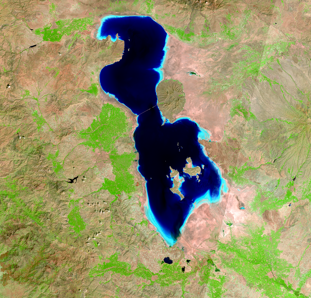
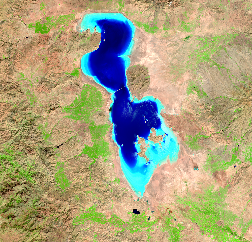
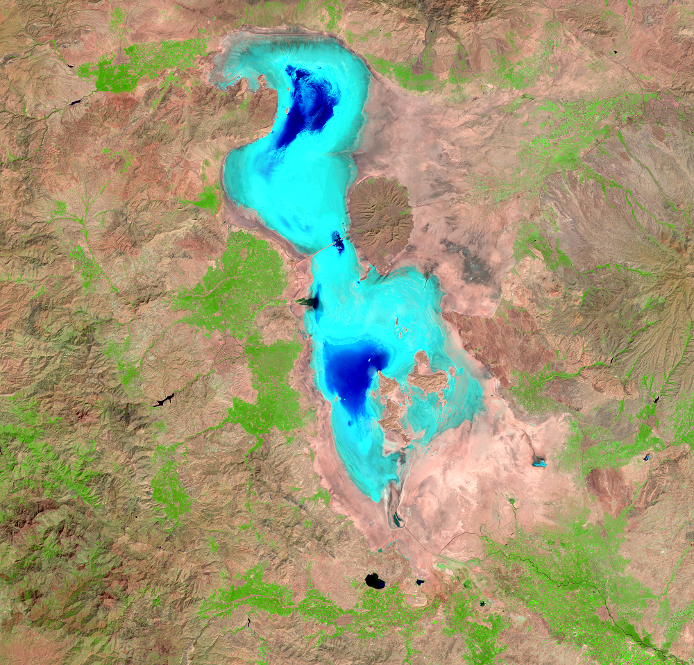
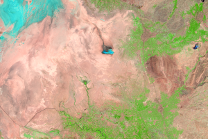
Lake Urmia in Iran is another closed basin lake that has been shrinking. Continuous declines in water flowing into the lake have caused a general decline in its surface area since 1995.
Water only enters Lake Urmia via rainfall and runoff from rivers flowing into it. As a closed basin lake, its water levels fluctuate with changes in rainfall. Once water reaches the lake, it only leaves via evaporation. When the water that flows into the lake is diverted for human uses, those dynamics are prone to big changes.
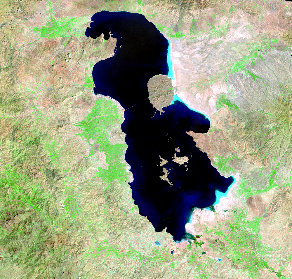
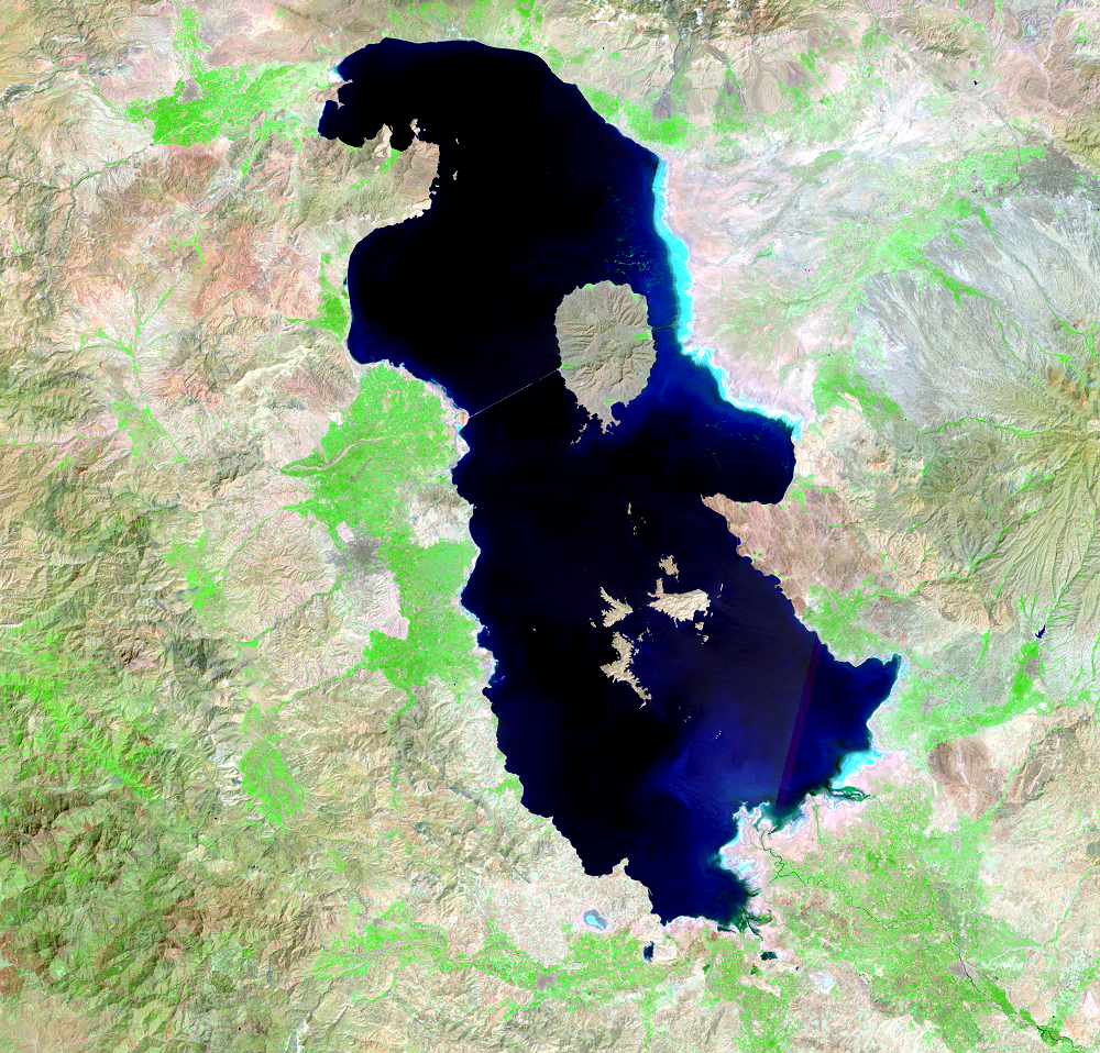
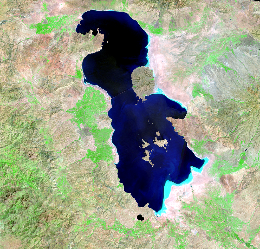
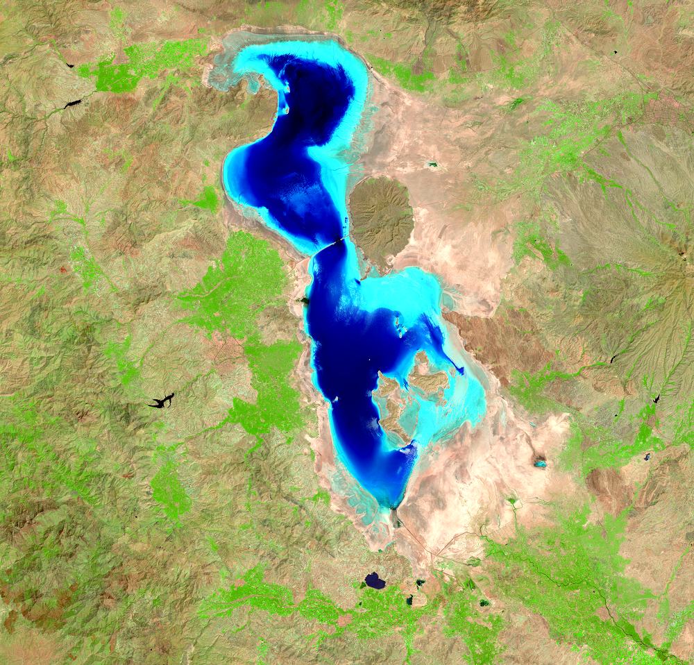
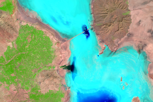
The lake’s southern basin is shallower than its northern basin, so recent images show the water disappearing from the southern basin first. These Landsat images use the shortwave-infrared, near-infrared, and green wavelengths of light. Because water absorbs infrared light, water (dark blue to black) contrasts with the surrounding land areas. As the water becomes shallower, light is reflected off of the lakebed in shades of light blue. Lighter blue and bright areas immediately surrounding the lake are where the receding shoreline has exposed the lake bottom.
Data from the USDA Foreign Agricultural Service shows a downward trend since the mid-1990s. However, a fresh pulse of water from rains during fall 2018 and spring 2019, along with seasonal snowmelt, increased lake levels. This increase isn’t only evident in the graph data. The 2019 Landsat image shows a rebound in water levels over 2018. The basin remained mostly filled as recently as 2019. The 2023 image shows that drought returned, bringing water levels down again.
Imagery
Downloads
AghaKouchak, A., Norouzi, H., Madani, K., Mirchi, A., Azarderakhsh, M., Nazemi, A., Nasrollahi, N., Farahmand, A., Mehran, A., and Hasanzadeh, E., 2014, Aral Sea Syndrome Desiccates Lake Urmia: Call for Action: Journal of Great Lakes Research, available online at http://dx.doi.org/10.1016/j.jglr.2014.12.007. (Accessed January 22, 2015.)
Carrington, D., 2014, Save One Dying Lake, Save the Middle East? CNN, http://www.cnn.com/2014/08/14/world/meast/save-one-dying-lake-save-the-middle-east/. (Accessed November 17, 2014.)
Delju, A.H., Ceylan, A., Piguet, E., and Rebetez, M., 2013, Observed Climate Variability and Change in Urmia Lake Basin, Iran: Theoretical and Applied Climatology, v. 111, no. 1–2, p. 285–296. (Also available at http://link.springer.com/article/10.1007%2Fs00704-012-0651-9.)
Doermann, L., 2023, Lake Urmia Shrivels Again: NASA Earth Observatory, accessed October 10, 2023, at https://earthobservatory.nasa.gov/images/151913/lake-urmia-shrivels-again.
Earth Snapshot, 2012, Scientists Warn of Dangers of Shrinking Lake Urmia, Iran: Earth Snapshot Web page at http://www.eosnap.com/lakes/scientists-warn-of-dangers-of-shrinking-lake-urmia-iran/. (Accessed November 13, 2014.)
Kabiri, K., Pradhan, B., Sharifi, A., Ghobadi, Y., and Pirasteh, S., 2012, Manifestation of Remotely Sensed Data Coupled with Field Measured Meteorological Data for an Assessment of Degradation of Urmia Lake, Iran: 2012 Asia Pacific Conference on Environmental Science and Technology, Advances in Biomedical Engineering, vol.6, p.395–401. (Available at https://www.researchgate.net/publication/235707752_Manifestation_of_Remotely_Sensed_Data_Coupled_With_Field_Measured_Meteorological_Data_for_an_Assessment_of_Degradation_of_Urmia_Lake_Iran.)
Pappas, S., 2014, Dead Volcano, Dying Lake Seen from Space: Livescience, http://www.livescience.com/47177-lake-urmia-from-space-photo.html. (Accessed November 17, 2014.)
Patel, K., 2019, Reviving the Shriveled Lake Urmia: NASA Earth Observatory, accessed Sep. 24, 2019, at https://earthobservatory.nasa.gov/images/144848/reviving-the-shriveled-lake-urmia.
Pengra, B., 2012, The Drying of Iran’s Lake Urmia and Its Environmental Consequences: UNEP Global Environmental Alert Service (GEAS) Web page at http://na.unep.net/geas/getUNEPPageWithArticleIDScript.php?article_id=79. (Accessed November 17, 2014.)
Wilkinson, M.J., 2014, Lake Urmia: NASA Earth Observatory, available at http://earthobservatory.nasa.gov/IOTD/view.php?id=84116. (Accessed November 17, 2014.)
Zeinoddini, M., Tofighi, M.A., and Vafaee, F., 2009, Evaluation of Dike-Type Causeway Impacts on the Flow and Salinity Regimes in Urmia Lake, Iran: Journal of Great Lakes Research, v. 35, no. 1, p. 13–22.
Related Content
Causes and Plans
The diversion of water from the rivers for agricultural use is probabl...
Populations
About 76 million people live within 500 kilometers (310 miles) of Lake...
Salt and Farming
Lake Urmia is a hypersaline lake. Rivers carry sediments and minerals ...