

Lisan Peninsula
Earth Resources Observation and Science (EROS) Center - Earthshots
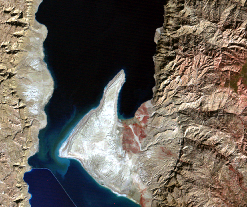
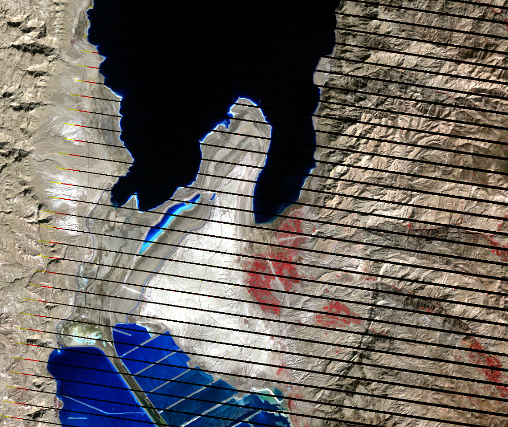
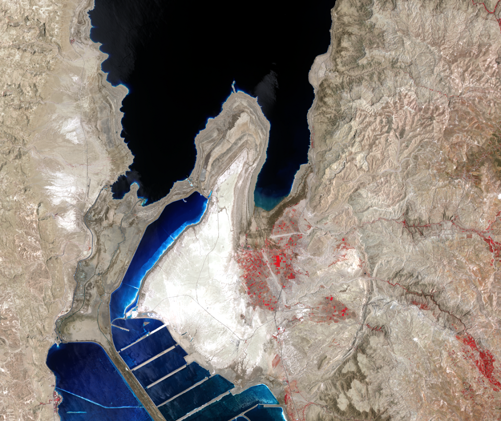
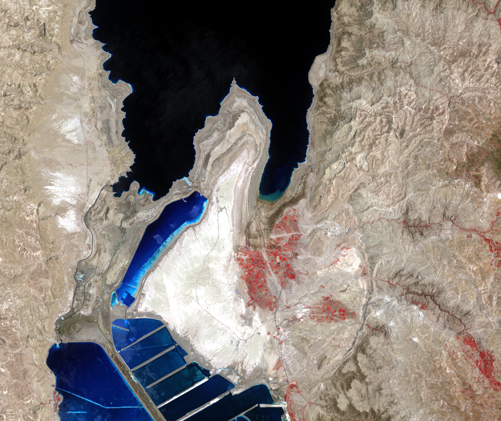
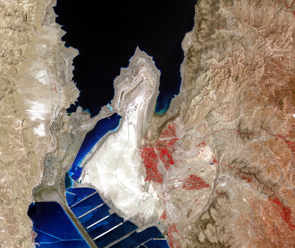
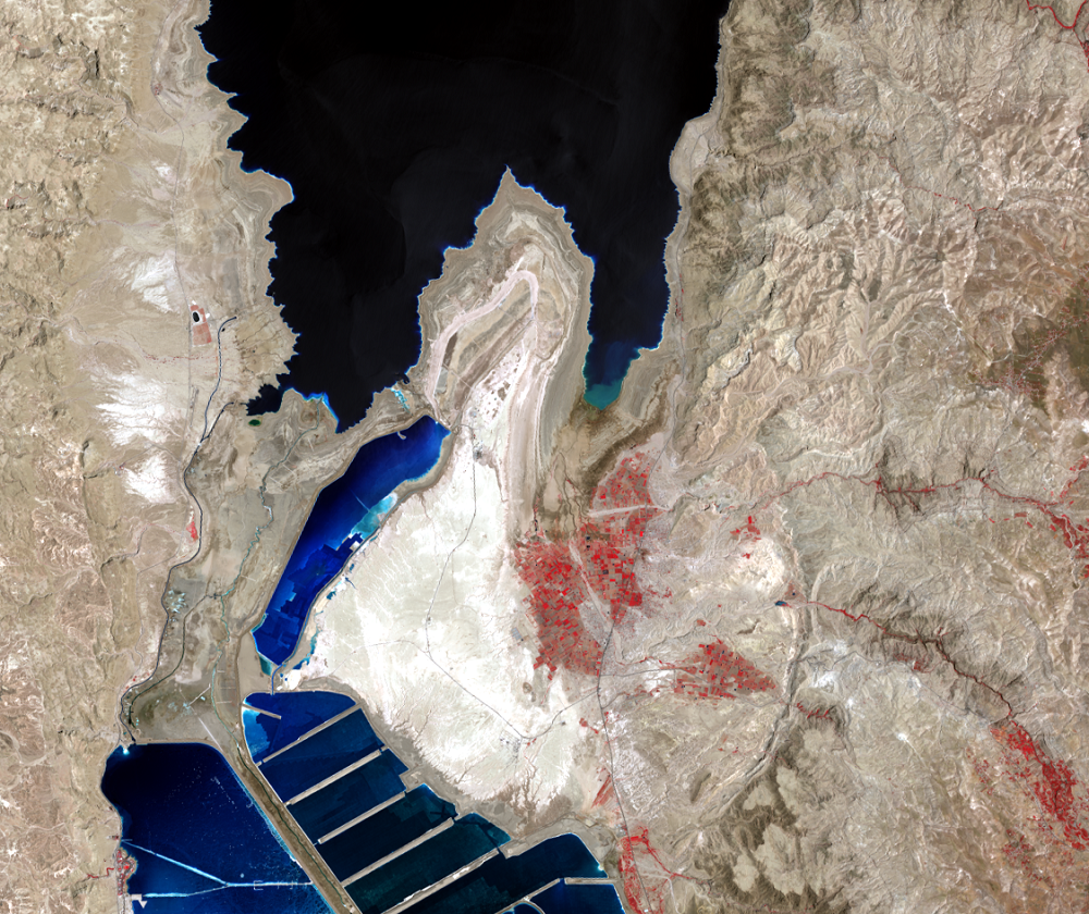
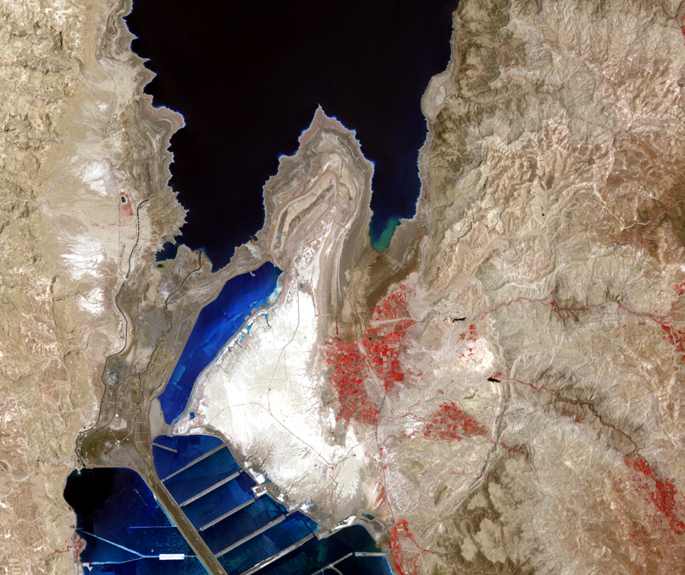
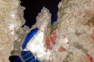
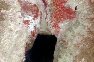
The prominent land feature that separates the northern and southern basins is the Lisan Peninsula. (Lisan means “tongue” in Arabic.) The geologic name for this structure is diapir, a mass of low density material that has pushed upward.
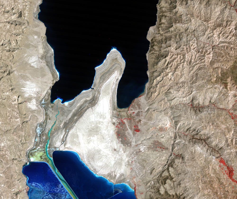
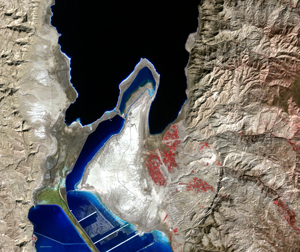
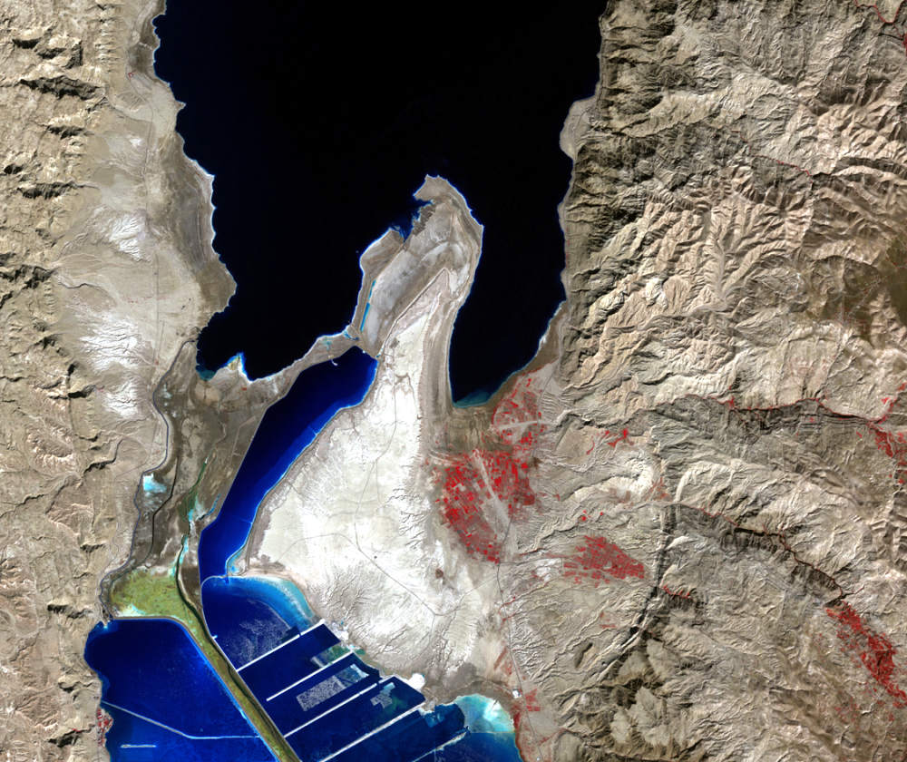
On March 22, 2000, the northern part of a salt pan on the Lisan Peninsula collapsed 2 months after it was completed. The February 15, 2000, image shows water in this pan, but in the October 28, 2000, and later images, the water is drained out. About 56 million cubic meters of brine went back into the Dead Sea when the dike collapsed.
As the Dead Sea level declines, the land that becomes exposed is unstable. Future land feature changes similar to the salt pan collapse on the Lisan Peninsula may accompany the decreased water levels and exposure of additional unstable land.
Imagery
Downloads
Related Content
Dead Sea, Israel, Jordan, West Bank
The water surface level of the Dead Sea is the lowest natural land or ...
Industry
The Dead Sea has no outlet. The only way water exits the sea is by eva...
Lisan Peninsula
The prominent land feature that separates the northern and southern ba...
Rates of Decline
The Dead Sea is fed mainly by the Jordan River, which enters from the ...