

Losing Forest Fast
Earth Resources Observation and Science (EROS) Center - Earthshots
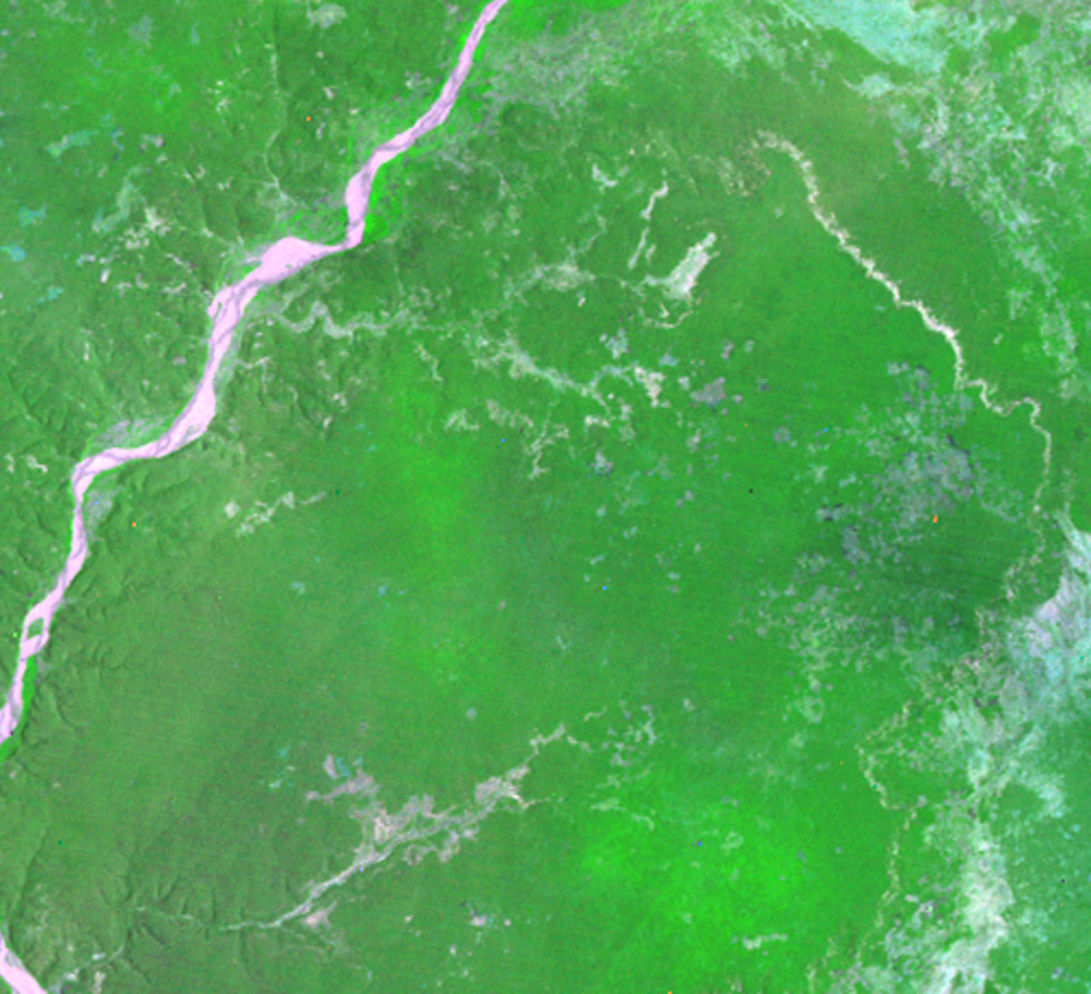
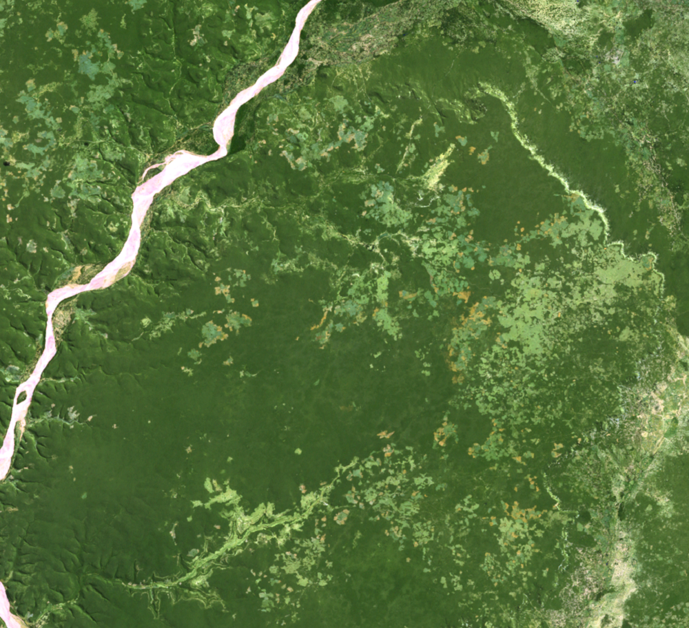
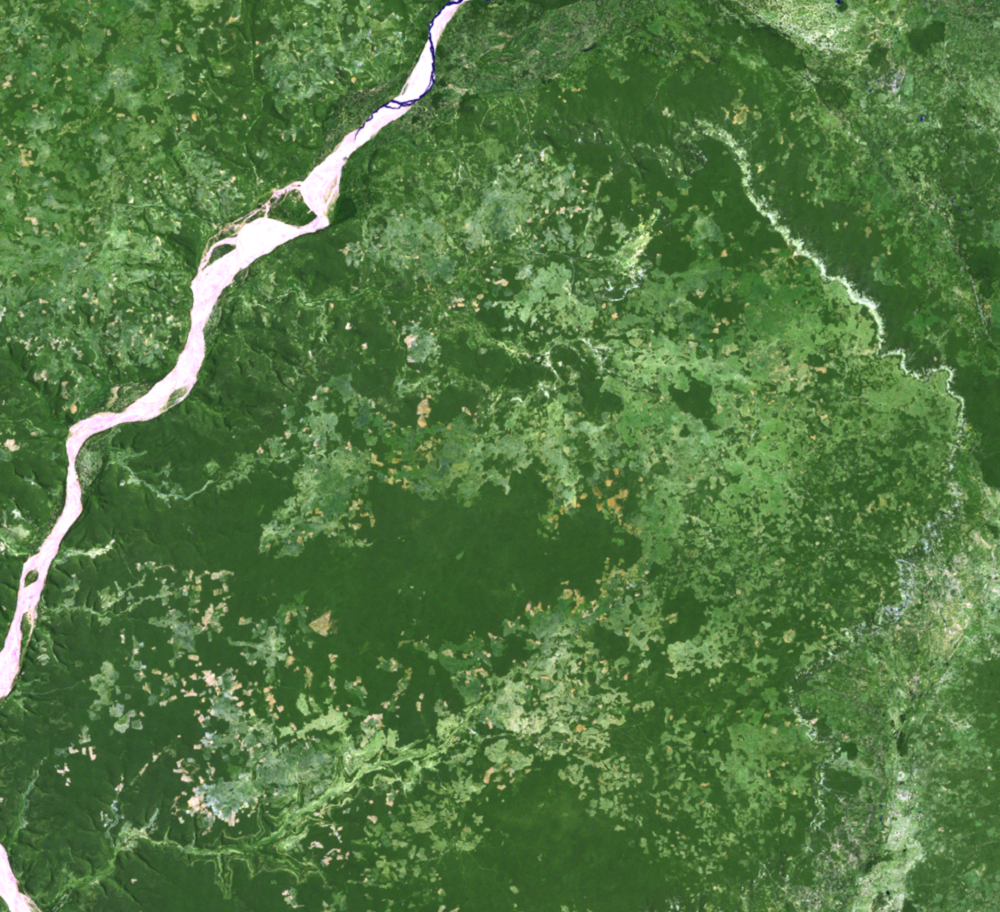
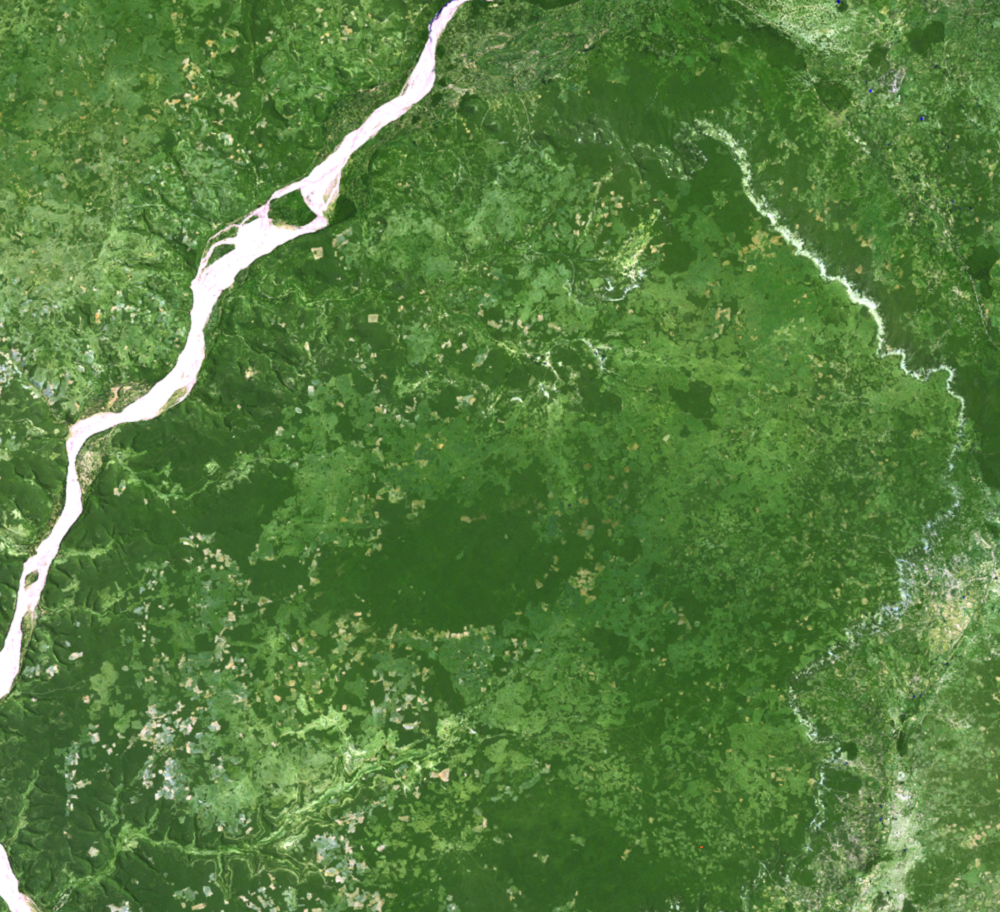
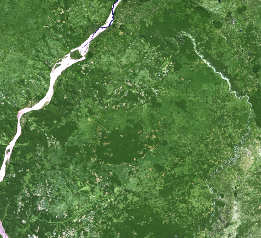
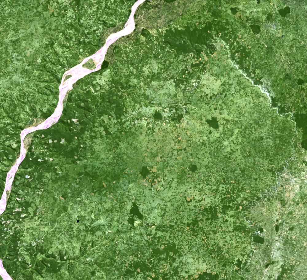
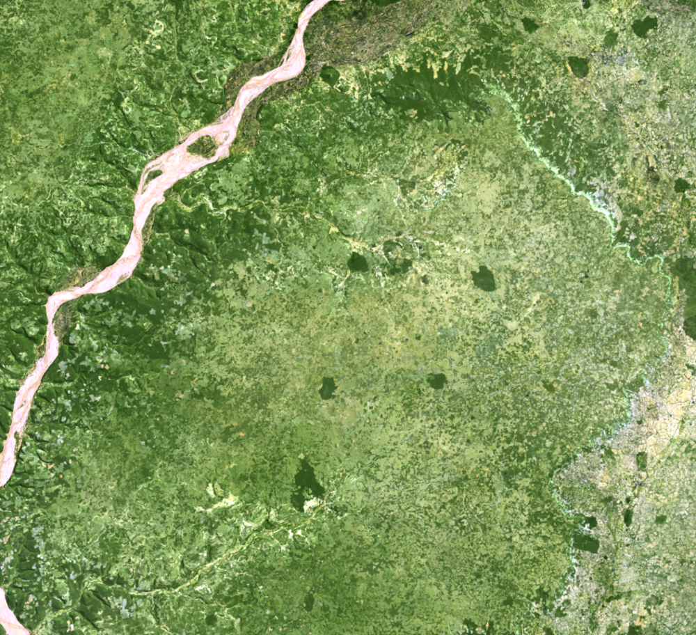
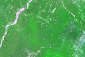
Looking at a more specific region within these images makes it clear that that the Spiny Thicket seems to be disappearing fast. Since 1990, this ecoregion has had the highest deforestation rate in the country.
Agriculture in this region is done by slash-and-burn. The fields are cleared by burning, then planted.
The forest is also used for charcoal production. Most households use charcoal to cook their daily meals. Even though this is less destructive than slash-and-burn, charcoal production causes the degradation of vast areas of the Spiny Thicket. Even when the Spiny Thicket regenerates, it does so as cactus scrub.
Landsat is uniquely suited to monitoring these types of land changes over large areas. Forests once covered Madagascar, but forest cover has been reduced to less than one-fourth of the island’s original extent. Information gathered by Landsat can help improve management of remaining resources.
Imagery
Every picture has a story to tell
Correlated
Additional story information
Downloads
Other Stories
Related imagery and additional content
Deforestation
All of Madagascar is being threatened by deforestation, but this threa...
Losing Forest Fast
Looking at a more specific region within these images makes it clear t...