

Mélange
Earth Resources Observation and Science (EROS) Center - Earthshots
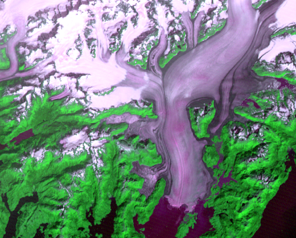
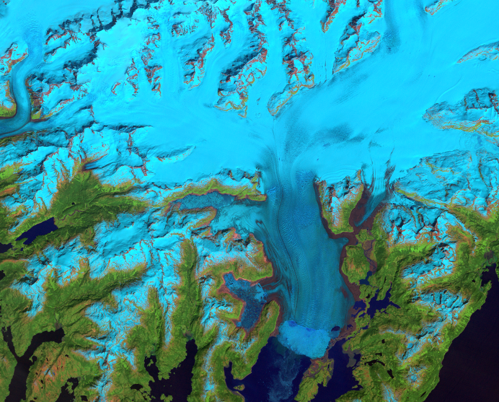
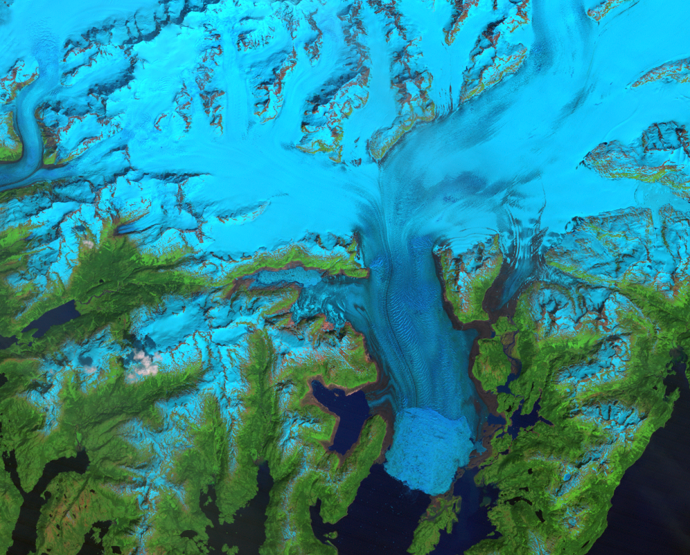
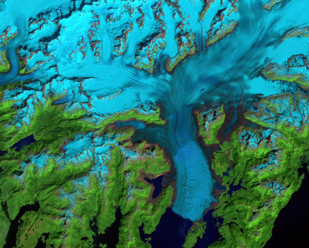
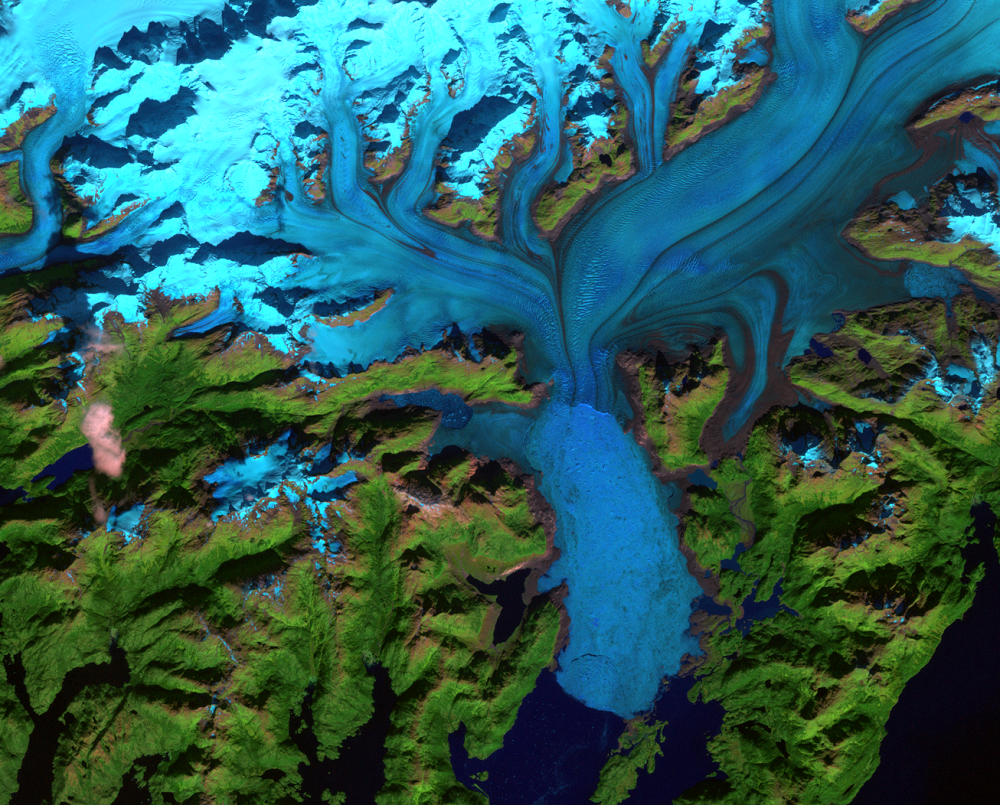
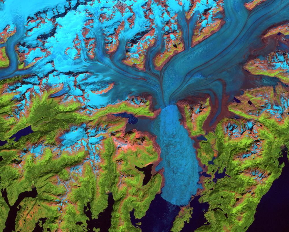
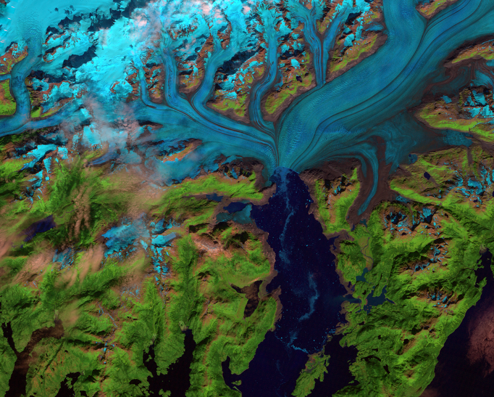
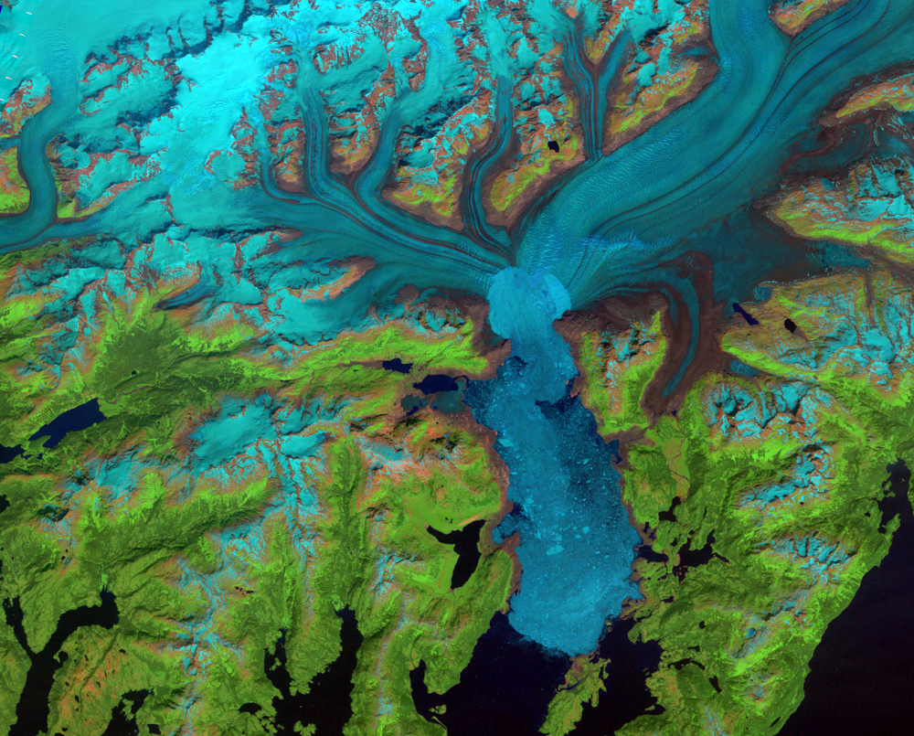
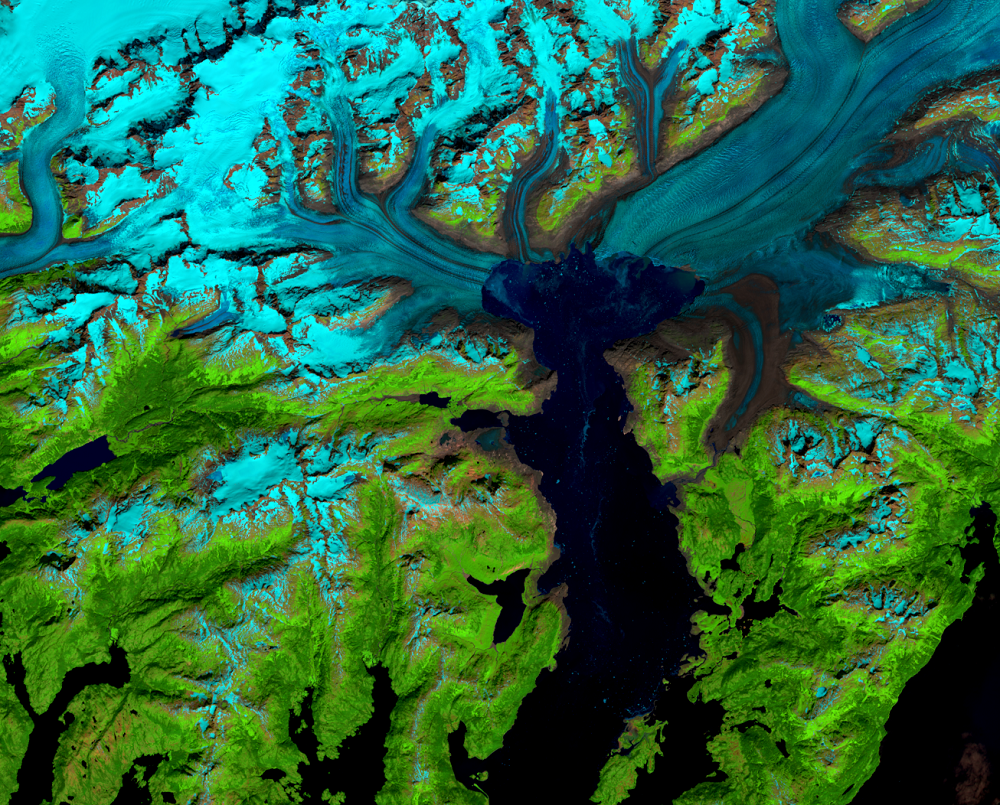
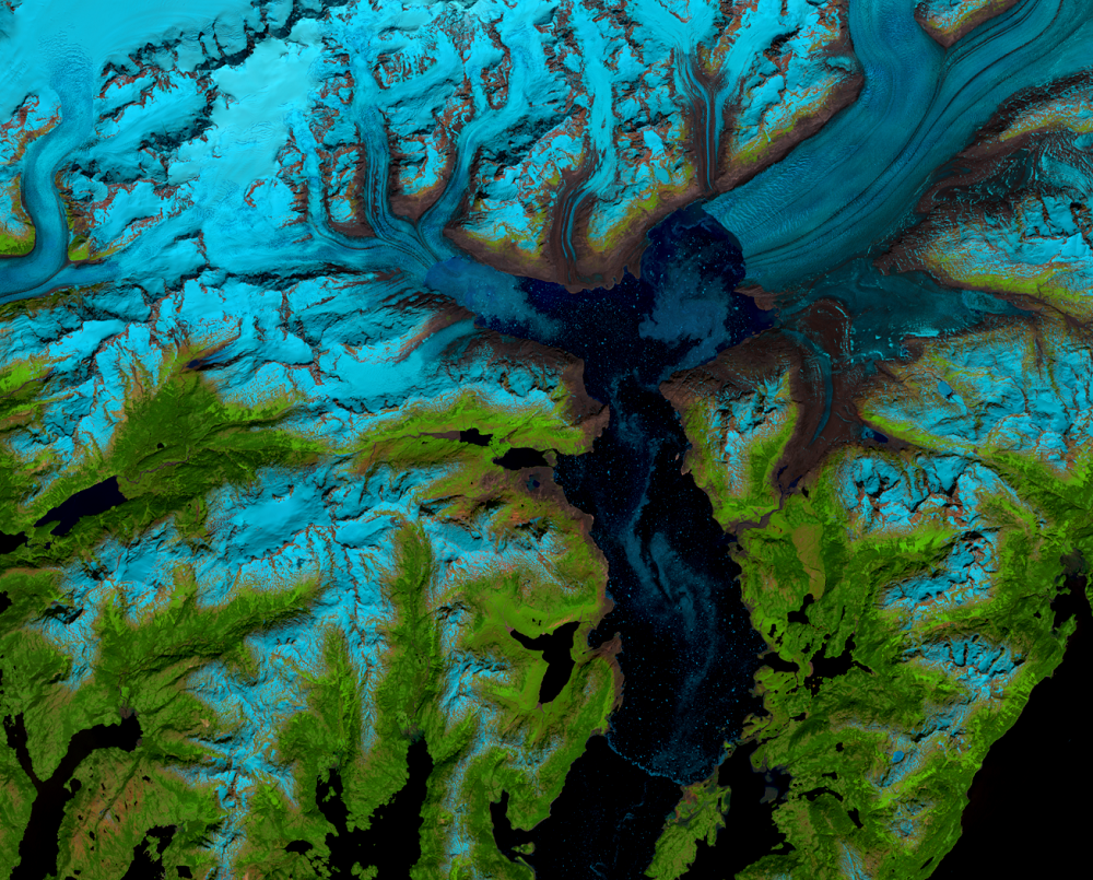
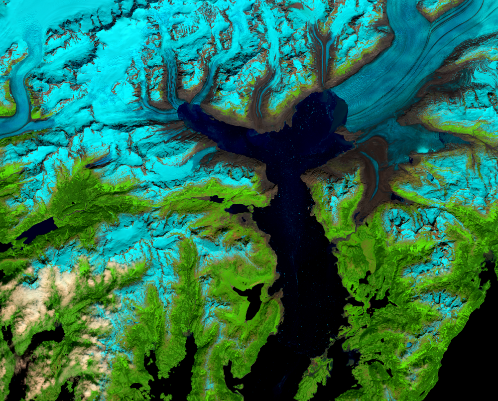
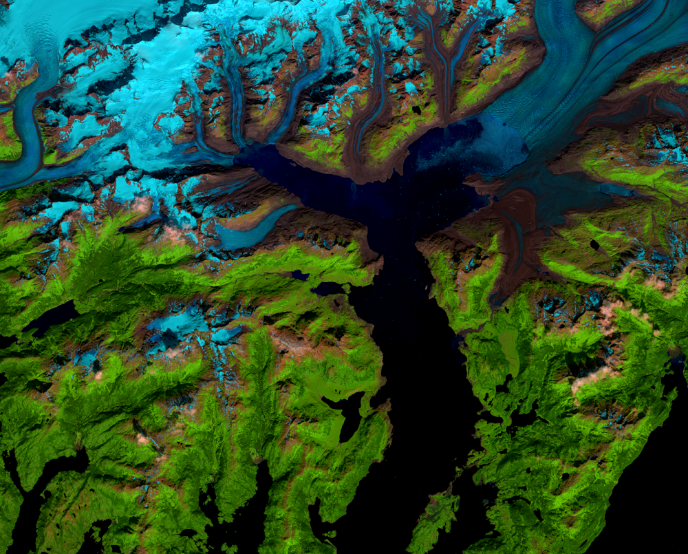
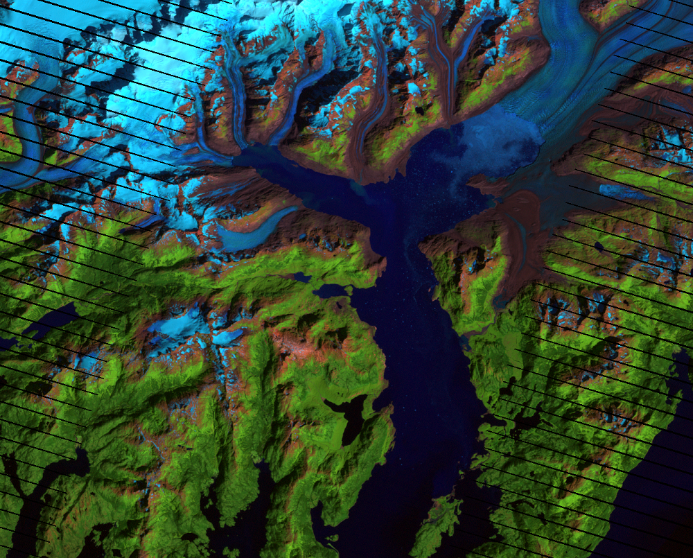
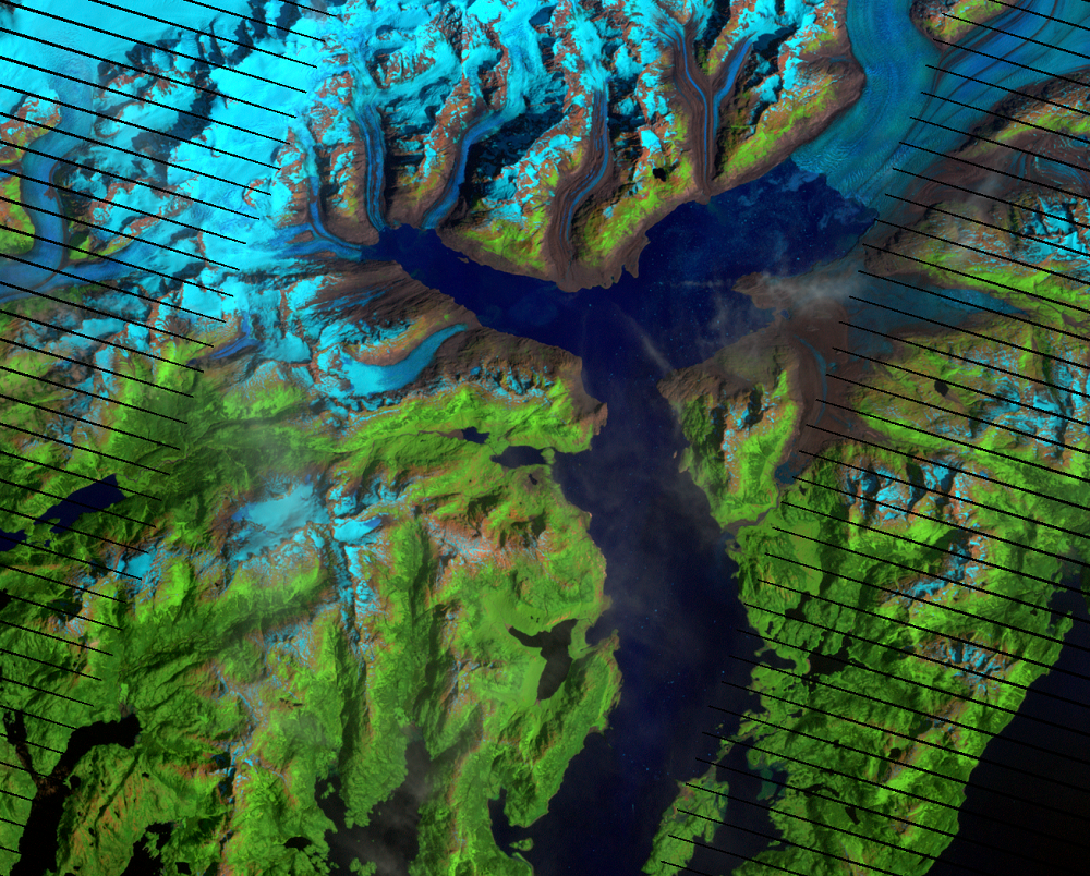
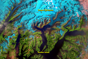
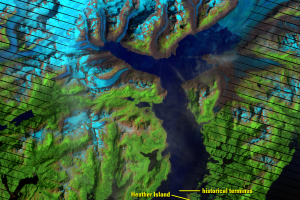
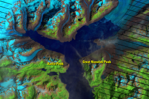
Landsat images show chunks of ice floating on the surface of the water as Columbia Glacier retreats. These icebergs have broken off, or calved, from the front edge of the glacier. This conglomerate of floating ice and chunks of icebergs is known as an ice mélange, which can slow the rate that glaciers slip into the sea.
The ice mélange looks less defined in the images than the glacier itself, which usually has some smooth-looking longitudinal lines. The mélange appears more mottled, and in some images there is very little of it at all (like in 2006). So don’t confuse ice mélange with the end of the glacier.
Columbia’s terminal moraine is still evident long after the end of the glacier retreated far upstream and serves as a marker for the maximum advance of the glacier. A terminal moraine is the accumulated mass of sediment, rocks, and debris that the glacier deposits at the terminus. The moraine at this historical terminus prevents the mélange from drifting beyond it.
View an animation showing more Landsat images of Columbia Glacier.
Imagery


Downloads
Related Content
Columbia Glacier, Alaska, USA
Some landscape changes around the world happen at glacial pace—very sl...
Mélange
Landsat images show chunks of ice floating on the surface of the water...
Pinning Points
Air temperature increases can bring about long-term loss of ice mass f...