

Mesabi Range, Minnesota, USA
Earth Resources Observation and Science (EROS) Center - Earthshots
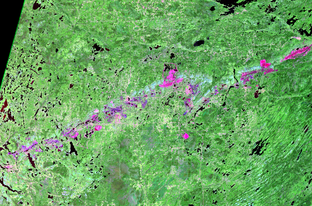
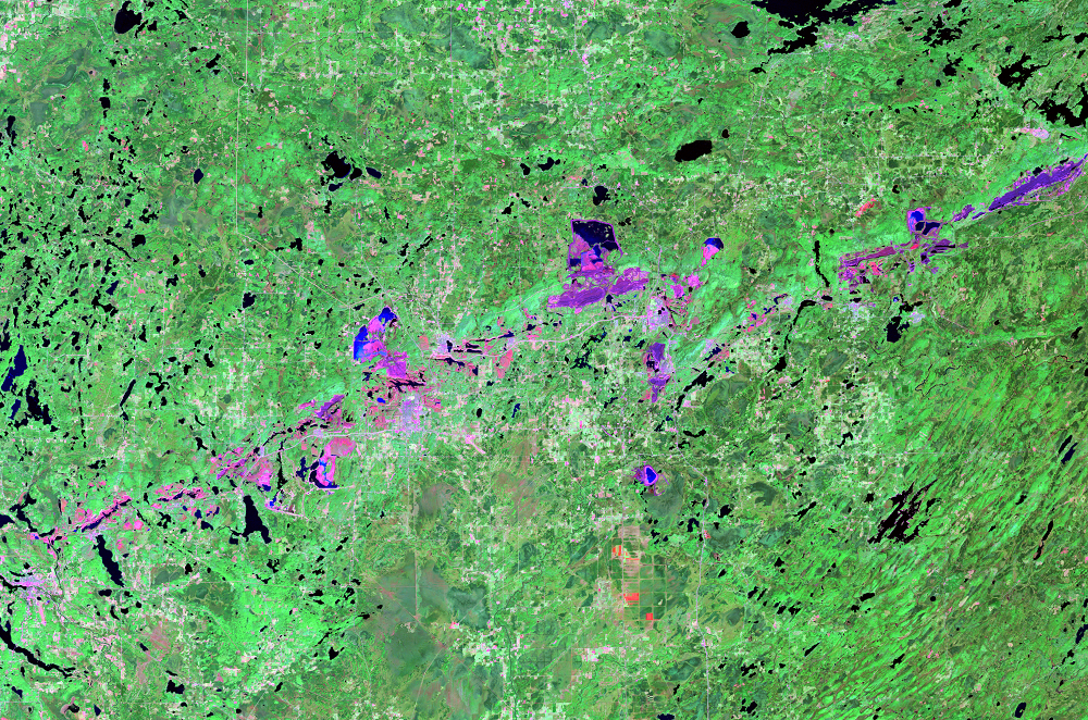
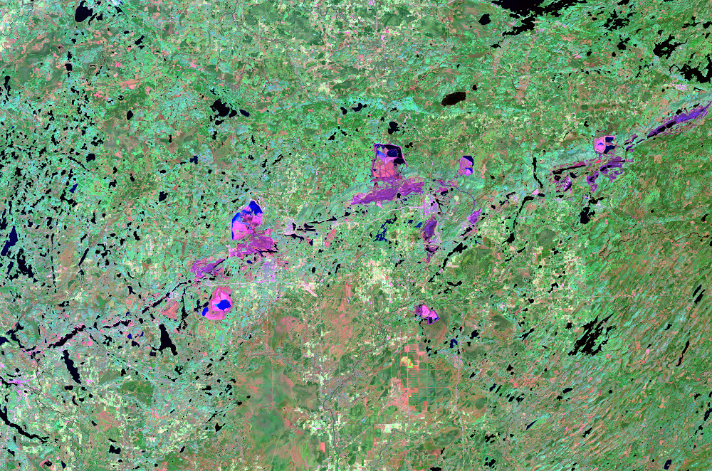
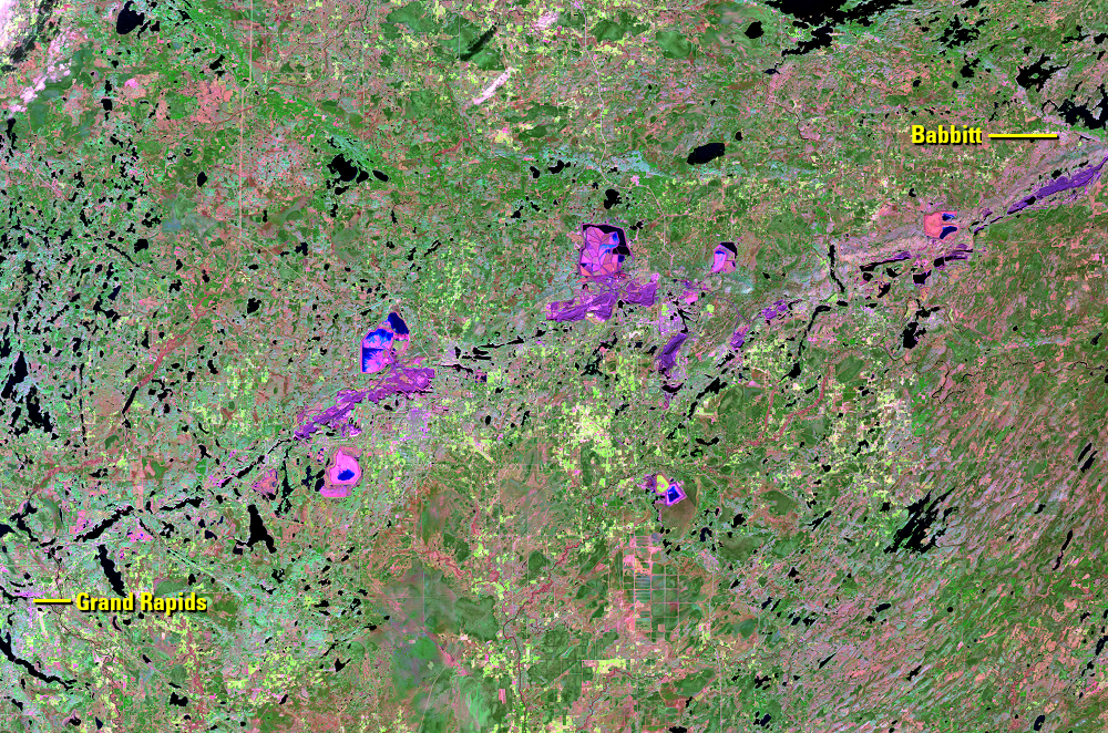
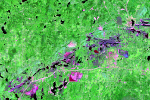
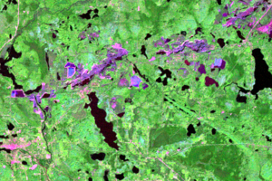
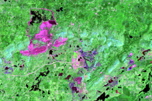
The boom times of iron ore mining in northern Minnesota are long gone, but mining operations continue and are even expanding, as seen in these Landsat images.
The Mesabi Range, which stretches 80–100 miles from Grand Rapids to Babbitt, contributed about 60% of the total iron ore output in the United States throughout most of the 20th century. The soft ore was close to the surface, and it could be scooped from open-pit mines and shipped by rail to Lake Superior and eventually to steel mills.
Iron ore production peaked in the 1940s when more than 600,000 tons were shipped during World War II. Production remained high in the postwar years and then declined. The high-grade ore was soon nearly depleted. Mining activity on the Mesabi Range now involves digging out lower grade ore for processing.
The iron ore open-pit mines on the Range are among the biggest in the world. But the footprints of the mines’ tailings ponds are even bigger. Both are readily visible in these Landsat images.
Imagery
Every picture has a story to tell

Correlated
Additional story information
Downloads
Brown, A., 2008, Overburden: Modern Life on the Iron Range: Duluth, MN, Red Step Press, 239p.
Central Iron Range Initiative, 2007, Central Iron Range Heritage/History: Central Iron Range Initiative, accessed September 29, 2016, at http://www.cirimn.com/mining/heitage/.
Iron Mining Association of Minnesota, [n.d.], Minnesota’s Iron Mining Industry: Iron Mining Association of Minnesota, accessed September 29, 2016, at http://www.taconiterocks.com/minnesotas-iron-mining-industry.html.
Iron Trail, 2012, Hull Rust Mahoning Mine View: Iron Trail, accessed September 29, 2016, at http://www.irontrail.org/attractions/mining/hull-rust/.
Manuel, J.T., 2015, Taconite Dreams: The Struggle to Sustain Mining on Minnesota’s Iron Range, 1915-2000: Minneapolis, University of Minnesota Press, 279p.
Minnesota Department of Natural Resources, 2016, Canisteo Mine Pit Outflow Project: MNDNR, accessed September 29, 2016, at http://www.dnr.state.mn.us/waters/mine_pit/canisteo.html.
Minnesota Historical Society, 2016, Iron Range Region: Historical Overview: Minnesota Historical Society, accessed September 29, 2016, at http://www.mnhs.org/preserve/nrhp/iron_range_overview.html.
Minnesota Minerals Coordinating Committee, 2016, Explore Minnesota—Iron Ore: Minnesota Minerals Coordinating Committee, accessed September 29, 2016, at http://mcc.mn.gov/explore.html.
Myette, C.F., 1991, Hydrology, water quality, and simulation of ground-water flow at a taconite-tailings basin near Keewatin, Minnesota: U.S. Geological Survey Water-Resources Investigations Report 88-4230, 61p. https://pubs.er.usgs.gov/publication/wri884230.
WCCO, 2015, Finding Minnesota—The ‘Grand Canyon Of The North,’ WCCO, accessed September 29, 2016, at http://minnesota.cbslocal.com/2015/05/31/finding-minnesota-the-grand-canyon-of-the-north/.
Zanko, L.M., Niles, H.B., and Oreskovich, J.A., 2008, Mineralogical and microscopic evaluation of coarse taconite tailings from Minnesota taconite operations: Regulatory Toxicology and Pharmacology, v. 52, no. 1, p. S51–S65. http://dx.doi.org/10.1016/j.yrtph.2007.09.016.
Other Stories
Related imagery and additional content
Grand Canyons
Other mines also continue to expand, even in the Landsat era. The Hull...
Pit Lakes
At the western end of the Mesabi Range is another consequence of the m...
Taconite
The mines on the Mesabi Range historically extracted hematite, a rusty...