

More about This Flood
Earth Resources Observation and Science (EROS) Center - Earthshots
The flooding that happened in summer 2008 in Indiana and Illinois started late in 2007 with above normal snowfall. This extra snow saturated the ground as it melted in spring 2008. The above normal rainfall in the spring only made the situation worse. (Many U.S. Geological Survey streamgages in the region already showed stream levels at higher than average streamflow.) The heavy rainfall event on June 6–7, while by itself might not have caused catastrophic flooding, combined with the saturated conditions from the previous winter snows to cause this flood.
On June 6, 2008, a nearly stationary (unmoving) weather front was draped across south-central Indiana, and moisture from the Gulf of Mexico streamed north to fuel thunderstorm development. Nearly continuous thunderstorms over a 12–16 hour interval dumped significant amounts of rain on the region. This rain flowed into the already high rivers and streams, which rose quickly.
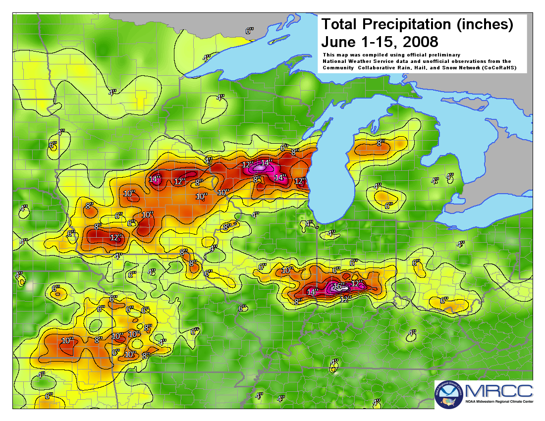
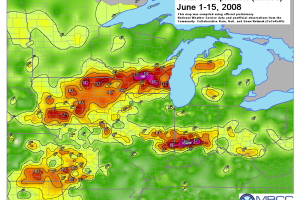
In the precipitation map on the left, the colors indicate the amount of rainfall for the first half of June 2008. The colorful area from eastern Illinois and into central Indiana reflects the heavy rain that occurred there at that time.
- Green = less than 4 inches
- Yellow to orange to red = 6–12 inches
- Violet to white = 12 inches or more
Imagery
Downloads
Related Content
Illinois/Indiana, USA
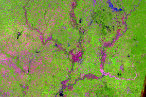
These three Landsat 5 images show several rivers in southern Illinois ...
A New Cutoff
Floods are examples of short-term environmental change. They cause sub...
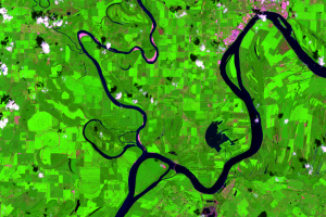
Eel River
Just west of Clay City, there is a large, nearly square-shaped area of...
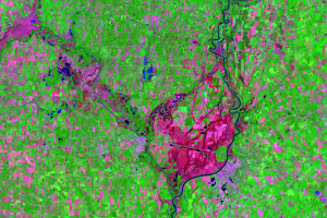
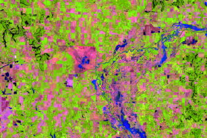
Lawrenceville and Vincennes
In this area at near Lawrenceville, Illinois, and Vincennes, Indiana, ...
More about This Flood
The flooding that happened in summer 2008 in Indiana and Illinois star...
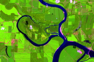
New Cutoff Close Up
Cutoffs are common on meandering rivers like the Wabash, but it’s rare...