

“Nighttime” Images
Earth Resources Observation and Science (EROS) Center - Earthshots
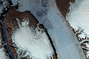
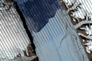
Landsat 8 normally images all Earth landmasses every 16 days. However, at high latitudes, there is considerable overlap because Landsat 8’s orbital tracks converge at the Poles. As a result, this increases the temporal frequency of Landsat 8 coverage over northern Greenland.
Building on this imaging overlap, Landsat 8 takes advantage of long hours of daylight in the Arctic to acquire “nighttime” sunlit images, increasing temporal coverage even more. The two Landsat 8 images were acquired a little over 3 hours apart, one on its descending orbit and one ascending. Having multiple images increases the chances of acquiring more cloud-free images and helps scientists monitor iceberg calving events.
Imagery
Every picture has a story to tell
Correlated
Additional story information
Downloads
Other Stories
Related imagery and additional content
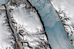
2010 Ice Break
Scientists observed rifts in Petermann Glacier throughout the first de...
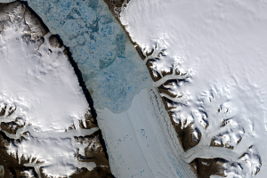
2012 Break
Just two years later, another large iceberg broke off Petermann Glacie...
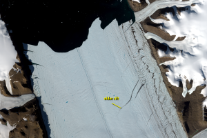
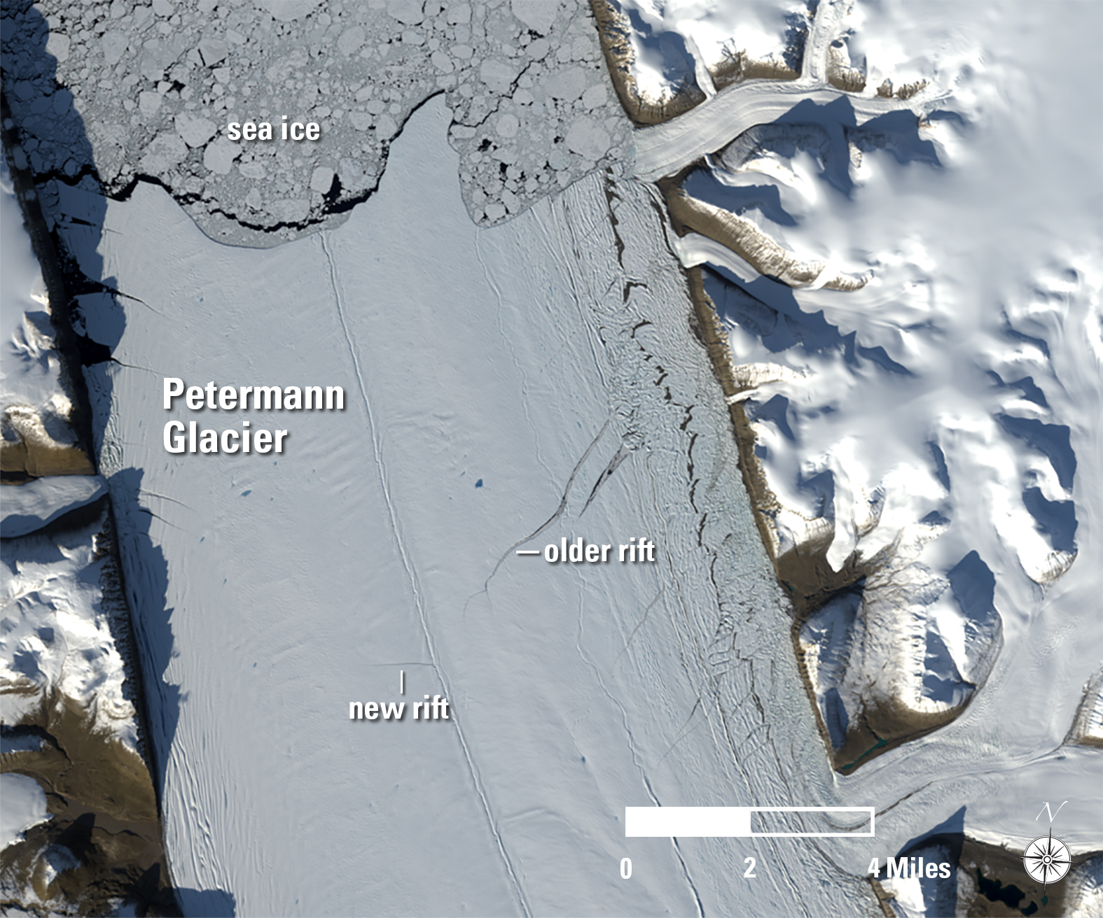
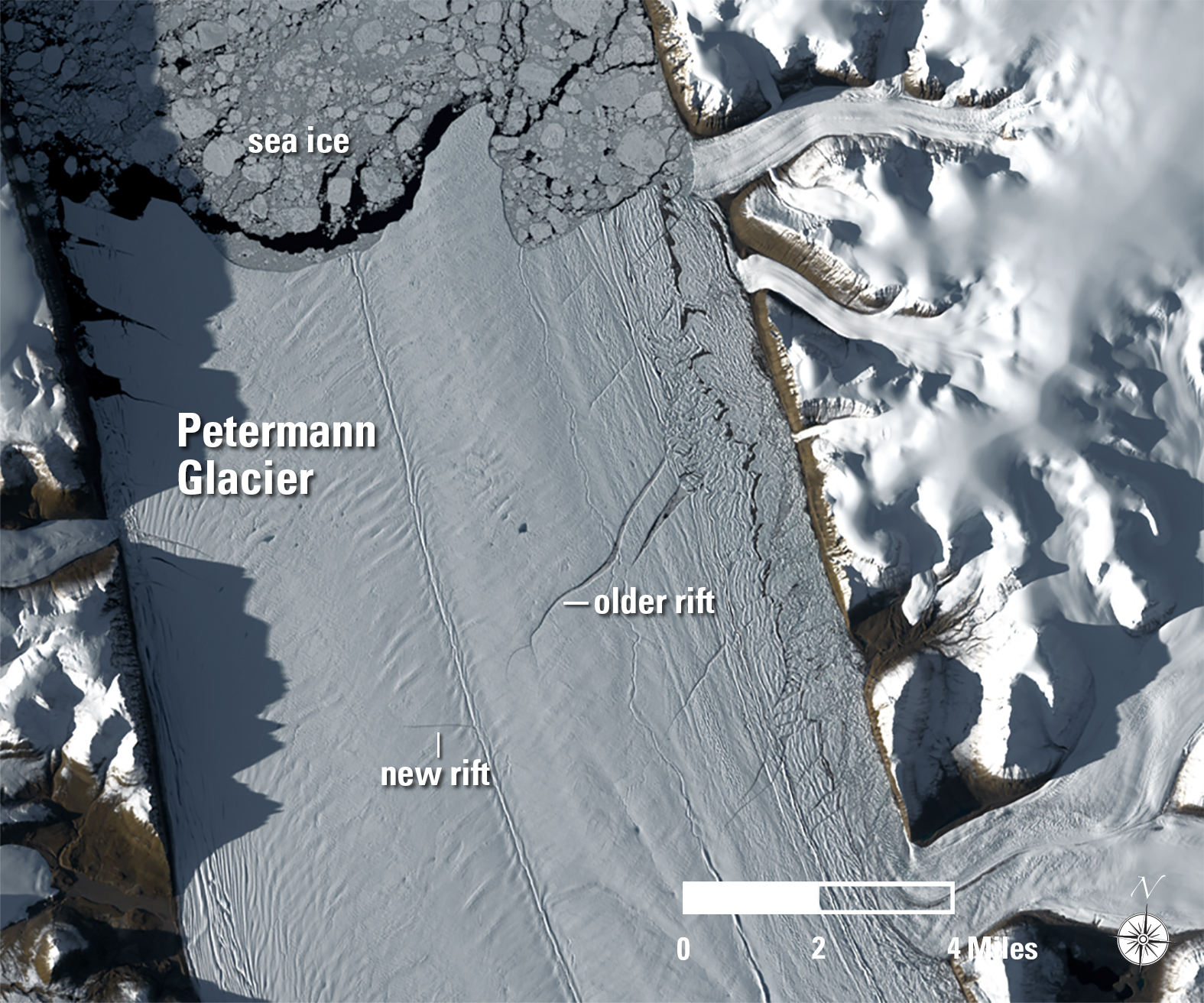
2017 Rift
A new rift formed on Petermann Glacier in 2017. An older crack to the ...
Seasonal Changes
Landsat 8 has a 16-day repeat cycle. That means it images the same spo...
The Long Dark Winter
Compare the two Landsat images from June 24, 2014, and September 19, 2...
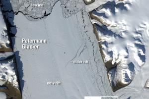
“Nighttime” Images
Landsat 8 normally images all Earth landmasses every 16 days. However,...