

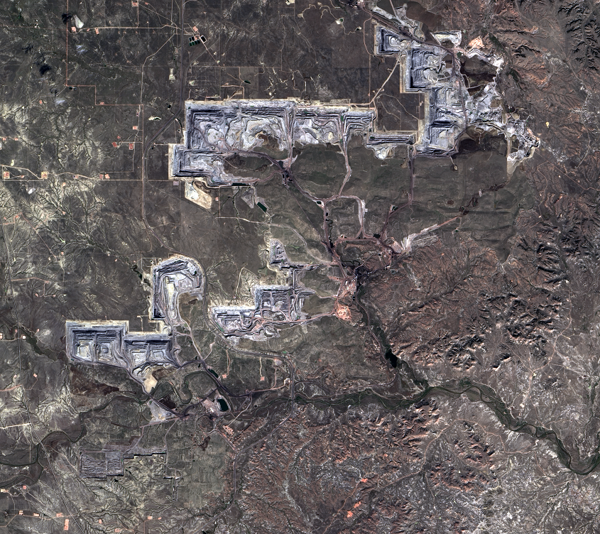
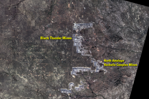
North Antelope Rochelle Complex Mines
Earth Resources Observation and Science (EROS) Center - Earthshots
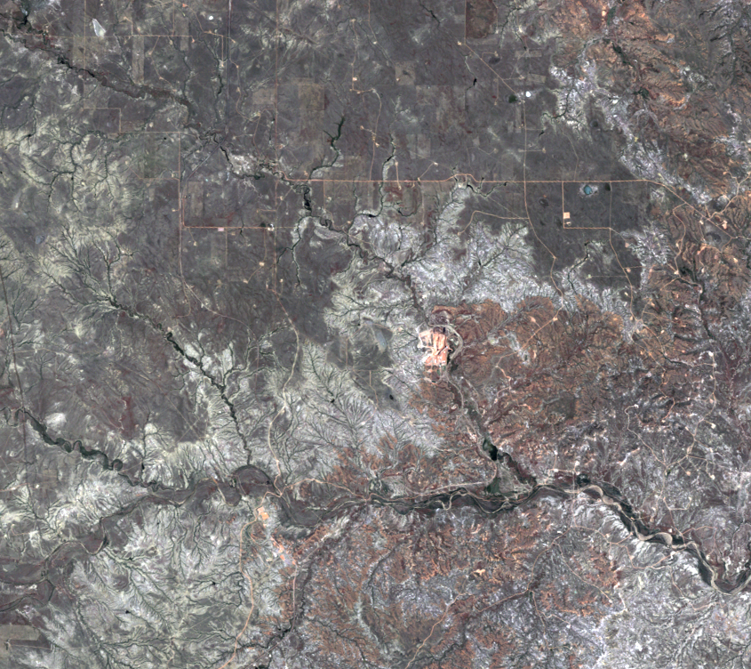
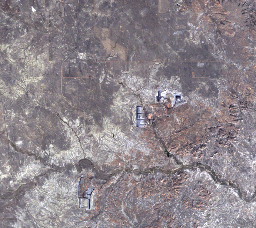
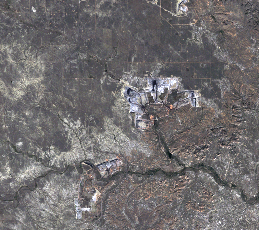
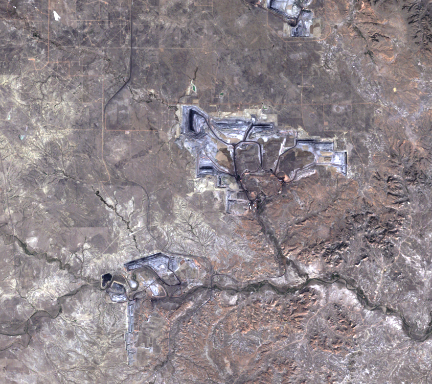
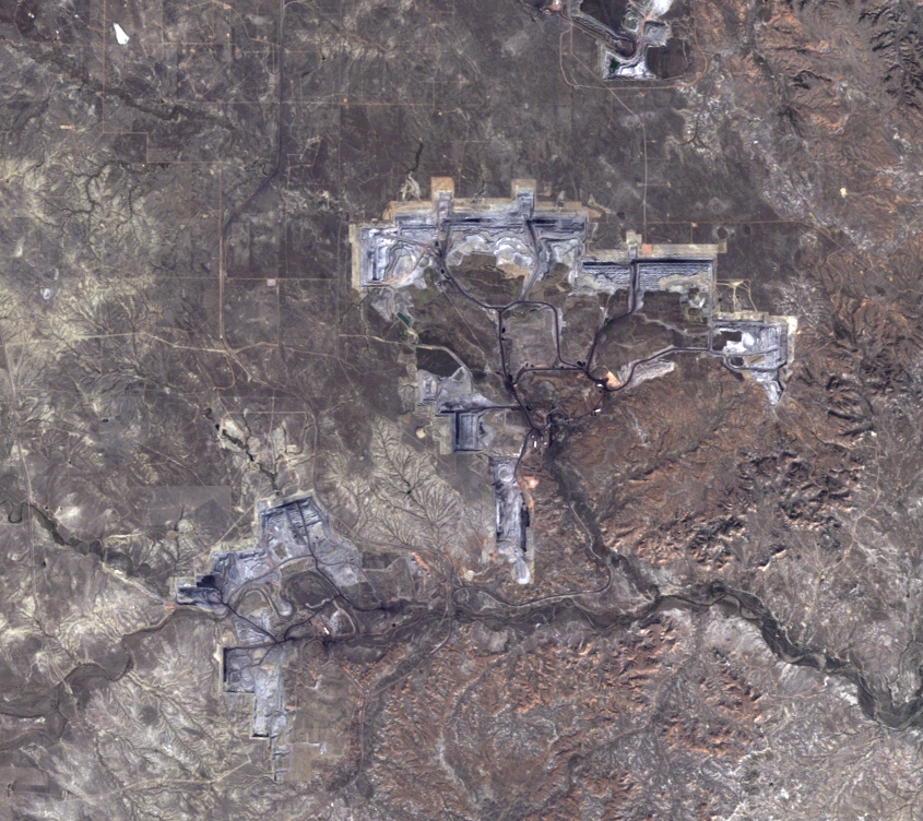
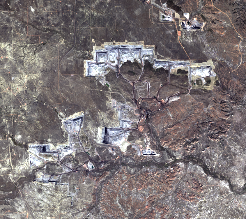
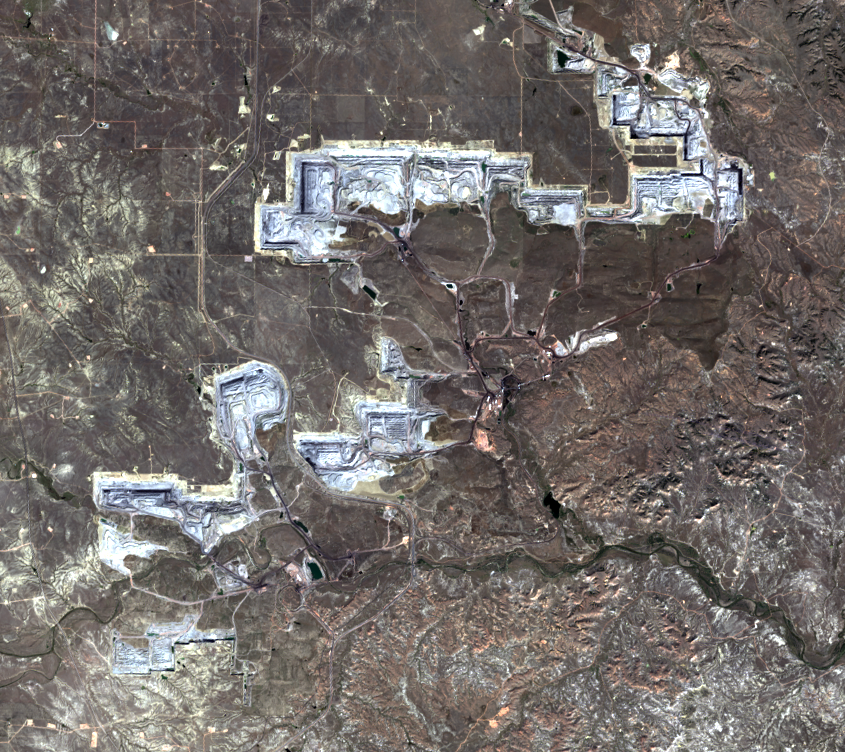
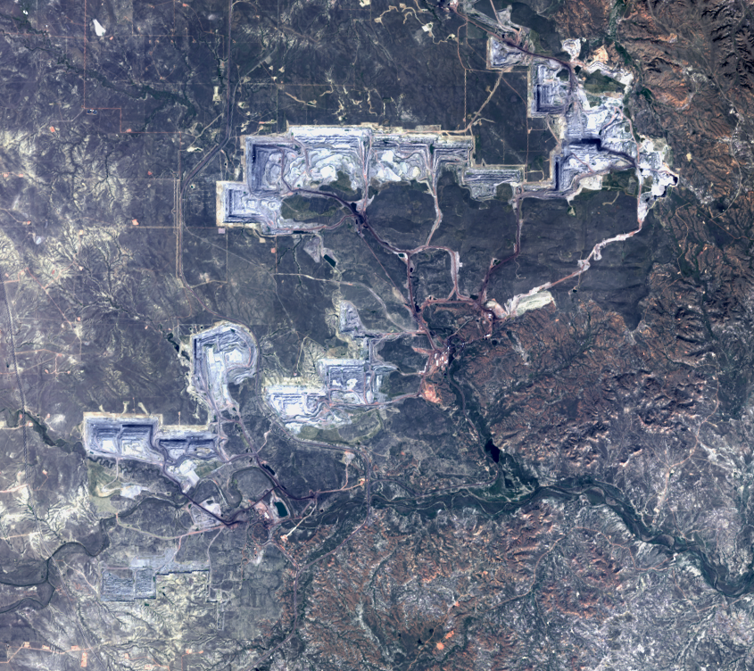
The North Antelope Rochelle Complex is the most productive of the PRB mines. In 2018, the mine sold 98.4 million tons of coal. In 2017, it accounted for 13.1% of U.S. coal production. It began operations in 1983, and the series of Landsat images shows the progression of this mine since 1984.


Imagery
Downloads
Related Content
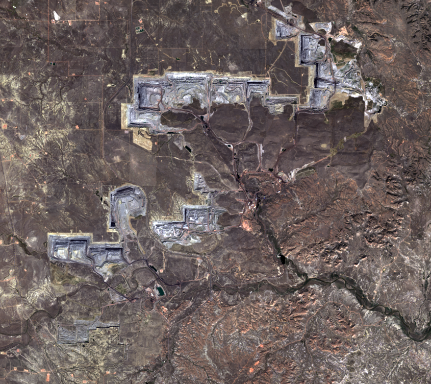
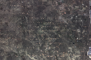
Powder River Basin, Wyoming, USA
Every day, 100 empty trains enter Wyoming. They leave fully loaded wit...
Animations
The coal mines in the PRB advance quickly enough to see a lot of chang...

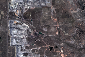
Black Thunder Mine
The Black Thunder Mine, shown in the series of Landsat images on the l...
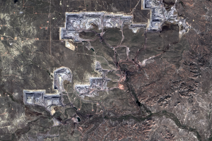
North Antelope Rochelle Complex Mines
The North Antelope Rochelle Complex is the most productive of the PRB ...
Oil
The PRB has become about more than just coal. Oil production is also i...
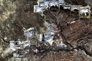
The Mining Process
The mining process that takes place in the PRB is called surface minin...